Related Research Articles
Kongsøya is an island in Svalbard, Norway. It is the largest of the islands in King Charles Land. Its area is 191 square kilometres (74 sq mi). The other main island in the chain is Svenskøya.

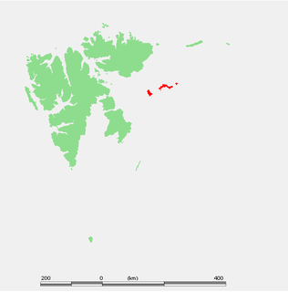
Svenskøya is an island in Svalbard. It is the second largest island of Kong Karls Land with an area of 137 km².

Hinlopen Strait is the strait between Spitsbergen and Nordaustlandet in Svalbard, Norway. It is 150 kilometers (93 mi) long and 10 to 60 kilometers wide. The strait is difficult to pass because of pack ice. It is believed to have been named after Thijmen Jacobsz Hinlopen.

Lilliehöökfjorden is a 14 kilometer long fjord branch of Krossfjorden in Albert I Land at the northwestern side of Spitsbergen, Svalbard. The fjord is named after Gustaf Bertil Lilliehöök.
Kapp Altmann is a headland at the southern side of Kongsøya in Kong Karls Land, Svalbard. It has a length of 1.9 kilometers and a width between 100 and 200 meters. Outside the spit are two small islands. The headland is named after Arctic explorer Johan Andreas Altmann. Kapp Altmann defines the western extension of the bay Breibukta.
Lydiannasundet is a strait in the Svalbard archipelago, separating Kongsøya from Abel Island, both in Kong Karls Land. It is named after the vessel Lydianna, used for exploration of Kong Karls Land in 1872.
Retziusfjellet is a mountain on Kongsøya in Kong Karls Land, Svalbard. It is named after Swedish physician Gustaf Retzius. The mountain reaches a height of 320 meters, and is the highest point of Kongsøya. It is located south of Hårfagrehaugen, and northwest of Tordenskjoldberget.
Hårfagrehaugen is a mountain on Kongsøya in Kong Karls Land, Svalbard. It is named after Harald Fairhair, the first King of Norway. The mountain reaches a height of 304 m.a.s.l., and is located north of Retziusfjellet, separated by the valley of Hidalen.
Johnsenberget is a mountain at Kongsøya of the Kong Karls Land, Svalbard. It has a height of 235 m.a.s.l., and is located at the eastern part of the island, between Koppelvatna and Rundisflya, north of Andréebukta. The mountain is named after captain Nils Johnsen, who climbed the mountain in 1872.
Nordaustpynten is a headland at Kongsøya of the Kong Karls Land, Svalbard, the most northeastern point of the island.
Dunérfjellet is a mountain on Svenskøya in Kong Karls Land, Svalbard. It has a height of 230 m.a.s.l., and is located at the northern part of the island, separated from Mohnhøgda by the mountain pass Vindsalen. The mountain is named after Swedish astronomer Nils Christoffer Dunér. Dunérfjellet has a relatively flat plateau, with steep hills down to the lowlands of Svenskøya.
Mohnhøgda is a mountain on Svenskøya in Kong Karls Land, Svalbard. It has a height of 285 m.a.s.l., and is located at the northern part of the island, separated from Dunérfjellet by the mountain pass Vindsalen. The mountain is named after Norwegian meteorologist and astronomer Henrik Mohn.
Tordenskjoldberget is a mountain on the island of Kongsøya in Kong Karls Land, Svalbard. It is named after naval officer Peter Tordenskjold. The mountain is located at the western side of the island, south of Retziusfjellet and is separated from Sjögrenfjellet by the mountain pass Passet.
Bremodden is a headland at the eastern side of Kongsøya in Kong Karls Land, Svalbard. It is located east of Koppelvatna, about 2.5 kilometers south of Nordaustpynten, and defines the northeastern extension of the bay Andréebukta.
Arnesenodden is a headland on Svenskøya in Kong Karls Land, Svalbard. It is the most northern point of Svenskøya, at the foot of the mountain Mohnhøgda. The headland is named after Arctic explorer Magnus Arnesen.
Kapp Hammerfest is a headland on Svenskøya in Kong Karls Land, Svalbard. It is the most southern point of Svenskøya, and the headland has a length of about 1.5 kilometers. The headland is named after the Norwegian city of Hammerfest. North of the headland, at the western side of the Svenskøya, is Kyrkjevika with Antarcticøya and other smaller islands.
Kapp Weissenfels is a headland on Svenskøya in Kong Karls Land, Svalbard. It is the most eastern point of Svenskøya, and the headland has a length of about 1.2 kilometers. The headland is named after the German city of Weißenfels. The outer point is about 25 meters high, and serves as a breeding place for guillemot, kittiwakes and ptarmigan. Nearby are sand beaches with undulating sand dunes.
Kyrkjevika is a bay at the southwestern coast of Svenskøya in Kong Karls Land, Svalbard. Kyrkjevika is partly sheltered by Antarcticøya and other islands.
Antarcticøya is an island at the southwestern coast of Svenskøya in Kong Karls Land, Svalbard. It is located outside the bay of Kyrkjevika. The island is named after the ship Antarctic. Antarcticøya is the largest among several small islands at the outer part of Kyrkjevika.
Lernerneset is a headland at the northwestern coast of Abel Island in Kong Karls Land, Svalbard. The headland is named after German Arctic explorer Theodor Lerner. A former variant of the name was Kap Lerner.
References
- ↑ "Erik Eriksenstretet (Svalbard)". Norwegian Polar Institute . Retrieved 15 July 2013.
- ↑ Arctic Pilot: Sailing directions Svalbard–Jan Mayen. 7. Stavanger: The Norwegian Hydrographic Service and The Norwegian Polar Institute. 1988. p. 382. ISBN 82-90653-06-9.
Coordinates: 79°09′N26°33′E / 79.150°N 26.550°E
| This Svalbard location article is a stub. You can help Wikipedia by expanding it. |