
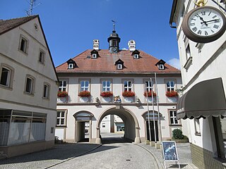
Hirschaid is a German market town in the Upper Franconian district of Bamberg and lies roughly twelve kilometres south of Bamberg on the Regnitz and the Main-Danube Canal.

Schlüsselfeld is a town on the southwestern edge of the Upper Franconian district of Bamberg
Burgebrach is a market town in the Upper Franconian district of Bamberg and the seat of the administrative community (Verwaltungsgemeinschaft) of Burgebrach.
Burgwindheim is a municipality with market rights in the west of the Upper Franconian district of Bamberg and a member of the administrative community (Verwaltungsgemeinschaft) of Ebrach.

Buttenheim is a market town in the Upper Franconian district of Bamberg and lies in the Regnitz Valley between Bamberg and Nuremberg, Germany.

Ebrach is a community with market rights in the Upper Franconian district of Bamberg and the seat of the Verwaltungsgemeinschaft of Ebrach.

Frensdorf is a community in the Upper Franconian district of Bamberg.

Pettstadt is a community in the Upper Franconian district of Bamberg with about 1,900 inhabitants.

Pommersfelden is a community in the Upper Franconian district of Bamberg in Germany.
Dreuschendorf is a small village located in Bavaria, Germany. It is in Upper Franconia, in the Bamberg district. Dreuschendorf is a constituent community of Buttenheim.
Geisfeld is a small village located in Bavaria, Germany. It is in Upper Franconia, in the Bamberg district. Geisfeld is a constituent community of Strullendorf.
Tiefenhöchstadt is a small village located in Bavaria, Germany. It is in Upper Franconia, in the Bamberg district. Tiefenhöchstadt is a constituent community of Buttenheim.

Stackendorf is a small village located in Bavaria, Germany. It is in Upper Franconia, in the Bamberg district. Stackendorf is a constituent community of Buttenheim. In 2007, it had a population of 270.

On 8 March 1988 the Bavarian State Ministry for State Development and the Environment designated an area of 1,280 square kilometres (490 sq mi) in the Steigerwald in North Bavaria, Germany, as the Steigerwald Nature Park. About half the area consists of protected landscapes. The nature park is run by the Steigerwald Tourist Association and Steigerwald Nature Park.

The Dreifrankenstein is a boundary stone that marks the tripoint where the three Franconian provinces of Upper, Middle and Lower Franconia meet in southern Germany. As part of the regional reforms in 1972 the boundary marker was moved around 7 kilometres as the crow flies to the southeast. Today both points are marked by stones that are referred to as the Old and New Dreifrankenstein.

The Steigerwald is a hill region up to 498.5 m above sea level (NHN) in the Bavarian-Franconian part of the South German Scarplands between Würzburg and Nuremberg. It is part of the Keuper Uplands, and within it, it is continued to the north-northeast and right of the river Main, by the Haßberge, and to the south-southwest by the Franconian Heights. Part of the region is a designated as the Steigerwald Nature Park.
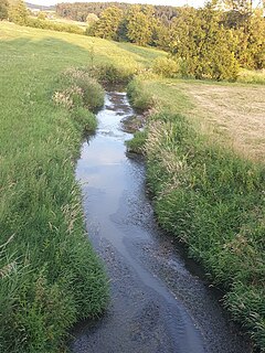
Reiche Ebrach is a river of Bavaria, Germany. It flows into the Regnitz near Hirschaid.
Hochstall is a small village located in Bavaria, Germany. It is in Upper Franconia, in the Bamberg district. Hochstall is a constituent community of Buttenheim.
Gunzendorf is a small village located in Bavaria, Germany. It is in Upper Franconia, in the Bamberg district. Gunzendorf is a constituent community of Buttenheim.
Ebrach is a community in the Upper Franconian district of Bamberg.


