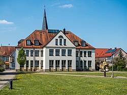
Hirschaid

Last updated
Hirschaid
Hirschhaid-townhall- P5022885.jpg
Town hall
Wappen Hirschaid.svg
Location of Hirschaid within Bamberg district
Hirschaid in BA.svg
Germany adm location map.svg
Red pog.svg
Hirschaid
Bavaria location map.svg
Red pog.svg
Hirschaid
Coordinates: 49°49′N10°59′E / 49.817°N 10.983°E / 49.817; 10.983 Coordinates: 49°49′N10°59′E / 49.817°N 10.983°E / 49.817; 10.983
Country Germany
State Bavaria
Admin. region Oberfranken
District Bamberg
Subdivisions10 Gemeindeteile
Government
   Mayor (202026) Klaus Homann [1] (CSU)
Area
  Total40.95 km2 (15.81 sq mi)
Elevation
248 m (814 ft)
Population
 (2020-12-31) [2]
  Total12,457
  Density300/km2 (790/sq mi)
Time zone UTC+01:00 (CET)
  Summer (DST) UTC+02:00 (CEST)
Postal codes
96114
Dialling codes 09543
Vehicle registration BA
Website www.hirschaid.de

Hirschaid is a German market town in the Upper Franconian district of Bamberg and lies roughly twelve kilometres south of Bamberg on the Regnitz and the Main-Danube Canal.

Contents

Geography

Location

The community's main centre lies south-southeast of Bamberg where the Reiche Ebrach empties into the Regnitz.

For various reasons, among them the community's favourable location on the A 73 and its close proximity to Bamberg (12 km), Forchheim (13 km), Erlangen (about 30 km), Fürth (about 40 km) and Nuremberg (about 50 km), Hirschaid has grown markedly since the 1960s.

Constituent communities

Hirschaid's main and namesake centre is by far the biggest of its Gemeindeteile with a population of 6,080. The community furthermore has these outlying centres, each given here with its own population figure (as of 2019): [3]

Ironically, Großbuchfeld (“Great Beech Field”) is actually smaller than Kleinbuchfeld (“Little Beech Field”).

History

The community's name goes back to the von Hirzheide noble family whose coat of arms were charged with a hart, still seen in the community's arms today.

Hirschaid lies not far from the former via regia, an ancient road that since antiquity joined the north in the area around Lüneburg with the south all the way to Lower Austria. The name Hirschaid refers to the former landscape and wildlife (Hirsch is “hart” in German).

Finds dug up on the Regnitz Valley terraces bear witness to an early settlement beginning no later than the New Stone Age. Bearing witness to the later La Tène culture (Celtic) are above all the finds and wall remains on the nearby Friesener Warte

In 1079, Hirschaid became historical for the first time through a document issued by King Heinrich IV. In 1979, this date was duly celebrated in the community's 900th anniversary celebration. From 1300, it was the seat of the Lords, ministeriales and Vögte (sing. Vogt – reeve) of Hirzheide. Their Frankish line died out in 1590, although a Swedish-Livonian line still lives today. The coat of arms that they bore then, showing a golden hart in silver climbing out of a blue three-knolled hill (a charge called a Dreiberg in German heraldry), foreshadowed the one now borne by the community.

Although Hirschaid was mostly spared in the German Peasants' War, the community, lying on the main through road, was hard hit in the Thirty Years' War. A chronicler reports from this time: “After Candlemas 1633 the Swedes also came here and dwelt in the Swedish way. They plundered and robbed whatever they could get; nothing was holy to them. The House of God had its windows and doors beaten in, the inside was demolished, the bells taken away and broken up...”

Further plunderings had to be suffered in the Seven Years' War and especially in the Napoleonic Wars, when on 6 August 1793 a heavy cavalry and artillery battle broke out right near the community between the Imperial Army and French troops.

With Secularization, Hirschaid, which had been assigned to the tithing area of Eggolsheim, passed along with its 105 “autonomous houses” to Bavaria.

The building of the Ludwig Danube-Main Canal in 1834 and the opening of the Nuremberg-Bamberg railway line in 1844 yielded the first industrial incentives for Hirschaid. Basket weaving, which was introduced about this time, offered others work and a livelihood. About 1900, the population had grown to roughly 1,120, and the number of houses to 173.

Because of its favourable location, determined by the railway station on the Nuremberg-Bamberg railway line and the community's lying right near the highways, but also by administrative reform in 1972, the market community of Hirschaid with its constituent communities has grown to have more than 11,000 inhabitants and is developing itself appreciably into a small transport and economic centre.

Religion

All figures are rough.

Politics

Community council

The community council is made up of 24 members, listed here by party or voter community affiliation, and also with the number of seats that each holds:

Coat of arms

Hirschaid's arms might heraldically be described thus: In argent a mullet of eight azure halved per fess emerging therefrom above a hart attired springing sable.

Economy and infrastructure

Education

The community is served by Realschule Hirschaid.

Established businesses

Sport and leisure

The Frankenlagune swimming pool, opened in May 2000 has an 82 m2 indoor basin with whirlpool, a 66 m2 heated outdoor basin and a 38 m2 mother-child basin.

Town partnerships

On 11 September 1999, the partnership with the community of Ivančna Gorica, Slovenia, about 30 km southeast of the capital Ljubljana, was founded.

Famous people

Honorary citizens

Related Research Articles

Erlangen-Höchstadt is a Landkreis (district) in Bavaria, Germany. It is bounded by the districts of Fürth, Neustadt (Aisch)-Bad Windsheim, Bamberg, Forchheim and Nürnberger Land, and by the cities of Nuremberg and Erlangen. The city of Erlangen is not part of the district, but nonetheless its administrative seat.

Hirschau Municipality in Bavaria, Germany

Hirschau is a municipality in the Amberg-Sulzbach district, Upper Palatinate, Bavaria, Germany.

Wattendorf Municipality in Bavaria, Germany

Wattendorf is the smallest community in the Upper Franconian district of Bamberg and a member of the administrative community (Verwaltungsgemeinschaft) of Steinfeld.

Parsberg Town in Bavaria, Germany

Parsberg is a town in the county of Neumarkt in Bavaria, Germany. It is 23 km southeast of Neumarkt in der Oberpfalz, and 33 km northwest of Regensburg, next to the A3 autobahn, the main route from Nuremberg to Regensburg. It was formerly the seat of the Counts of Parsberg, whose coat of arms is now used by the town.

Schlüsselfeld Town in Bavaria, Germany

Schlüsselfeld is a town on the southwestern edge of the Upper Franconian district of Bamberg

Bischberg Municipality in Bavaria, Germany

Bischberg is a community in the Upper Franconian district of Bamberg lying at the forks of the rivers Regnitz and Main some 5 km west of Bamberg.

Breitengüßbach Municipality in Bavaria, Germany

Breitengüßbach is a community in the Upper Franconian district of Bamberg. It was first mentioned as Gusibach and as belonging to the royal court at Hallstadt in an Imperial document issued between 812 and 830.

Buttenheim Town in Bavaria, Germany

Buttenheim is a market town in the Upper Franconian district of Bamberg and lies in the Regnitz Valley between Bamberg and Nuremberg, Germany.

Frensdorf Municipality in Bavaria, Germany

Frensdorf is a community in the Upper Franconian district of Bamberg.

Gerach Municipality in Bavaria, Germany

Gerach is a community in the Upper Franconian district of Bamberg and a member of the administrative community (Verwaltungsgemeinschaft) of Baunach. It lies in the Naturpark Haßberge roughly 20 km north of Bamberg and roughly 10 km south of Ebern.

Pettstadt Municipality in Bavaria, Germany

Pettstadt is a community in the Upper Franconian district of Bamberg with about 1,900 inhabitants.

Priesendorf Municipality in Bavaria, Germany

Priesendorf is a community in the Upper Franconian district of Bamberg and a member of the administrative community (Verwaltungsgemeinschaft) of Lisberg.

Schönbrunn im Steigerwald Municipality in Bavaria, Germany

Schönbrunn im Steigerwald is a community in the Upper Franconian district of Bamberg and a member of the administrative community (Verwaltungsgemeinschaft) of Burgebrach.

Stadelhofen Municipality in Bavaria, Germany

Stadelhofen is a municipality in the Upper Franconian district of Bamberg and a member of the administrative community (Verwaltungsgemeinschaft) of Steinfeld.

Strullendorf Municipality in Bavaria, Germany

Strullendorf is a community in the Upper Franconian district of Bamberg.

Viereth-Trunstadt Municipality in Bavaria, Germany

Viereth-Trunstadt is a community in the Upper Franconian district of Bamberg lying on the Main.

Möhrendorf Town in Bavaria, Germany

Möhrendorf is a town in the district of Erlangen-Höchstadt, in Bavaria, Germany. It lies on the river Regnitz and the Rhine-Main-Danube Canal.

Gößweinstein Municipality in Bavaria, Germany

Gößweinstein is a municipality in the district of Forchheim in Bavaria in Germany. It lies within the region known as Franconian Switzerland.

Eichenbühl Municipality in Bavaria, Germany

Eichenbühl is a community in the Miltenberg district in the Regierungsbezirk of Lower Franconia (Unterfranken) in Bavaria, Germany.

Mönchberg Municipality in Bavaria, Germany

Mönchberg is a market community in the Miltenberg district in the Regierungsbezirk of Lower Franconia (Unterfranken) in Bavaria, Germany. It is the seat of the Verwaltungsgemeinschaft of Mönchberg and a state-recognized climatic spa (Luftkurort).

References

  1. Liste der ersten Bürgermeister/Oberbürgermeister in kreisangehörigen Gemeinden, Bayerisches Landesamt für Statistik, 15 July 2021.
  2. "Tabellenblatt "Daten 2", Statistischer Bericht A1200C 202041 Einwohnerzahlen der Gemeinden, Kreise und Regierungsbezirke". Bayerisches Landesamt für Statistik (in German). June 2021.
  3. "Zahlen/Daten/Fakten". Markt Hirschaid. Retrieved 27 September 2021.

Further reading