Zapfendorf

Last updated
Zapfendorf
Unterleiterbach 216793.jpg
Unterleiterbach Palace
DEU Zapfendorf COA.svg
Location of Zapfendorf within Bamberg district
Zapfendorf in BA.svg
Germany adm location map.svg
Red pog.svg
Zapfendorf
Bavaria location map.svg
Red pog.svg
Zapfendorf
Coordinates: 50°3′33″N11°33′33″E / 50.05917°N 11.55917°E / 50.05917; 11.55917 Coordinates: 50°3′33″N11°33′33″E / 50.05917°N 11.55917°E / 50.05917; 11.55917
Country Germany
State Bavaria
Admin. region Oberfranken
District Bamberg
Subdivisions9 Ortsteile
Government
   Mayor (202026) Michael Senger [1]
Area
  Total30.55 km2 (11.80 sq mi)
Elevation
248 m (814 ft)
Population
 (2020-12-31) [2]
  Total5,010
  Density160/km2 (420/sq mi)
Time zone UTC+01:00 (CET)
  Summer (DST) UTC+02:00 (CEST)
Postal codes
96199
Dialling codes 09547
Vehicle registration BA
Website www.zapfendorf.de

Zapfendorf is a municipality with market rights in the Upper Franconian district of Bamberg in Bavaria, Germany with roughly 5,000 inhabitants.

Contents

Geography

Lying as it did on a transport corridor along the Main running east–west as well as from Thuringia to Bavaria, Zapfendorf in the Main Valley was always a way station. On the Main itself, log drivers floated wood from the Frankenwald (forest) down to the Rhine and even as far as Rotterdam.

Population development

On 30 June 2006, Zapfendorf had 5,063 inhabitants, and on 31 December 2006, 5,083. In the next half year, the figure fell to 5,016 by 30 June 2007.

Constituent communities

Zapfendorf's main and namesake centre is by far the biggest of its Gemeindeteile with a population of 2,796. The community furthermore has these outlying centres, each given here with its own population figure:

(as of 30 June 2005)

History

The place was already settled quite early on, as witnessed by finds from the Bronze Age. Zapfendorf had its first documentary mention in 904. The name stems from “Zapfo” (Dorf means “village” in German), and may well refer to an innkeeper who tapped beer (zapfen means “draw”, as from a beer keg, in German). The original overlords were the Meranians, who were followed by the Truhendingens, who in turn sold the community in 1390 to the High Monastery at Bamberg. Since the Reichsdeputationshauptschluss of 1803, the community has belonged to Bavaria.

On 1 April 1945, a munitions train on a siding in Zapfendorf was struck by low-level bombers. Burning parts of this train rained down on the village and destroyed it utterly, leaving only a few houses unscathed.

In 1955, Zapfendorf was designated a market. In 1972, the communities of Lauf, Oberleiterbach, Kirchschletten, Sassendorf, Reuthlos, Roth and Oberoberndorf were amalgamated with Zapfendorf, as was Unterleiterbach in 1978. Until 1972, Zapfendorf belonged to the Staffelstein district before it passed to the Bamberg district. Today, it is classed as a small centre in the Upper Franconia-West region.

Politics

The first mayor is Michael Senger from the Wählergemeinschaft Sassendorf, elected in 2020.

The community council is made up of 16 members, listed here by party or voter community affiliation, and also with the number of seats that each holds:

Coat of arms

Zapfendorf's arms might heraldically be described thus: Party per fess gules and Or, gules two cloakpins Or per saltire, Or a lion rampant sable armed and langued gules, thereover a bendlet argent.

Established businesses

In Zapfendorf is found Werk IV of the Bayerische Milchindustrie eGmbH (BMI for short, the “Bavarian Milk Industry”), which was founded in 1952 with the goal of processing and marketing the excess low-fat milk yield.

Within Zapfendorf's municipal limits, one brewery may still be found, the Brauerei Hennemann in the outlying centre of Unterleiterbach. Until a few years ago, the Drei Kronen brewery had also been brewing in Zapfendorf. In Unterleiterbach, there was until the mid-1990s another brewery, the Brauerei Mahkorn.

Sightseeing

In the market community of Zapfendorf stand the following points of interest:

Related Research Articles

Wattendorf Municipality in Bavaria, Germany

Wattendorf is the smallest community in the Upper Franconian district of Bamberg and a member of the administrative community (Verwaltungsgemeinschaft) of Steinfeld.

Scheßlitz Town in Bavaria, Germany

Scheßlitz is a town in the Upper Franconian district of Bamberg and lies on the rise to the Franconian Switzerland on the A 70 between Bamberg and Bayreuth, lying 14 km northeast of the former.

Rothenbuch Municipality in Bavaria, Germany

Rothenbuch is a community in the Aschaffenburg district in the Regierungsbezirk of Lower Franconia (Unterfranken) in Bavaria, Germany. It has a population of around 1,700.

Altendorf, Upper Franconia Municipality in Bavaria, Germany

Altendorf is a community in the Upper Franconian district of Bamberg, Bavaria, Germany.

Bischberg Municipality in Bavaria, Germany

Bischberg is a community in the Upper Franconian district of Bamberg lying at the forks of the rivers Regnitz and Main some 5 km west of Bamberg.

Breitengüßbach Municipality in Bavaria, Germany

Breitengüßbach is a community in the Upper Franconian district of Bamberg. It was first mentioned as Gusibach and as belonging to the royal court at Hallstadt in an Imperial document issued between 812 and 830.

Buttenheim Town in Bavaria, Germany

Buttenheim is a market town in the Upper Franconian district of Bamberg and lies in the Regnitz Valley between Bamberg and Nuremberg, Germany.

Ebrach Municipality in Bavaria, Germany

Ebrach is a municipality with market rights in the Upper Franconian district of Bamberg and the seat of the Verwaltungsgemeinschaft of Ebrach.

Gerach Municipality in Bavaria, Germany

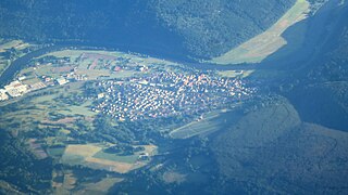
Gerach is a community in the Upper Franconian district of Bamberg and a member of the administrative community (Verwaltungsgemeinschaft) of Baunach. It lies in the Naturpark Haßberge roughly 20 km north of Bamberg and roughly 10 km south of Ebern.

Lisberg Municipality in Bavaria, Germany

Lisberg is a community in Bavaria, Germany. It is in the Upper Franconian district of Bamberg and a member of the administrative community (Verwaltungsgemeinschaft) of Lisberg, lying in the Steigerwald (forest).

Memmelsdorf Municipality in Bavaria, Germany

Memmelsdorf is a community in the Upper Franconian district of Bamberg bordering in the west directly on the city of Bamberg.

Oberhaid Municipality in Bavaria, Germany

Oberhaid is a community in the Upper Franconian district of Bamberg.

Rattelsdorf Municipality in Bavaria, Germany

Rattelsdorf is a municipality with market rights in the Upper Franconian district of Bamberg.

Reckendorf Municipality in Bavaria, Germany

Reckendorf is a community in the district of Bamberg, in Upper Franconia, Bavaria, Germany. With roughly 2,000 inhabitants, Reckendorf is a member of the administrative community (Verwaltungsgemeinschaft) of Baunach.

Schönbrunn im Steigerwald Municipality in Bavaria, Germany

Schönbrunn im Steigerwald is a community in the Upper Franconian district of Bamberg and a member of the administrative community (Verwaltungsgemeinschaft) of Burgebrach.

Stadelhofen Municipality in Bavaria, Germany

Stadelhofen is a municipality in the Upper Franconian district of Bamberg and a member of the administrative community (Verwaltungsgemeinschaft) of Steinfeld.

Karsbach Municipality in Bavaria, Germany

Karsbach is a municipality in the Main-Spessart district in the Regierungsbezirk of Lower Franconia (Unterfranken) in Bavaria, Germany and a member of the Verwaltungsgemeinschaft of Gemünden am Main.

Retzstadt Municipality in Bavaria, Germany

Retzstadt is a community in the Main-Spessart district in the Regierungsbezirk of Lower Franconia (Unterfranken) in Bavaria, Germany and a member of the Verwaltungsgemeinschaft of Zellingen.

Valley, Bavaria Municipality in Bavaria, Germany

Valley is a municipality in the district of Miesbach in Bavaria in Germany. The municipality of Valley holds, as of 2006, 2949 inhabitants.

Erlenbach bei Marktheidenfeld Municipality in Bavaria, Germany

Erlenbach bei Marktheidenfeld is a community in the Main-Spessart district in the Regierungsbezirk of Lower Franconia in Bavaria, Germany and a member of the Verwaltungsgemeinschaft of Marktheidenfeld. It has given itself the title Weinort mit Herz – Wine Town with Heart.

References

  1. Liste der ersten Bürgermeister/Oberbürgermeister in kreisangehörigen Gemeinden, Bayerisches Landesamt für Statistik, 15 July 2021.
  2. "Tabellenblatt "Daten 2", Statistischer Bericht A1200C 202041 Einwohnerzahlen der Gemeinden, Kreise und Regierungsbezirke". Bayerisches Landesamt für Statistik (in German). June 2021.