Rattelsdorf

Last updated
Rattelsdorf
Rattelsdorf Hochwasser 1073583.jpg
View towards Rattelsdorf
DEU Rattelsdorf COA.svg
Location of Rattelsdorf within Bamberg district
Rattelsdorf in BA.svg
Germany adm location map.svg
Red pog.svg
Rattelsdorf
Bavaria location map.svg
Red pog.svg
Rattelsdorf
Coordinates: 50°0′56″N10°53′13″E / 50.01556°N 10.88694°E / 50.01556; 10.88694 Coordinates: 50°0′56″N10°53′13″E / 50.01556°N 10.88694°E / 50.01556; 10.88694
Country Germany
State Bavaria
Admin. region Oberfranken
District Bamberg
Subdivisions13 Ortsteile
Government
   Mayor (201723) Bruno Kellner [1]
Area
  Total39.58 km2 (15.28 sq mi)
Elevation
259 m (850 ft)
Population
 (2020-12-31) [2]
  Total4,592
  Density120/km2 (300/sq mi)
Time zone UTC+01:00 (CET)
  Summer (DST) UTC+02:00 (CEST)
Postal codes
96179
Dialling codes 09547
Vehicle registration BA
Website www.markt-rattelsdorf.de

Rattelsdorf is a municipality with market rights in the Upper Franconian district of Bamberg.

Contents

Geography

Rattelsdorf lies in the Upper Franconia-West region. It consists of 13 smaller population centres which are all found within the same area. Among them, Ebing is the second-biggest. What follows is a list of all centres with population figures:

  • Busendorf bei Rattelsdorf 107
  • Ebing 1,284
  • Freudeneck 47
  • Helfenroth 14
  • Hilkersdorf 57
  • Höfen 150
  • Höfenneusig 35
  • Medlitz 176
  • Mürsbach 492
  • Poppendorf 59
  • Rattelsdorf 2,102
  • Speiersberg 45
  • Zaugendorf 50

as of May 2005

The community also has 7 traditional rural land units, known in German as Gemarkungen, named Busendorf, Ebing, Höfen b. Rattelsdorf, Medlitz, Mürsbach, Rattelsdorf and Daschendorfer Forst, six of which have the same names as six of the constituent communities (it is traditional for a Gemarkung to be named after a town or village lying nearby).

History

Until Secularization in 1803, The Benedictine Monastery at Michelsberg held sway over Rattelsdorf. Michelsberg was one of the monasteries incorporated into the High Monastery at Bamberg. Since the Reichsdeputationshauptschluss of 1803, the community has belonged to Bavaria. In the course of administrative reform in Bavaria, today’s community came into being under the Gemeindeedikt (“Community Edict”) of 1818. Until 1972, Rattelsdorf belonged to Staffelstein district. The constituent community of Höfen, with Höfenneusig and Freudeneck, as well as Mürsbach, with Zaugendorf and Helfenroth, belonged to Ebern district until 1972, and thereby to Lower Franconia.

Population development

Within municipal limits, 3,413 inhabitants were counted in 1970, 3,987 in 1987 and 4,566 in 2000. In May 2005, 4,681 inhabitants were counted.

Infrastructure

All together, Rattelsdorf has four breweries: the Schwanenbräu in Ebing, the Brauerei Endres in Höfen, the Sonnenbräu in Mürsbach and the Brauerei Fischer in Freudeneck (the smallest place in Bamberg district that has a brewery). In all three brewery inns, one can enjoy Franconian beer and bread specialities.

Also, in Medlitz there was the Brauerei Schwarzer Adler until 1986 and until 2002, Mürsbach also had the Brauerei Feiler.

Politics

The mayor is Bruno Kellner (Vereinigtes Umland). The community council is made up of 16 members, shown here according to party affiliation:

In 1999, municipal tax revenue, converted to euros, amounted to €1,642,000 of which business taxes (net) amounted to €195,000.

Coat of arms

Rattelsdorf's coat of arms might heraldically be described thus: Argent on ground vert a church gules with roof and cupola azure, the latter surmounted by a Latin cross Or, before the church a pine tree vert, above the church and sinister, an arm clad sable, the hand holding a Latin cross sable.

Economy and infrastructure

According to official statistics, there were 318 workers on the social welfare contribution rolls working in producing businesses, and in trade and transport none. In other areas, 1,673 workers on the social welfare contribution rolls worked from home. In processing businesses there was one business, and in construction there were seven. Furthermore, in 1999, there were 108 agricultural operations with a working area of 1 729 ha, of which 1 294 ha was cropland and 434 ha was meadowland.

Transport

Through the municipal area runs Bundesstraße 4. Being discussed at one time was a local airport to be built on a district plain north of Rattelsdorf. Plans were, however, dropped owing to citizens’ protests.

Education

In 1999 the following institutions existed in Rattelsdorf:

Related Research Articles

Stegaurach Municipality in Bavaria, Germany

Stegaurach is a community in the Upper Franconian district of Bamberg and the seat of the administrative community (Verwaltungsgemeinschaft) of Stegaurach.

Wattendorf Municipality in Bavaria, Germany

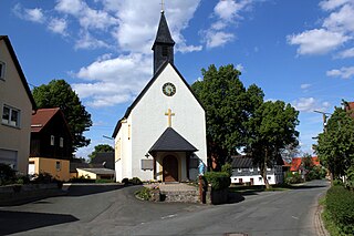
Wattendorf is the smallest community in the Upper Franconian district of Bamberg and a member of the administrative community (Verwaltungsgemeinschaft) of Steinfeld.

Hallstadt Town in Bavaria, Germany

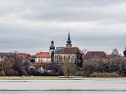
Hallstadt is a town in the Upper Franconian district of Bamberg on the left bank of the Main, 4 km north of Bamberg.

Scheßlitz Town in Bavaria, Germany

Scheßlitz is a town in the Upper Franconian district of Bamberg and lies on the rise to the Franconian Switzerland on the A 70 between Bamberg and Bayreuth, lying 14 km northeast of the former.

Altendorf, Upper Franconia Municipality in Bavaria, Germany

Altendorf is a community in the Upper Franconian district of Bamberg, Bavaria, Germany.

Bischberg Municipality in Bavaria, Germany

Bischberg is a community in the Upper Franconian district of Bamberg lying at the forks of the rivers Regnitz and Main some 5 km west of Bamberg.

Burgwindheim Municipality in Bavaria, Germany

Burgwindheim is a municipality with market rights in the west of the Upper Franconian district of Bamberg and a member of the administrative community (Verwaltungsgemeinschaft) of Ebrach.

Ebrach Municipality in Bavaria, Germany

Ebrach is a municipality with market rights in the Upper Franconian district of Bamberg and the seat of the Verwaltungsgemeinschaft of Ebrach.

Frensdorf Municipality in Bavaria, Germany

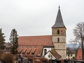
Frensdorf is a community in the Upper Franconian district of Bamberg.

Gerach Municipality in Bavaria, Germany

Gerach is a community in the Upper Franconian district of Bamberg and a member of the administrative community (Verwaltungsgemeinschaft) of Baunach. It lies in the Naturpark Haßberge roughly 20 km north of Bamberg and roughly 10 km south of Ebern.

Gundelsheim, Bavaria Municipality in Bavaria, Germany

Gundelsheim is a community in the Upper Franconian district of Bamberg.

Lauter, Bavaria Municipality in Bavaria, Germany

Lauter is a community in the Upper Franconian district of Bamberg and a member of the administrative community (Verwaltungsgemeinschaft) of Baunach.

Memmelsdorf Municipality in Bavaria, Germany

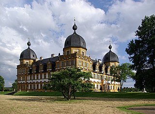
Memmelsdorf is a community in the Upper Franconian district of Bamberg bordering in the west directly on the city of Bamberg.

Oberhaid Municipality in Bavaria, Germany

Oberhaid is a community in the Upper Franconian district of Bamberg.

Priesendorf Municipality in Bavaria, Germany

Priesendorf is a community in the Upper Franconian district of Bamberg and a member of the administrative community (Verwaltungsgemeinschaft) of Lisberg.

Reckendorf Municipality in Bavaria, Germany

Reckendorf is a community in the district of Bamberg, in Upper Franconia, Bavaria, Germany. With roughly 2,000 inhabitants, Reckendorf is a member of the administrative community (Verwaltungsgemeinschaft) of Baunach.

Stadelhofen Municipality in Bavaria, Germany

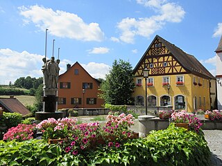
Stadelhofen is a municipality in the Upper Franconian district of Bamberg and a member of the administrative community (Verwaltungsgemeinschaft) of Steinfeld.

Viereth-Trunstadt Municipality in Bavaria, Germany

Viereth-Trunstadt is a community in the Upper Franconian district of Bamberg lying on the Main.

Zapfendorf Municipality in Bavaria, Germany

Zapfendorf is a municipality with market rights in the Upper Franconian district of Bamberg in Bavaria, Germany with roughly 5,000 inhabitants.

Röttenbach Town in Erlangen-Höchstadt district, Bavaria, Germany

Röttenbach is a town in the district of Erlangen-Höchstadt, in Bavaria, Germany.

References

  1. Liste der ersten Bürgermeister/Oberbürgermeister in kreisangehörigen Gemeinden, Bayerisches Landesamt für Statistik, accessed 19 July 2021.
  2. "Tabellenblatt "Daten 2", Statistischer Bericht A1200C 202041 Einwohnerzahlen der Gemeinden, Kreise und Regierungsbezirke". Bayerisches Landesamt für Statistik (in German). June 2021.