Erlbach-Kirchberg

Last updated
Erlbach-Kirchberg
Ortsteil of Lugau
Wappen Erlbach-Kirchberg.png
Coat of arms
Germany adm location map.svg
Red pog.svg
Erlbach-Kirchberg
Coordinates: 50°46′N12°46′E / 50.767°N 12.767°E / 50.767; 12.767 Coordinates: 50°46′N12°46′E / 50.767°N 12.767°E / 50.767; 12.767
Country Germany
State Saxony
District Erzgebirgskreis
Town Lugau
Area
  Total 15.88 km2 (6.13 sq mi)
Elevation 350 m (1,150 ft)
Population (2011-12-31)
  Total 1,673
  Density 110/km2 (270/sq mi)
Time zone CET/CEST (UTC+1/+2)
Postal codes 09385
Dialling codes 037295
Vehicle registration ERZ

Erlbach-Kirchberg is a former municipality in the district Erzgebirgskreis, in Saxony, Germany. Since 1 January 2013, it is part of the town Lugau.

Erzgebirgskreis District in Saxony, Germany

Erzgebirgskreis is a district (Kreis) in the Free State of Saxony, Germany. It is named after the Erzgebirge, a mountain range in the southern part of the district which forms part of the Germany–Czech Republic border. It borders the districts of Vogtlandkreis and Zwickau, the urban district Chemnitz, the district Mittelsachsen and the Czech Republic.

Saxony State in Germany

Saxony, officially the Free State of Saxony, is a landlocked federal state of Germany, bordering the federal states of Brandenburg, Saxony Anhalt, Thuringia, and Bavaria, as well as the countries of Poland and the Czech Republic. Its capital is Dresden, and its largest city is Leipzig.

Germany Federal parliamentary republic in central-western Europe

Germany, officially the Federal Republic of Germany, is a country in Central and Western Europe, lying between the Baltic and North Seas to the north, and the Alps to the south. It borders Denmark to the north, Poland and the Czech Republic to the east, Austria and Switzerland to the south, France to the southwest, and Luxembourg, Belgium and the Netherlands to the west.

Contents

History

Erlbach was established as a waldhufendorf settlement by Frankish farmers in the 12th century. The first documented mention of the place was in 1486.

<i>Waldhufendorf</i> type of village

The Waldhufendorf is a form of rural settlement established in areas of forest clearing with the farms arranged in a series along a road or stream, like beads on a chain. It is typical of the forests of central Germany and is a type of Reihendorf, in which each farmstead usually has two wide strips of land adjacent to the farmhouse.

Franks people

The Franks were a collection of Germanic peoples, whose name was first mentioned in 3rd century Roman sources, associated with tribes on the Lower and Middle Rhine, on the edge of the Roman Empire. Later the term was associated with Romanized Germanic dynasties within the collapsing Roman Empire, who eventually commanded the whole region between the rivers Loire and Rhine. They then imposed power over many other post-Roman kingdoms and Germanic peoples, and still later they were given recognition by the Catholic Church as successors to the old rulers of the Western Roman Empire.

Monuments

A monument was erected in Erlbach graveyard in memorial of six unknown concentration camp prisoners who were murdered in the vicinity in March 1945 by SS soldiers on a death march from Auschwitz.

<i>Schutzstaffel</i> Major paramilitary organization of Nazi Germany

The Schutzstaffel was a major paramilitary organization under Adolf Hitler and the Nazi Party (NSDAP) in Nazi Germany, and later throughout German-occupied Europe during World War II. It began with a small guard unit known as the Saal-Schutz made up of NSDAP volunteers to provide security for party meetings in Munich. In 1925, Heinrich Himmler joined the unit, which had by then been reformed and given its final name. Under his direction (1929–45) it grew from a small paramilitary formation to one of the most powerful organizations in Nazi Germany. From 1929 until the regime's collapse in 1945, the SS was the foremost agency of security, surveillance, and terror within Germany and German-occupied Europe.

Related Research Articles

Matilda of Ringelheim German queen consort and duchess consort of Saxony

Saint Matilda was Duchess of Saxony from 912 and German queen from 919 by her marriage with Henry the Fowler, the first king of the Ottonian dynasty. Upon her husband's death in 936, she founded Quedlinburg Abbey to commemorate the late king. Matilda lived to see Western Imperial rule restored when her eldest son Otto was crowned Holy Roman Emperor in 962. Her surname refers to Ringelheim, where her comital Immedinger relatives established a nunnery about 940.

Neustadt (Aisch)-Bad Windsheim District in Bavaria, Germany

Neustadt (Aisch)-Bad Windsheim is a Landkreis (district) in Bavaria, Germany. It is bounded by the districts of Würzburg, Kitzingen, Bamberg, Erlangen-Höchstadt, Fürth and Ansbach, and by the state of Baden-Württemberg.

Neustadt an der Aisch Place in Bavaria, Germany

Neustadt an der Aisch is a small town of around 12,000 in the northern part of Bavaria (Germany), within the Franconian administrative region Middle Franconia. It is the district town of the district Neustadt (Aisch)-Bad Windsheim.

Kirchberg may refer to:

Niedenstein Place in Hesse, Germany

Niedenstein is a small town and an officially recognized climatic spa in the Schwalm-Eder district in northern Hesse, Germany.

Kirchberg, Saxony Place in Saxony, Germany

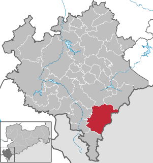
Kirchberg is a town in the Zwickau district, in the Free State of Saxony, Germany. It is situated at the western end of the Ore Mountains, 11 km south of Zwickau.

Markneukirchen Place in Saxony, Germany

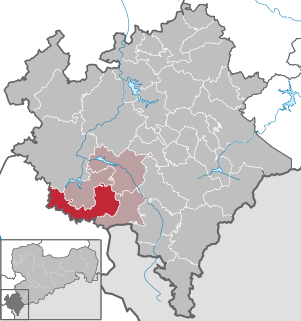
Markneukirchen is a town in the Vogtlandkreis district, in the Free State of Saxony, Germany, close to the Czech border. It lies in between the Erzgebirge and the Fichtelgebirge in the Elstergebirge, 24 km (14.9 mi) southeast of Plauen, and 14 km (8.7 mi) northeast of Asch.

Kirchberg, Bern Place in Bern, Switzerland

Kirchberg is a municipality in the administrative district of Emmental in the canton of Bern in Switzerland.

Großschönau, Saxony Place in Saxony, Germany

Großschönau is a municipality in the district Görlitz, in Saxony, Germany located in the Cross-border region with the Czech Republic. It used to be a famous Upper Lusatian center of Damask fabric production until the end of the 1980s. Since then it has turned into an area of tourism.

Seelitz Place in Saxony, Germany

Seelitz is a municipality in the district of Mittelsachsen, in Saxony, Germany. It is part of the administrative partnership Verwaltungsgemeinschaft Rochlitz based in the eponymous town.

Erlbach, Saxony Ortsteil of Markneukirchen in Saxony, Germany

Erlbach is a village and a former municipality in the Vogtlandkreis district, in Saxony, Germany. Since 1 January 2014, it is part of the town Markneukirchen.

Triebel Place in Saxony, Germany

Triebel is a municipality in the Vogtlandkreis district, in Saxony, Germany, situated south of the town of Plauen.

Andreas Kirchner East German bobsledder

Andreas Kirchner was an East German hammer thrower and bob pusher for record holder Wolfgang Hoppe.

Kirchberg, Rhein-Hunsrück Place in Rhineland-Palatinate, Germany

Kirchberg, the Stadt auf dem Berg, called Kerbrich in Moselle Franconian, is a town in the Rhein-Hunsrück-Kreis (district) in Rhineland-Palatinate, Germany. It is the seat of the like-named Verbandsgemeinde, to which it also belongs.

Woppenroth Place in Rhineland-Palatinate, Germany

Woppenroth is an Ortsgemeinde – a municipality belonging to a Verbandsgemeinde, a kind of collective municipality – in the Rhein-Hunsrück-Kreis (district) in Rhineland-Palatinate, Germany. It belongs to the Verbandsgemeinde of Kirchberg, whose seat is in the like-named town.

Vysoký kámen special area of conservation in the Czech Republic

The stony summit Vysoký kámen lies 8 km west of Kraslice in okres Sokolov and 1 km from the German border in the Elstergebirge, part of the Erzgebirge.

Zwickau (district) District in Saxony, Germany

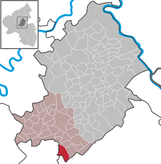
Zwickau is a district (Kreis) in the Free State of Saxony, Germany.

Silberstraße (Wilkau-Haßlau) human settlement in Germany

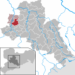
Silberstraße is a formerly independent parish in the German state of Saxony. Since 1999 it has been part of the borough of Wilkau-Haßlau, in the district of Zwickau. It has around 2,000 inhabitants and lies at an elevation of 340 m above sea level (NN). As well as the old village houses it also has a newly built residential area with modern housing units, large industrial estates with textile firms and agricultural concerns.

Chemnitzer Umland – Erzgebirgskreis II federal electoral district of Germany

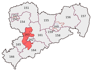
Chemnitzer Umland – Erzgebirgskreis II is one of the 299 single member constituencies used for the German parliament, the Bundestag. One of sixteen constituencies covering the state of Saxony, it contains parts of the Erzgebirgskreis, Mittelsachsen and Zwickau local government districts. The constituency elects one representative under the mixed member proportional representation (MMP) system. Under the current constituency numbering system, it is designated as constituency 163.

Erlbach may refer to:

References