This article includes a list of general references, but it lacks sufficient corresponding inline citations .(April 2021) |
Erp is a village in Erftstadt, North Rhine-Westphalia, Germany. It has about 2650 inhabitants (2006).
This article includes a list of general references, but it lacks sufficient corresponding inline citations .(April 2021) |
Erp is a village in Erftstadt, North Rhine-Westphalia, Germany. It has about 2650 inhabitants (2006).
Erp is located 25 km south-west of Cologne in an open and flat landscape about 125 metres above sea level. The municipal territory covers 1630 ha. The soil is a rich loess. The land outside the village is entirely used for agricultural purposes, with sugar beet, wheat, barley and potatoes being the main products. A small brook, the Erpa, rises a few hundred meters west of the village and flows through it in an easterly direction.
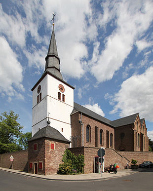
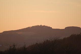
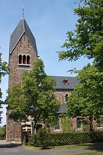
Erp's widely visible landmark is the high white tower of St. Pantaleon's church in the centre of the village. A large number of farm houses and buildings, many of which have been transformed into accommodation over the last years, still characterise the appearance of the village. A green band of meadows and gardens on both sides of the Erpa runs through the old centre. Many new buildings – mostly detached houses – built as of the 1960s around the old centre complete the picture.
The oldest traces of human settlement in the municipal territory go back to prehistoric times. The names of the village and of the brook Erp/Erpa are of pre-Germanic origin (from "Erl-Apa", which means "running water"). They indicate that the place has been inhabited continuously for more than 2000 years.
Various objects from Roman times (coins, pots, bricks) were discovered in and around the village. A visible trace of these times is the Roman road between Cologne and Trier, which runs through the south of the municipal territory. In the present day its straight route is still used as a track across the fields.
In 1140 Erp was mentioned in a document for the first time. In the Middle Ages Erp lay in the territory of the archbishop and electoral prince of Cologne. However, the Counts of Schleiden residing in the town of the same name in the nearby mountains of the Eifel and as of 1451 their successors, the Counts of Manderscheid-Blankenheim, held the power in the village. In these times almost the entire population of the village worked in the agricultural sector. During the Thirty Years' War in February 1642, Erp was completely destroyed (except for one house) by French and Hessian troupes. During the long reign (1644–1684) of Count Salentin Ernst of Manderscheid-Blankenheim the village was slowly rebuilt.
The old feudal system disappeared with the arrival of French troops in October 1794. The French made Erp a municipality (in French: “mairie”) as part of the French administration. After the official recognition of the annexation of the Rhineland in the Treaty of Lunéville in 1801 Erp became French; a situation that should last until 1814. The French period had important consequences for the village. The big farms which had been owned for centuries by nobles, monasteries or other religious institutions were sold by auction and became property of private persons. Moreover, the legal and administrative system changed completely.
In 1815 the Prussians followed the French. They retained – except for the language and some smaller modifications here and there - the legal and administrative system introduced by the French. Erp remained a municipality in the district of Lechenich, which became district of Euskirchen in 1827. This administrative structure should stay for almost 150 years.
In the end of the 19th century the industrialisation started to change the rhythm of life in Erp which had been determined by the agriculture for centuries. The quarrying of brown coal in the nearby area of the Ville, a low ridge west of Cologne, and around Zülpich offered jobs for the local population outside of the agriculture. Moreover, in 1894 Erp got a rail way station, which allowed the transport of agricultural products beyond the immediate surroundings. This was also the beginning of the cultivation of sugar beets in Erp which is still the main pillar of its agriculture.
During a bomb attack on 30 November 1944 a large part of the village was severely damaged. In the beginning of March 1945 Erp was taken by American troops. Subsequently, Erp became part of the British occupation zone. In August 1946 Erp became part of the new Land North Rhine-Westphalia (in German: “Nordrhein-Westfalen”).
In 1969, the municipality of Erp was integrated in the newly created town of Erftstadt, a merger of a small town and several villages right and left of the river Erft. In 1975, Erftstadt was cut from the district of Euskirchen and attached to the newly created Erft-district, which was renamed into Rhein-Erft-district (in German: Rhein-Erft-Kreis) in 2003.
The agriculture, dominating factor of the economy for centuries has lost its importance as employer for the local population. Today the field work is done by the few remaining farmers themselves with bigger and bigger machines. The vast majority of the working population commutes to the nearby city of Cologne. Erp’s biggest employer is now a gravel and recycling company. Moreover, there are a number of jobs in local businesses and some smaller workshops.
Erp is located at the federal road (in German: Bundesstrasse) B 265, which connects it with Cologne and Trier. The next highway (A1/61) is 7 km away.
Erp has a kindergarten
Erp is rich in clubs, organisations and societies. The riflemen guild which has its roots in the 17th century organises an annual fair. Erp being a traditional stronghold of the carnival has a carnival club that organises the annual season with numerous events and - as a well known highlight - the carnival parade on Rosenmontag. Moreover, there are sport clubs, choirs, a horticulture club and many others.
Finally, the dialect spoken in Erp has some particularities which have been the object of linguistic research in the 1980s; the most distinct feature being the rolling “R”.
![]() Media related to Erp, North Rhine-Westphalia at Wikimedia Commons
Media related to Erp, North Rhine-Westphalia at Wikimedia Commons
Coordinates: 50°46′N6°43′E / 50.767°N 6.717°E
| General | |
|---|---|
| National libraries | |
The Rhein-Erft-Kreis is a district in the west of North Rhine-Westphalia, Germany. Neighboring districts are Neuss, district-free Cologne, Rhein-Sieg, Euskirchen, Düren.
Euskirchen is a Kreis (district) in the south-west of North Rhine-Westphalia, Germany. Neighboring districts are Aachen, Düren, Rhein-Erft-Kreis, Rhein-Sieg, Ahrweiler, Daun, Bitburg-Prüm, and the Liège province (Belgium).

The Rhein-Sieg-Kreis is a Kreis (district) in the south of North Rhine-Westphalia, Germany. Neighboring districts are Rheinisch-Bergischer Kreis, Oberbergischer Kreis, Altenkirchen, Neuwied, Ahrweiler, Euskirchen, Rhein-Erft-Kreis, the urban district of Cologne. The federal city of Bonn is nearly completely surrounded by the district.
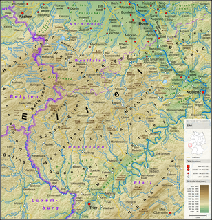
The Eifel is a low mountain range in western Germany and eastern Belgium. It occupies parts of southwestern North Rhine-Westphalia, northwestern Rhineland-Palatinate and the southern area of the German-speaking Community of Belgium.

The Erft is a river in North Rhine-Westphalia, Germany. It flows through the foothills of the Eifel, and joins the Lower Rhine. Its origin is near Nettersheim, and its mouth in Neuss-Grimlinghausen south of the Josef Cardinal Frings Bridge. The river is 106.6 kilometres (66.2 mi) long, which is significantly shorter than it was originally. Due to the open-pit mining of lignite in the Hambacher Loch, the flow of the river had to be changed.
Erftstadt is a town located about 20 km south-west of Cologne in the Rhein-Erft-Kreis, state of North Rhine-Westphalia, Germany. The name of the town derives from the river that flows through it, the Erft. The neighbouring towns are Brühl, Kerpen, Zülpich and Weilerswist.

Euskirchen is a town in North Rhine-Westphalia, Germany, capital of the district Euskirchen. While Euskirchen resembles a modern shopping town, it also has a history dating back over 700 years, having been granted town status in 1302. As of December 2007, it had a population of 55,446. Its local football club is called TSC Euskirchen.

The Swist is a stream, 43.6 kilometres (27.1 mi) long, in the German Rhineland. It rises on the northern edge of the Eifel at 330 metres above sea level and empties from the right and southeast into the Rhine tributary, the Erft, between Weilerswist and Bliesheim. Occasionally the Swist is also called the Swistbach, and locals often just call it der Bach.

Jünkerath is an Ortsgemeinde – a municipality belonging to a Verbandsgemeinde, a kind of collective municipality – in the Vulkaneifel district in Rhineland-Palatinate, Germany. It was th seat of the former Verbandsgemeinde of Obere Kyll.

Kerschenbach is an Ortsgemeinde – a municipality belonging to a Verbandsgemeinde, a kind of collective municipality – in the Vulkaneifel district in Rhineland-Palatinate, Germany. It belongs to the Verbandsgemeinde of Gerolstein, whose seat is in the municipality of Gerolstein.

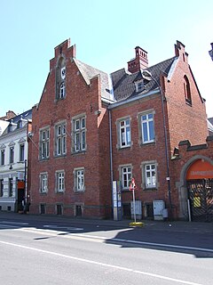
Erftstadt station is the only passenger station of the town of Erftstadt in the German state of North Rhine-Westphalia and is thus the major transport hub of the town. The station building is located in the district of Liblar. The station is served by Regional-Express services, RE 22 and RE 12 (Eifel-Mosel-Express) and Regionalbahn service RB 24 (Eifelbahn) of the Verkehrsverbund Rhein-Sieg, which run from Trier via Kalle to Cologne Hauptbahnhof and together provide services at 30-minute intervals. These services operate on the Eifel Railway (Eifelstrecke).
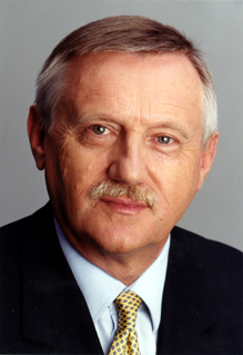
Edgar Moron is a German politician for the Social Democratic Party of Germany (SPD). He served in the Landtag of North Rhine-Westphalia for twenty years, from 1990 to 2010, reaching the position of 1st Vice President in 2005.
The Michelsberg, at 586.1 m above sea level (NHN), is the highest point in the borough of Bad Münstereifel in the county of Euskirchen in the German state of North Rhine-Westphalia. The hill, which rises near the village of Mahlberg belongs to that part of the Eifel mountains known as the Ahr Hills (Ahreifel), and is the second highest point in the range.
The fortification on the Stromberg near Ripsdorf in the German state of North Rhine-Westphalia is a circular rampart site, which may have been a Celtic refuge fort.
Dollendorf is a village in the municipality of Blankenheim in the district of Euskirchen in the German state of North Rhine-Westphalia. It gives its name to the surrounding limestone depression (Kalkmulde).
The Alte Burg near Lommersdorf in the municipality of Blankenheim in the county of Euskirchen in the German state of North Rhine-Westphalia is a levelled mediaeval castle site.

Arloff Castle is on the river Erft in the village of Arloff, part of the borough of Bad Münstereifel in the county of Euskirchen, in the German state of North Rhine-Westphalia.
Arloff is a village in the borough of Bad Münstereifel in the district of Euskirchen in the German state of North Rhine-Westphalia.
Houverath is a village in the town of Bad Münstereifel in the district of Euskirchen, in the German state of North Rhine-Westphalia.
The Eifel dialects are those dialects spoken in the Eifel mountains of Germany. They divide into two language regions: the dialects spoken in the southern Eifel (Eifelisch) are part of the Moselle Franconian dialect group and closely resemble Luxembourgish. In the northern Eifel, by contrast, the dialects (Eifelplatt) belong to the Ripuarian dialect group and are more like Öcher Platt or Kölsch. In between there is a dialect continuum of typical transitions, whereby more or less every village speaks a little differently from its neighbours.