
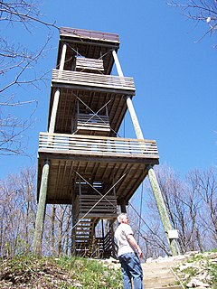
Zorah or Tzorah, perhaps "place of wasps," was a biblical town in the lower hill country of Judah. The site lies at an elevation of about 1,150 feet (350 m) above sea-level.

The Ouachita National Forest is a vast congressionally-designated National Forest that lies in the western portion of Arkansas and portions of extreme-eastern Oklahoma.

Kisatchie National Forest, the only National forest in Louisiana, United States, is located in the forested piney hills and hardwood bottoms of seven central and northern parishes. It is part of the Cenozoic uplands and has large areas of longleaf pine forests. It is one of the largest pieces of natural landscape in Louisiana, with some 604,000 acres (2,440 km2) of public land, more than half of which is vital longleaf pine and flatwoods vegetation. These support many rare plant and animal species. There are also rare habitats, such as hillside seepage bogs and calcareous prairies. The forest also contains and provides a buffer for the Kisatchie Hills Wilderness, a nationally designated wilderness area that contributes to protecting biodiversity of the coastal plain region of the United States.

The Flathead National Forest is a national forest in the western part of the U.S. state of Montana. The forest lies primarily in Flathead County, south of Glacier National Park. The forest covers 2,404,935 acres of which about 1 million acres (4,000 km2) is designated wilderness. It is named after the Flathead Native Americans who live in the area.

The Spring Mountains National Recreation Area (SMNRA) is a U.S. national recreation area, administered by the U.S. Forest Service, west of Las Vegas, Nevada. It covers over 316,000 acres. The area runs from low meadows, to the 11,918-foot (3,633 m) Mount Charleston. The SMNRA is a part of the Humboldt-Toiyabe National Forest. It adjoins the Red Rock Canyon National Conservation Area, which is administered by the Bureau of Land Management.

The Chattahoochee–Oconee National Forest in northern Georgia comprises two United States National Forests, the Oconee National Forest in eastern Georgia and the Chattahoochee National Forest located in the North Georgia Mountains. The Chattahoochee National Forest is composed of an eastern and western forest. The western forest contains Johns Mountain, Little Sand Mountain, and Taylor Ridge (Georgia). The combined total area of the Chattahoochee–Oconee National Forest is 866,468 acres (3,506 km2), of which the Chattahoochee National Forest comprises 750,145 acres (3,036 km2) and the Oconee National Forest comprises 116,232 acres (470 km2). The county with the largest portion of the eastern forest is Rabun County, Georgia, which has 148,684 acres (601.7 km2) within its boundaries.

Chippewa National Forest is a National Forest located in north central Minnesota, United States, in the counties of Itasca, Cass and Beltrami. Forest headquarters are located in Cass Lake, Minnesota. There are local ranger district offices in Blackduck, Deer River and Walker.

The Israel National Trail, is a hiking path that was inaugurated in 1995. The trail crosses the entire country of Israel. Its northern end is at Dan, near the Lebanese border in the far north of the country, and it extends to Eilat at the southernmost tip of Israel on the Red Sea, a length of 1,015 km (631 mi).
The Kettle Moraine State Forest is a state forest in southeastern Wisconsin. The chief feature of the reserve is the Kettle Moraine, a highly glaciated area. The area contains very hilly terrain and glacial landforms, such as kettles, kames and eskers. The 56,000-acre (23,000 ha) forest is divided into two large and three small units, which are spread across a hundred miles.

The Whiskeytown–Shasta–Trinity National Recreation Area is a United States National Recreation Area in northern California. The recreation area was authorized in 1965 by the United States Congress. Recreational activities available include swimming, fishing, boating, camping, and hiking.

Ouachita National Recreation Trail is a 223-mile (359 km) long, continuous hiking trail through the Ouachita Mountains of Oklahoma and Arkansas. It is the longest backpacking trail in the Ouachita National Forest, spanning 192 miles across its length. Approximately 177 miles of the trail is in Arkansas and 46 miles of the trail is in Oklahoma. The trail is used by hikers, backpackers, hunters, and mountain bikers. It is a non-motorized single track trail open only to foot traffic and partially open to mountain bicycles. Segments opened to mountain bikes are from the western terminus of the Ouachita Trail at Talimena State Park to the Big Cedar trailhead on US Highway 259 at approximately Mile Marker (MM) 30.5 in Oklahoma, and from the Talimena Scenic Drive Trailhead at MM 54.1, east to Highway 7 at mile 160.4, north of Jessieville, Arkansas.

Ellicott Rock Wilderness is managed by the United States Forest Service and is part of the National Wilderness Preservation System. It was first designated by Congress in 1975 with the Eastern Wilderness Act. The majority of this land lays in South Carolina. Additional lands were added to Ellicott Rock Wilderness in 1984 with the passing of the North Carolina Wilderness Act and the Georgia Wilderness Act, today designated wilderness totals 8,274 acres (33.48 km2). Ellicott Rock Wilderness is the only wilderness that straddles three states, with boundaries located around the point at which Georgia, North Carolina, and South Carolina come together. Ellicott Rock Wilderness also spans three National Forests. Sumter National Forest in South Carolina is responsible for 2,859 acres (11.57 km2), receives the majority of recreation in the wilderness, and is also the lead manager of Ellicott Rock Wilderness. Nantahala National Forest in North Carolina is responsible for the majority of the wilderness at 3,394 acres (13.74 km2) and the Chattahoochee National Forest in Georgia manages 2,021 acres (8.18 km2) of the wilderness. In 1979, all Forest Service land was surveyed under the Roadless Area Review and Evaluation and 1,982 acres (8.02 km2) on the Sumter National Forest were classified as Roadless National Forest System land and named Ellicott Rock Extension. The Andrew Pickens Ranger district on the Sumter National Forest recommended the Ellicott Rock Extension as wilderness in 1995 in their Resource Management Plan. Although not fully designated, recommended wilderness is managed as if it were designated wilderness. In June 2017 during a land management plan revision, the Nantahala Ranger District on the Nantahala National Forest added 824 acres (3.33 km2) of proposed wilderness, currently called Ellicott Rock West Extension.

Britannia Park is a forest and recreation area in Israel, in the Judean lowland.
The Siskiyou Wilderness is a federal wilderness area designated by the passage of the California Wilderness Act of 1984. Originally, the land area was 153,000 acres (620 km2) The Northern California Wild Heritage Act of 2006 added 30,122 acres (121.90 km2) for the current total of 182,802 acres (739.77 km2). All of the wilderness is in Northern California and is managed by the U.S. Forest Service. The wilderness spans three national forests: the Rogue River–Siskiyou, the Klamath, and the Six Rivers.

Mateh Yehuda Regional Council is a regional council in the Jerusalem District of Israel. In 2008 it was home to 36,200 people.
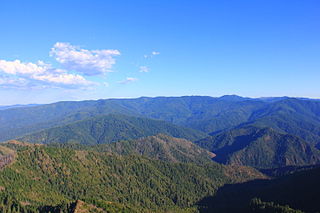
The Wild Rogue Wilderness is a wilderness area surrounding the 84-mile (135 km) Wild and Scenic portion of the Rogue River in southwestern Oregon, U.S. to protect the watershed. The wilderness was established in 1987 and now comprises 35,818 acres (14,495 ha). Because it spans part of the Rogue River-Siskiyou National Forest as well as the Medford district of the Bureau of Land Management (BLM), the Wild Rogue Wilderness is administered by both the BLM and the Forest Service.

Eshtaol was is a moshav in central Israel, and a biblical location mentioned in the books of Joshua and Judges and in the first book of Chronicles. Located 6 km north of Beit Shemesh, it falls under the jurisdiction of Mateh Yehuda Regional Council. In 2019 it had a population of 1,238.

Mount Mansfield State Forest covers 44,444 acres (179.86 km2) in seven towns in Chittenden, Lamoille and Washington counties in Vermont. The towns are Bolton and Underhill in Chittenden County, Cambridge, Johnson, Morristown and Stowe in Lamoille County, and Waterbury in Washington County. Mt. Mansfield State Forest is the largest contiguous landholding owned by the Vermont Department of Forests, Parks and Recreation.

Adullam-France Park, also known as Parc de France-Adoulam, is a sprawling park of 50,000 dunams (ca. 12,350 acres) in the Central District of Israel, located south of Beit Shemesh. The park, established in 2008 for public recreation, features two major hiking and biking trails, and four major archaeological sites from the Second Temple period. It stretches between Naḥal Ha-Elah, its northernmost boundary, to Naḥal Guvrin, its southernmost boundary. To its west lies the Beit Guvrin-Beit Shemesh highway, and to its east the "green line" – now territories under joint Israeli-Palestinian Arab control – which marks its limit.

