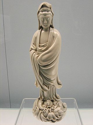
A figurine or statuette is a small, three-dimensional sculpture that represents a human, deity or animal, or, in practice, a pair or small group of them. Figurines have been made in many media, with clay, metal, wood, glass, and today plastic or resin the most significant. Ceramic figurines not made of porcelain are called terracottas in historical contexts.
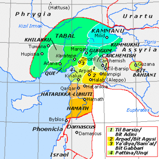
Carchemish, also spelled Karkemish, was an important ancient capital in the northern part of the region of Syria. At times during its history the city was independent, but it was also part of the Mitanni, Hittite and Neo-Assyrian Empires. Today it is on the frontier between Turkey and Syria.

Aram was a historical region mentioned in early cuneiforms and in the Bible. The area did not develop into a larger empire but consisted of several small states in present-day Syria. Some of the states are mentioned in the Hebrew Bible, Aram-Damascus being the most outstanding one, which came to encompass most of Syria. In the Bible, Aram-Damascus is simply commonly referred to as Aram.
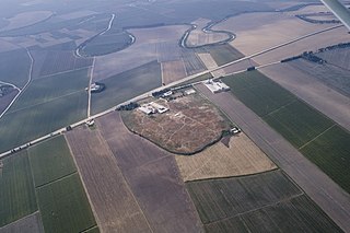
Tell Ta'yinat is a low-lying ancient tell on the east bank at the bend of the Orontes River where it flows through the Amuq valley, in the Hatay province of southeastern Turkey about 25 kilometers south east of Antakya, and lies near Tell Atchana, the site of the ancient city of Alalakh. Tell Ta'yinat has been proposed as the site of Alalaḫu, inhabited in late 3rd millennium BC, mentioned in Ebla's Palace G archive; and in later times as Kinalua, the capital city of an Iron Age Neo-Hittite kingdom. Among the findings are an Iron Age temple and several 1st millennium BC cuneiform tablets. Chatal Huyuk (Amuq) is another major site that is located in the area.

Zincirli Höyük is an archaeological site located in the Anti-Taurus Mountains of modern Turkey's Gaziantep Province. During its time under the control of the Neo-Assyrian Empire it was called, by them, Sam'al. It was founded at least as far back as the Early Bronze Age and thrived between 3000 and 2000 BC, and on the highest part of the upper mound was found a walled citadel of the Middle Bronze Age.
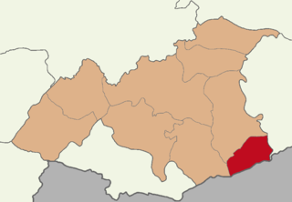
Karkamış, formerly Carablus, is a municipality and district of Gaziantep Province, Turkey. Its area is 298 km2, and its population is 9,379 (2022). It is next to the site of ancient Carchemish.

The states called Neo-Hittite, Syro-Hittite, or Luwian-Aramean were Luwian and Aramean regional polities of the Iron Age, situated in southeastern parts of modern Turkey and northwestern parts of modern Syria, known in ancient times as lands of Hatti and Aram. They arose following the collapse of the Hittite New Kingdom in the 12th century BCE, and lasted until they were subdued by the Assyrian Empire in the 8th century BCE. They are grouped together by scholars, on the basis of several cultural criteria, that are recognized as similar and mutually shared between both societies, northern (Luwian) and southern (Aramaean). Cultural exchange between those societies is seen as a specific regional phenomenon, particularly in light of significant linguistic distinctions between the two main regional languages, with Luwian belonging to the Anatolian group of Indo-European languages and Aramaic belonging to the Northwest Semitic group of Semitic languages. Several questions related to the regional grouping of Luwian and Aramaean states are viewed differently among scholars, including some views that are critical towards such grouping in general.
Tille Höyük is an archaeological site in at Geldibuldu village in the Adıyaman Province of Turkey. It is a small settlement mound on the west bank of the Euphrates some 60 km east of Adıyaman.
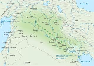
The Civilization of Mesopotamia ranges from the earliest human occupation in the Paleolithic period up to Late antiquity. This history is pieced together from evidence retrieved from archaeological excavations and, after the introduction of writing in the late 4th millennium BC, an increasing amount of historical sources. While in the Paleolithic and early Neolithic periods only parts of Upper Mesopotamia were occupied, the southern alluvium was settled during the late Neolithic period. Mesopotamia has been home to many of the oldest major civilizations, entering history from the Early Bronze Age, for which reason it is often called a cradle of civilization.
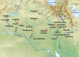
Til Barsip or Til Barsib is an ancient site situated in Aleppo Governorate, Syria by the Euphrates river about 20 kilometers south of ancient Carchemish.
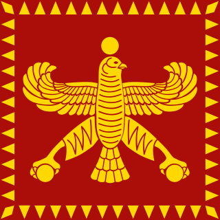
Eber-Nari (Akkadian), also called Abar-Nahara (Aramaic) or Aber Nahra (Syriac), was a region of the ancient Near East. Translated as "Beyond the River" or "Across the River" in both the Akkadian and Aramaic languages, it referred to the land on the opposite side of the Euphrates from the perspective of Mesopotamia and Persia. In this context, the region is further known to modern scholars as Transeuphratia. Functioning as a satrapy, it was originally administered by the Neo-Assyrian Empire before being absorbed by the Neo-Babylonian Empire and then by the Achaemenid Empire. During the Greek conquest of Persia, Eber-Nari was, like the rest of the Achaemenid Empire, annexed by the Macedonian Empire of Alexander the Great. It was later dissolved by the Seleucid Empire, which incorporated it into Syria, along with Assyria.
Tell Fray is a tell, or settlement mound, on the east bank of the Euphrates in Raqqa Governorate, northern Syria. The archaeological site takes its name from an ancient irrigation canal, hence 'Fray' or 'Little Euphrates'. It was part of a rescue excavation project for sites to be submerged by the creation of Lake Assad by the Tabqa Dam.
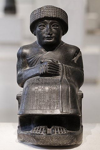
The art of Mesopotamia has survived in the record from early hunter-gatherer societies on to the Bronze Age cultures of the Sumerian, Akkadian, Babylonian and Assyrian empires. These empires were later replaced in the Iron Age by the Neo-Assyrian and Neo-Babylonian empires. Widely considered to be the cradle of civilization, Mesopotamia brought significant cultural developments, including the oldest examples of writing.

Bouqras is a large, oval shaped, prehistoric, Neolithic Tell, about 5 hectares (540,000 sq ft) in size, located around 35 kilometres (22 mi) from Deir ez-Zor in Syria.

Tell Rifaat is a city in northern Aleppo Governorate, northwestern Syria. Located roughly 40 kilometres (25 mi) north of Aleppo, the city is the administrative center of Nahiya Tell Rifaat. Nearby localities include Azaz to the north, Mare' to the east, Kafr Naya to the south, Deir Jmal and Oqayba to the southwest and Ibbin Samaan to the west. In the 2004 census, Tell Rifaat had a population of 20,514.
Tell Judaidah is an archaeological site in south-eastern Turkey, in the Hatay province. It is one of the largest excavated ancient sites in the Amuq valley, in the plain of Antioch. Settlement at this site ranges from the Neolithic through the Byzantine Period.

Niğde Archaeological Museum is located in the centre of the Turkish provincial capital, Niğde between Dışarı Cami Sokak and Öğretmenler Caddesi. It contains objects found at sites in the surrounding area, including the tell of Köşk Höyük and the Graeco-Roman city of Tyana, both in the nearby town of Kemerhisar.
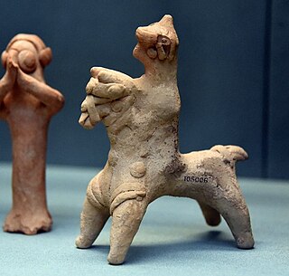
The Euphrates Handmade Syrian Horses and Riders are zoomorphic clay figurines representing horses and horses with riders. They date from the late Iron Age period and were produced in the Middle Euphrates region, alongside anthropomorphic figures known as Euphrates Syrian Pillar Figurines (EU_SPFs).
Tell Hadidi is an ancient Near East archaeological site in Syria about 30 kilometers north of Emar and 5 kilometers north of Ekalte.

Chatal Höyük (Amuq) is a large archaeological site in the eastern part of the Amuq plain in Turkey. It is located in the valley of the Orontes River, and it was inhabited from the late 4th millennium BCE, and until about 500 BC. It was a large town during the time of the Hittite Empire. In the Iron Age it was a part of the state of Unqi, based at the nearby site of Tell Tayinat.


