Contents
Hollinwood Branch Canal | |||||||||||||||||||||||||||||||||||||||||||||||||||||||||||||||||||||||||||||||||||||||||||||||||||||||||||||||||||||||||||||||||||||||||||||||||||||||||||||||||||||||||||||||||||||||||||||||
|---|---|---|---|---|---|---|---|---|---|---|---|---|---|---|---|---|---|---|---|---|---|---|---|---|---|---|---|---|---|---|---|---|---|---|---|---|---|---|---|---|---|---|---|---|---|---|---|---|---|---|---|---|---|---|---|---|---|---|---|---|---|---|---|---|---|---|---|---|---|---|---|---|---|---|---|---|---|---|---|---|---|---|---|---|---|---|---|---|---|---|---|---|---|---|---|---|---|---|---|---|---|---|---|---|---|---|---|---|---|---|---|---|---|---|---|---|---|---|---|---|---|---|---|---|---|---|---|---|---|---|---|---|---|---|---|---|---|---|---|---|---|---|---|---|---|---|---|---|---|---|---|---|---|---|---|---|---|---|---|---|---|---|---|---|---|---|---|---|---|---|---|---|---|---|---|---|---|---|---|---|---|---|---|---|---|---|---|---|---|---|---|
| |||||||||||||||||||||||||||||||||||||||||||||||||||||||||||||||||||||||||||||||||||||||||||||||||||||||||||||||||||||||||||||||||||||||||||||||||||||||||||||||||||||||||||||||||||||||||||||||
The Fairbottom Branch Canal was a canal near Ashton-under-Lyne in Greater Manchester, England.
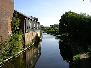
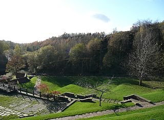
The canal left the Hollinwood Branch Canal at Fairbottom Junction immediately above lock 22. It was just over one mile long (1.82 km) and it was lock free. It terminated at Fenny Fields Bridge, Bardsley, which is situated in the Medlock Valley between Ashton-under-Lyne and Oldham.
Although this canal was mainly rural, its main purpose was to carry coal so there was a loading stage for coal and a short private branch for the same purpose. There was also a mill.
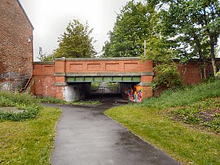
Immediately north east of the terminus at Fenny Fields Bridge an industrial community was founded at Park Bridge and a tramway, which included a small-bore tunnel 150 yards (140 m) long, connected the two together. This community was founded in 1783 by Samuel Lees to make rollers for the textile industry. This community expanded rapidly as the demand for textile machinery increased. Following the premature death of Samuel in 1804 the factory was successfully run by his widow Hannah Lees née Buckley and in later years the company was renamed Hannah Lees & Sons in her honour. The last part of this works closed in 1963 due to the decline in the textile industry.

Around 1800, water was being supplied to this canal by Fairbottom Bobs , a Newcomen engine working for mine drainage. [1]
At first, waggon haulage on the tramway was by means of horses but early in the 1840s a steam locomotive called ‘The Ashtonian’ replaced them. Because of the narrow-bore tunnel, the driver needed to be of short stature and even then he had to kneel down to pass through the tunnel. The locomotive's funnel also had to be removed. This tramway remained operational into the 1880s.
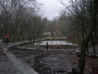
In the early 1930s two leakages occurred that made it necessary to lower the water level in the canal and this, coupled with mining subsidence, caused its unofficial closure in 1932. By 1948 the canal was completely unnavigable but it did remain in water.
Much of the line of the former canal remained intact and there are now plans to re-open part of it again as an amenity canal along with much of the Hollinwood Branch Canal.
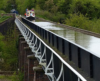
The Stratford-upon-Avon Canal is a canal in the south Midlands of England. The canal, which was built between 1793 and 1816, runs for 25.5 miles (41.0 km) in total, and consists of two sections. The dividing line is at Kingswood Junction, which gives access to the Grand Union Canal. Following acquisition by a railway company in 1856, it gradually declined, the southern section being un-navigable by 1945, and the northern section little better.

Tameside is a metropolitan borough of Greater Manchester, England, named after the River Tame, which flows through it, and includes the towns of Ashton-under-Lyne, Audenshaw, Denton, Droylsden, Dukinfield, Hyde, Mossley and Stalybridge. Tameside is bordered by the metropolitan boroughs of Stockport to the south, Oldham to the north and northeast, Manchester to the west, and to the east by the Borough of High Peak in Derbyshire. As of 2022, the population of Tameside was 232,753, making it the 8th-most populous borough of Greater Manchester.

Ashton-under-Lyne is a market town in Tameside, Greater Manchester, England. The population was 48,604 at the 2021 census. Historically in Lancashire, it is on the north bank of the River Tame, in the foothills of the Pennines, 6 miles (9.7 km) east of Manchester.
The Ashton Canal is a canal in Greater Manchester, England, linking Manchester with Ashton-under-Lyne.

The Huddersfield Narrow Canal is an inland waterway in northern England. It runs just under 20 miles (32 km) from Lock 1E at the rear of the University of Huddersfield campus, near Aspley Basin in Huddersfield, to the junction with the Ashton Canal at Whitelands Basin in Ashton-under-Lyne. It crosses the Pennines by means of 74 locks and the Standedge Tunnel.

The River Medlock in Greater Manchester, England rises in east Oldham and flows south and west for 10 miles to join the River Irwell in Manchester city centre.

The Peak Forest Canal is a narrow locked artificial waterway in northern England. It is 14.8 miles (23.8 km) long and forms part of the connected English/Welsh inland waterway network.

The Islington Branch Canal was a short canal branch at Ancoats in north-west England, which joined the main line of the Ashton Canal between locks 1 and 2.
The Stockport Branch Canal was a 5-mile (8 km) branch of the Ashton Canal from Clayton to Stockport.
The Hollinwood Branch Canal was a canal near Hollinwood, in Oldham, England. It left the main line of the Ashton Canal at Fairfield Junction immediately above lock 18. It was just over 4.5 miles (7.2 km) long and went through Droylsden and Waterhouses to terminate at Hollinwood Basin. It rose through four locks at Waterhouses (19–22) and another four at Hollinwood (23–26). Immediately above lock 22 at Waterhouses was Fairbottom Junction where the Fairbottom Branch Canal started. Beyond Hollinwood Basin there was a lock free private branch, known as the Werneth Branch Canal, to Old Lane Colliery, which opened in 1797. It is a biological Site of Special Scientific Interest and a Local Nature Reserve.
The Beat Bank Branch Canal was an abortive canal near Manchester, England. It was to leave the Stockport Branch Canal in South Reddish and it was to be lock free but with a short tunnel. It was to follow the contour above the right bank of the River Tame, firstly in a northerly direction and then easterly as it followed the meandering course of the river upstream. It was to terminate at or near to the coalmining hamlet of Beat Bank in Denton where it could also secure supplies of coal from nearby mines at Haughton Green.

The Swansea Canal was a canal constructed by the Swansea Canal Navigation Company between 1794 and 1798, running for 16.5 miles (26.6 km) from Swansea to Hen Neuadd, Abercraf in South Wales. It was steeply graded, and 36 locks were needed to enable it to rise 373 feet (114 m) over its length. The main cargos were coal, iron and steel, and the enterprise was profitable.
Park Bridge is an area of Ashton-under-Lyne, in the Metropolitan Borough of Tameside, in Greater Manchester, England. It is situated in the Medlock Valley, by Ashton-under-Lyne's border with Oldham. Park Bridge anciently lay within the medieval manor of Ashton; however, there is no record of Park Bridge until the 17th century. The name is probably a reference to the medieval Lyme Park, in the north west of the manor of Ashton. For nearly two hundred years from the 18th to the 20th centuries it was the site of the Park Bridge Ironworks.
The Oldham, Ashton and Guide Bridge Junction Railway (OA&GB) was a British railway company, which opened in 1861, connecting Oldham, Ashton and Guide Bridge. The company survived until it was nationalised in 1948.

The Shropshire Canal was a tub boat canal built to supply coal, ore and limestone to the industrial region of east Shropshire, England, that adjoined the River Severn at Coalbrookdale. It ran from a junction with the Donnington Wood Canal ascending the 316 yard long Wrockwardine Wood inclined plane to its summit level, it made a junction with the older Ketley Canal and at Southall Bank the Coalbrookdale (Horsehay) branch went to Brierly Hill above Coalbrookdale; the main line descended via the 600 yard long Windmill Incline and the 350 yard long Hay Inclined Plane to Coalport on the River Severn. The short section of the Shropshire Canal from the base of the Hay Inclined Plane to its junction with the River Severn is sometimes referred to as the Coalport Canal.
Dukinfield Junction is the name of the canal junction where the Peak Forest Canal, the Ashton Canal and the Huddersfield Narrow Canal meet near Ashton-under-Lyne, Greater Manchester, England. The area has been designated by Tameside Metropolitan Borough Council as a conservation area.

The Lancashire Coalfield in North West England was an important British coalfield. Its coal seams were formed from the vegetation of tropical swampy forests in the Carboniferous period over 300 million years ago.

Fairbottom Bobs is a Newcomen-type beam engine that was used in the 18th century as a pumping engine to drain a colliery near Ashton-under-Lyne. It is probably the world's second-oldest surviving steam engine. The engine was installed at Cannel Colliery at Fairbottom near Ashton-under-Lyne around 1760 or 1764. It became known locally as Fairbottom Bobs.