| Fairy Glen | |
|---|---|
 Lower waterfall | |
 | |
| Type | Nature reserve |
| Location | Rosemarkie (Higland, Scotland) |
| Coordinates | 57°35′37″N4°07′29″W / 57.5936960°N 4.1246066°W |
| Operated by | RSPB |
Fairy Glen is a protected area in the Highland, Scotland. [1]
| Fairy Glen | |
|---|---|
| Lower waterfall | |
| | |
| Type | Nature reserve |
| Location | Rosemarkie (Higland, Scotland) |
| Coordinates | 57°35′37″N4°07′29″W / 57.5936960°N 4.1246066°W |
| Operated by | RSPB |
Fairy Glen is a protected area in the Highland, Scotland. [1]

The reserve protects a belt of semi-natural woodland, with predominating broad-leaved trees, stretching at both sides of the Markie Burn, a stream tributary of the Moray Firth. The valley is narrow and steep-sided, and supports a variety of plants and local birds. [2] The wood management usually operates on non intervention basis, besides removal of invasive species and, when necessary, some tree safety interventions. [1]
Among the birds living in the nature reserve are:

The Glen is connected to some ancient costoms. Children of nearby villages used to cast flowers petals in the burn, in order to encourage the fairies to provide fresh water to their hamlets. [3] A peculiar sight in the Fairy Glen are some old logs known as Money trees , bearing hundreds of coins hammered into their wood, traditionally considered gifts to the fairies. [4] Nowadays the management of the nature reserve discourages this habit, because of the pollution [5] produced by metal corrosion and oxidation.

A footpath follows the small river from its mouth in Rosemarkie beach flanking two pleasant waterfalls and, after the uppermost of them, ends up in a tiny road which runs on the left side of the glen. [2] A car park is available close to the beginning of the walk. Some part of the footpath are steep and can become slippery with rainy weather; dogs can access the walk but have to be conducted on short leads from April to August, because of the disturbance they can cause to wildlife. [6]

RSPB Leighton Moss is a nature reserve in Lancashire, England, which has been in the care of the Royal Society for the Protection of Birds since 1964. It is situated near Silverdale, Carnforth, on the edge of Morecambe Bay and in the Arnside and Silverdale Area of Outstanding Natural Beauty.
Loch Garten is a large Highland freshwater loch near Boat of Garten, in the Strathspey area of the Cairngorms National Park, in Scotland. It is surrounded by the tall pine trees of the Abernethy Forest, a large area of which is an RSPB nature reserve. The loch is renowned for its breeding population of ospreys, which lend Boat of Garten its nickname "The Osprey Village".

Titchwell Marsh is an English nature reserve owned and managed by the Royal Society for the Protection of Birds (RSPB). Located on the north coast of the county of Norfolk, between the villages of Titchwell and Thornham, about 8 km (5.0 mi) east of the seaside resort of Hunstanton, its 171 hectares include reed beds, saltmarshes, a freshwater lagoon and sandy beach, with a small woodland area near the car park. This internationally important reserve is part of the North Norfolk Coast Site of Special Scientific Interest (SSSI) and the Norfolk Coast Area of Outstanding Natural Beauty (AONB), and is also protected through Natura 2000, Special Protection Area (SPA) and Ramsar listings.

RSPB Minsmere is a nature reserve owned and managed by the Royal Society for the Protection of Birds (RSPB) at Minsmere, Suffolk. The 1,000-hectare (2,500-acre) site has been managed by the RSPB since 1947 and covers areas of reed bed, lowland heath, acid grassland, wet grassland, woodland and shingle vegetation. It lies within the Suffolk Coast and Heaths Area of Outstanding Natural Beauty and the Suffolk Heritage Coast area. It is conserved as a Site of Special Scientific Interest, Special Area of Conservation, Special Protection Area and Ramsar site.
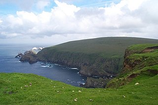
Hermaness is the northernmost headland of Unst, the most northerly inhabited island of Shetland, Scotland. It consists of huge sea cliffs and moorland, making it an ideal habitat for a variety of birds. Hermaness was designated a national nature reserve (NNR) in 1955. The NNR extends over 965 hectares, including the whole of the Hermaness peninsula and the outlying Muckle Flugga and Out Stack. The reserve has a path and boardwalk that extends out onto the moorland. The reserve is managed by NatureScot, though it remains in private ownership, with most being owned by the Buness Estate, although the stacks and skerries around Muckle Flugga are owned by the Northern Lighthouse Board.

The Caledonian Forest is the ancient (old-growth) temperate forest of Scotland. The forest today is a reduced-extent version of the pre-human-settlement forest, existing in several dozen remnant areas.

Rosemarkie is a village on the south coast of the Black Isle peninsula in Ross-shire, northern Scotland.

Glen Affric is a glen south-west of the village of Cannich in the Highland region of Scotland, some 15 miles west of Loch Ness. The River Affric runs along its length, passing through Loch Affric and Loch Beinn a' Mheadhoin. A minor public road reaches as far as the end of Loch Beinn a' Mheadhoin, but beyond that point only rough tracks and footpaths continue along the glen.

Glenmore Forest Park is a remnant of the Caledonian Forest near Aviemore in the Badenoch and Strathspey district of Highland, Scotland. Owned and managed by Forestry and Land Scotland, it lies within the Cairngorms National Park, and is one of six forest parks in the country. The forest park, which was established in 1948, covers 35.7 km2, of which 21.1 km2 is designated as a national nature reserve (NNR). Glenmore surrounds Loch Morlich, and is below the rise of the Cairngorms to the south; to the north the park extends to the summit of Meall a' Bhuachaille. The forest forms part of an expanse of Caledonian Forest that stretches from Glen Feshie to Abernethy, and which as a whole forms the largest single area of this habitat remaining in Scotland. It is home to much wildlife including Scottish crossbills, crested tits, capercaillie, narrow-headed ants, red squirrels and red deer.

Abernethy Forest is a remnant of the Caledonian Forest in Strathspey, in the Highland council area of Scotland. It lies within the Cairngorms National Park, close to the villages of Nethy Bridge, Boat of Garten, and Aviemore. The forest is an RSPB reserve, close to Loch Garten Osprey Centre, which is also owned by the RSPB. It is popular with walkers, as there are various trails throughout the reserve. The forest forms part of the wider Abernethy National Nature Reserve.

St Bees Head is a headland on the North West coast of the English county of Cumbria and is named after the nearby village of St Bees.

The Wyming Brook is a river in the City of Sheffield, England. Its source is the Redmires Reservoirs near the Hallam Moors. It flows in a north-easterly direction for over 0.6 miles (1 km) down quite steep terrain into an underground chamber where it joins the Rivelin tunnel before it flows into the lower of the Rivelin Dams. The river flows almost its entire length within the Wyming Brook Nature Reserve, a Site of Special Scientific Interest which is managed by the Wildlife Trust for Sheffield and Rotherham.

Corrie Fee is a glacier-carved corrie situated at the head of Glen Clova in the Angus Glens of Scotland. It forms part of Corrie Fee National Nature Reserve (NNR), which is managed by NatureScot and lies within the Cairngorms National Park. The adjoining Corrie Sharroch and the slopes of Craig Rennet are also included in the NNR.
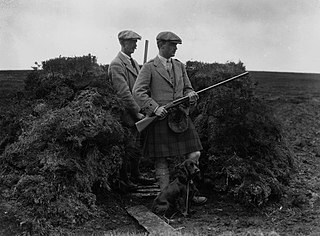
Driven grouse shooting is the shooting of the red grouse and a field sport in the United Kingdom. The grouse-shooting season begins on 12 August, sometimes called the "Glorious Twelfth", ending on 10 December each year.

Ariundle Oakwood is situated to the north of the village of Strontian in the Sunart area of the Highlands of Scotland. It is located on the western side of the glen of the Strontian River, to the south of former lead mining sites that lie further up this glen. The wood is part of the ancient Sunart Oakwood, and is a remnant of ancient oakwoods that once spanned the Atlantic coasts of Europe from Norway to Portugal. It was designated as a National Nature Reserve in 1977, and is managed primarily by NatureScot, in conjunction with Forestry and Land Scotland, who own the land surrounding the National Nature Reserve. The reserve is classified as a Category IV protected area by the International Union for Conservation of Nature, and also forms part of both a Site of Special Scientific Interest and a Special Area of Conservation.

The Clyde Valley Woodlands National Nature Reserve (NNR) comprises six separate woodland sites in the Clyde Valley region of South Lanarkshire, Scotland. These six sites are located along a 12 km section of the River Clyde and its tributaries, and lie close to built-up areas such as Hamilton and Lanark on the southern outskirts of Greater Glasgow. The sites can be easily accessed by about two million people living in the surrounding urban areas, making the reserve unique amongst Scotland's NNRs, most of which tend to be located in more remote areas. The six sites are:

The North Norfolk Coast Site of Special Scientific Interest (SSSI) is an area of European importance for wildlife in Norfolk, England. It comprises 7,700 ha (19,027 acres) of the county's north coast from just west of Holme-next-the-Sea to Kelling, and is additionally protected through Natura 2000, Special Protection Area (SPA) listings; it is also part of the Norfolk Coast Area of Outstanding Natural Beauty (AONB). The North Norfolk Coast is also designated as a wetland of international importance on the Ramsar list and most of it is a Biosphere Reserve.

Balnaguard Glen is a Scottish Wildlife Trust reserve near the village of Balnaguard, Perthshire. It is notable for its juniper woodland, which is amongst the largest in Perthshire.

Glen Nant is a glen lying to the south of Taynuilt in the Argyll and Bute council area of Scotland. An area of woodland of 339 hectares on the western side of the River Nant is designated as national nature reserve (NNR), which is owned and managed by Forestry and Land Scotland (FLS). It is an example of an Atlantic Oakwood, and is one of largest areas of upland oak woodland in north Argyll.

Scoska Wood is an IUCN Category IV – habitat or species management area, a British national nature reserve (NNR), and a Site of Special Scientific Interest (SSSI) in Littondale, North Yorkshire, England. It is a managed ancient woodland, known for its ash trees, grasses and moths. It was designated as an SSSI in 1975, and was awarded its IUCN status in 1992.
![]() Media related to Fairy Glen, Rosemarkie at Wikimedia Commons
Media related to Fairy Glen, Rosemarkie at Wikimedia Commons