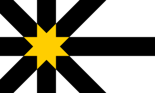
Sutherland is a historic county, registration county and lieutenancy area in the Highlands of Scotland. The name dates from the Viking era when the area was ruled by the Jarl of Orkney; although Sutherland includes some of the northernmost land on the island of Great Britain, it was called Suðrland from the standpoint of Orkney and Caithness.

Cape Wrath is a cape in the Durness parish of the county of Sutherland in the Highlands of Scotland. It is the most north-westerly point in Great Britain.

Durness is a village and civil parish in the north-west Highlands of Scotland. It lies on the north coast of the country in the traditional county of Sutherland, around 120 miles north of Inverness. The area is remote, and the parish is huge and sparsely populated, covering an area from east of Loch Eriboll to Cape Wrath, the most north-westerly point of the Scottish mainland.

Dunnet Head is a headland in Highland, on the north coast of Scotland. Dunnet Head includes the most northerly point of both mainland Scotland and the island of Great Britain.

ROTOR was an elaborate air defence radar system built by the British Government in the early 1950s to counter possible attack by Soviet bombers. To get it operational as quickly as possible, it was initially made up primarily of WWII-era systems, notably the original Chain Home radars for the early warning role, and the AMES Type 7 for plotting and interception control. Data from these stations was sent to a network of control stations, mostly built underground, using an extensive telephone and telex network.
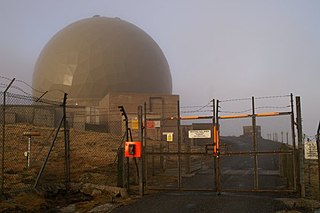
Remote Radar Head Saxa Vord or RRH Saxa Vord, is a Royal Air Force radar station located on the island of Unst, the most northern of the Shetland Islands in Scotland. As of July 2019 it is once more a fully operational radar station, after closure in 2006. The station's motto Praemoneo de Periculis reflects its role. RAF Saxa Vord is further north than Saint Petersburg in Russia, and on the same latitude as Anchorage, Alaska. The station was named after Saxa Vord, which is the highest hill on Unst at 935 ft (285 m). It holds the unofficial British record for wind speed, which in 1992 was recorded at 197 mph (317 km/h) — just before the measuring equipment blew away.
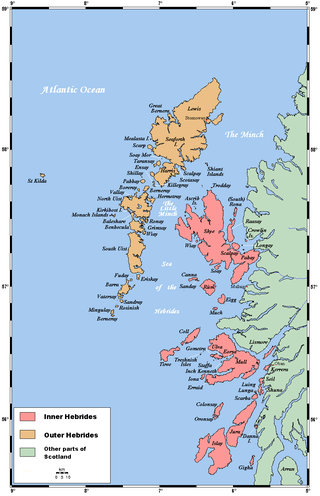
The Minch is a strait in north-west Scotland that separates the mainland from Lewis and Harris in the Outer Hebrides. It was known as Skotlandsfjörð in Old Norse.

Skaw is a settlement in the Scottish archipelago of Shetland, located on the island of Unst. It is located north of Haroldswick on a peninsula in the northeast corner of the island, and is the most northerly settlement in the United Kingdom. It is currently inhabited by a single inhabitant whose business is sheep farming.

Cape Wrath Trail is a hiking route that runs through the Scottish Highlands and along the west coast of Scotland.

Cape Wrath Lighthouse at Cape Wrath was built in 1828 by Robert Stevenson and was manned until 1998, when it was converted to automatic operation by the Northern Lighthouse Board. It is located at the most North-Westerly point on the British mainland, in the traditional county of Sutherland within Highland Region. Durness is the closest village, 10 miles (16 km) to the south-east with Inverness around 120 miles (190 km) to the south.

Remote Radar Head Trimingham or RRH Trimingham is a former TPS-77 radar station situated on the coast in the English county of Norfolk. The site is located on the coast road between Cromer and Mundesley, 1 kilometre east of the village of Trimingham but the activity has now moved to RRH Neatishead due to the threat from coastal erosion. The radar station was a satellite station of RAF Neatishead. This radar station was controlled and maintained by a section of Radar Technicians and Operators and supported by a team of Ground Engineers. Trimingham provided extensive coverage of the East coast of the United Kingdom and helped contribute to the recognised air picture and defence of the United Kingdom. The type 93 became operational on the site in April 1997.

Achiemore was a crofting community located on the Cape Wrath peninsula near the village of Durness in the Scottish county of Sutherland. The hamlet is just south of the farmstead of Daill on the western shore of the Kyle of Durness. Neither place has a permanent population with the village of Durness located 2.5 miles (4.0 km) to the east. Inverness is around 120 miles (190 km) to the south.
The geography of the North Sea studies coastal and submarine features as well as the people who live on its coasts. It is bounded by the east coasts of England and Scotland to the west and the northern and central European mainland to the east and south, including Norway, Denmark, Germany, the Netherlands, Belgium, and France. In the south-west, beyond the Straits of Dover, the North Sea becomes the English Channel. In the east, it connects to the Baltic Sea via the Skagerrak and Kattegat, narrow straits that separate Denmark from Norway and Sweden respectively. In the north, it opens in a widening funnel shape to the Norwegian Sea, which lies in the very north-eastern part of the Atlantic.

Balnakeil is a hamlet in the parish of Durness, Sutherland, Scottish Highlands, and is in the Scottish council area of Highland. It is on the north coast of Scotland around 3⁄4 mile northwest of Durness. The ruin of Balnakeil Church is a scheduled monument. The Kyle of Durness is west of Balnakeil which gives its name to the two-mile-wide (three-kilometre) Balnakeil Bay which the Kyle opens into.
The Outer Holm of Skaw is a small, uninhabited islet, a rock outlier off the northeast coast of the island of Whalsay, in the Shetland Islands of Scotland.
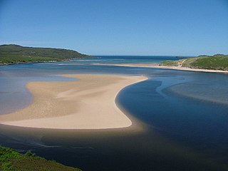
Kyle of Durness is a coastal inlet on the north coast of Scotland in the county of Sutherland. It extends 5+1⁄2 miles inland from Balnakeil and divides the Cape Wrath peninsula from the mainland. The nearest village is Durness.
The North Highland Way is a proposed 150 miles (240 km) hiking, cycling and horse riding trail in Scotland. Currently without official signage, it is navigable by GPS, linking Duncansby Head on the North East coast to Cape Wrath in the North West of Scotland's coast. The North Highland Way connects the Cape Wrath Trail in the west with the Moray Firth trail in the east. The North Coast 500 is a driving route, which follows a similar line to the North Highland Way.

Royal Air Force Aird Uig was a Royal Air Force radar station located on the western edge of the Isle of Lewis in the Outer Hebrides, Scotland. The main masts and operations room were located north of the village of Aird Uig on Gallan Head, with a separate domestic site nearer to the village, five-eighths mile further south.
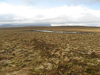
A' Mhòine, variously anglicised as the Moine,, the Moin, or the Mhoine, is a peninsula in the north of Sutherland in the Highlands, Scotland. The peninsula is bounded to the west by Loch Eriboll, and to the east by the Kyle of Tongue. The A838 road crosses the peninsula on an east–west axis. The coastline includes cliffs, waterfalls, and a few sandy beaches.

The River Dionard is a river in the historic county of Sutherland in northwest Scotland. It arises as the outflow from Loch Dionard which lies below the eastern side of Foinaven and flows north-northwest through Strath Dionard below that mountain's eastern flanks for 7 km before turning north and then northeast towards the head of the Kyle of Durness. Its winding channel is exposed at low tide within the sands of this shallow firth which connects with the Atlantic Ocean on the north coast. The principal headwater stream feeding Loch Dionard is the Allt an Easain Ghill which passes through two lochans beneath Meall Horn; the upper Lochan Ulbha and the lower An Dubh-loch. The nearby Allt Eilidh a' Chleirich flows from a third lochan, Lochan Sgeireach. There are numerous other streams and lochans in the upper catchment. The Gualin National Nature Reserve has been established within the catchment.


