Related Research Articles

Flores Island is a small island in Clayoquot Sound, off the west coast of Vancouver Island, British Columbia, Canada.
Blunden Harbour is a small harbour and native Indian reserve in the Canadian province of British Columbia. It is located the mainland side of Queen Charlotte Strait about 25 kilometres (16 mi) northeast of Port Hardy. Blunden Harbour was the location of a Kwakwaka'wakw village, whose residents referred to themselves as the 'Nak'waxda'xw and are known historically as the Nakoaktok.
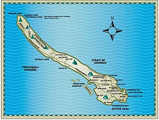
Parker Island is a roughly 400-acre (160 ha) island in the Southern Gulf Islands of British Columbia, Canada. It forms the western side of Montague Harbour, sheltering it from the strong wind gusts of Trincomali Channel. The island may be reached by floatplane, private boat, helicopter or water taxi; there is no public ferry service.
Denham Island is an islet north of Sonora Island in Cordero Channel, near the mouth of Bute Inlet in British Columbia, Canada.

The Franklin Range is a small mountain range on Vancouver Island, British Columbia, Canada, located just southwest of Robson Bight and Johnstone Strait. It has an area of 200 km2 and is a subrange of the Vancouver Island Ranges which in turn form part of the Insular Mountains. The range was named in 1861 by Captain Richards for noted Arctic explorer Rear Admiral Sir John Franklin who died exploring the Arctic and his wife, Lady Franklin. The Cracroft Islands across Johnstone Strait were named for Sophia Cracroft, Sir John's niece who accompanied Lady Franklin on her journey around the world that brought them to British Columbia during the Fraser Gold Rush of 1858.

Masset Inlet is a large saltwater bay located in the heart of the lowland of northern Graham Island, the northernmost and largest island of the Haida Gwaii islands on the North Coast of British Columbia, Canada. It is fed by several rivers, the largest of which is the Yakoun River, and is connected to the open sea of the Dixon Entrance by the narrow Masset Sound and Masset Harbour, which opens onto McIntyre Bay. The communities of Port Clements and Sewall are located on the shores of Masset Inlet. The community of Juskatla is located on Juus Ḵáahlii, the largest of Masset Inlet's arms. There are several islands in the inlet, the largest of which is Kumdis Island, at the inlet's egress to Masset Sound and just north of Port Clements. Masset Inlet helps form the isthmus of the Naikoon Peninsula.
Robson Bight is a small Vancouver Island bay at the west end of Johnstone Strait across from West Cracroft Island in British Columbia, Canada that includes a protected killer whale habitat famous for its whale-rubbing beaches. The bight is adjacent to Lower Tsitika River Provincial Park. The nearest access point is Telegraph Cove on the east coast of Northern Vancouver Island.
Simoom Sound is a sound on the Central Coast of British Columbia, Canada, located on the east and north sides of the Wishart Peninsula between Tribune Channel and Kingcome Inlet. The former steamer landing, now classified as a "locality", and the post office of Simoom Sound, British Columbia, located in Echo Bay on Gilford Island, is named after the sound. Kawages Indian Reserve No. 4 is located on the north side of Simoom Sound and is a reserve of the Dzawada'enuxw First Nation of the Kwakwaka'wakw peoples.
Actaeon Sound is a sound in the Queen Charlotte Strait region of the Central Coast of British Columbia, branching off northeasterly from the north side of Drury Inlet near its head on the mainland of British Columbia to the north of the town of Port McNeill, on the opposite side of Queen Charlotte Strait. On the south side of the sound is the Bond Peninsula at 50°56′50″N127°06′55″W, which is formed by a sidewater, Bond Lagoon at 50°56′34″N127°06′34″W, both presumably named in 1865 by Captain Pender, in association with other Admiralty and HMS Actaeon-related names.
Bramham Island is an island in the Queen Charlotte Strait region of the Central Coast of British Columbia, Canada, on the north side of the entrance to that strait. It lies in the entrance to the maze of waterways inland to the northeast, focused on Seymour Inlet, which includes Belize Inlet and Allison Harbour and Nugent Sound, though it is flanked only by Slingsby Channel on its north, and Schooner Channel on its east. To its west are the open waters at the convergence of Queen Charlotte Sound and Queen Charlotte Strait. About 23 km2 in size, it is mostly low-lying hills and has a number of freshwater lakes.

The Courtenay River is a short river on Vancouver Island, British Columbia, Canada, being the name of the channel from the confluence of the Puntledge and Tsolum Rivers, in the City of Courtenay, and its outlet into Comox Harbour, which is a part of the Strait of Georgia.
The Pearse Islands are a small group of islands in the Queen Charlotte Strait region of the Central Coast of British Columbia, Canada. They are just east of Cormorant Island, which is the location of the Village of Alert Bay. Cormorant Channel Marine Provincial Park is located in this group of islands.
Beaver Harbour is a harbour or bay on northern Vancouver Island, British Columbia, Canada, located to the east of the town of Port Hardy. Beaver Harbour Provincial Park was located on the west side of the bay but was transferred to local governance in 1970.

Broughton Island is an island in the Broughton Archipelago of the Queen Charlotte Strait area of the Central Coast of British Columbia, northwest of Gilford Island.
The Wakeman River is a river in the western Pacific Ranges on the Central Coast region of British Columbia, Canada, flowing south into Wakeman Sound, which is a sidewater of Kingcome Inlet.
Eliot Passage is a marine waterway between Village Island (E) and Pearl Island (W) in the Johnstone Strait region of the Central Coast of British Columbia, Canada, southwest of the opening of Knight Inlet. The Kwakwaka'wakw village of Memkumlis, also known as Mamalillaculla after the name of the group of Kwakwaka'wakw whose principal village it is, is on its eastern shore on Village Island.
Compton Island is an island in the Queen Charlotte Strait-Johnstone Strait region of the Central Coast of British Columbia, Canada, in Blackfish Sound to the east of Port McNeill All of it and three small adjacent islands comprise Compton Island Indian Reserve No. 6, a.k.a. Compton 6.
Compton Point is a headland in the Queen Charlotte Strait region of the Central Coast of British Columbia, Canada, forming the northwest entrance point to Wells Passage opposite North Broughton Island.
Drury inlet is an inlet in the Queen Charlotte Strait region of the Central Coast of British Columbia, Canada, extending west from Wells Passage to the northwest of North Broughton Island, northwest of the town of Port Hardy. Branching off to the northeast from the north side of the head of the inlet is Actaeon Sound.
Waddington Harbour is a harbour at the head of Bute Inlet in the Central Coast region of British Columbia, Canada. Also issuing into the head of Bute Inlet and Waddington Harbour, just east of the mouth of the Homathko, is the Teaquahan River. Issuing directly into the inlet a few miles south on the harbour's southeast is the Southgate River, one of the major rivers of the central Pacific Ranges, which begins on the west side of the Lillooet Icecap. Its lower valley adjacent to the inlet's shores is called Pigeon Valley.
References
- ↑ BC Names/GeoBC entry "Farewell Harbour"
- ↑ communicated to John T. Walbran by Capt. Browning in British Columbia Coast Names, 1592-1906: Their Origin and History, John T. Walbran, published for the Geographic Board of Canada, Ottawa, 1909 (republished for the Vancouver Public Library by J.J. Douglas Ltd, Vancouver, 1971.
50°36′04″N126°40′18″W / 50.60111°N 126.67167°W
| | This article about a location on the Central Coast of British Columbia, Canada is a stub. You can help Wikipedia by expanding it. |