Related Research Articles

St Brides Bay is a bay in western Pembrokeshire, West Wales.

Henrhyd Falls in the Brecon Beacons National Park, Wales, is the tallest waterfall in southern Wales with a drop of 90 feet (27 m). It lies on National Trust land, in the county of Powys. The nearest settlement to it is Coelbren, on the road between Glynneath and Abercraf. Though not in the core of the area, it is considered by many to constitute a part of Wales' celebrated Waterfall Country.

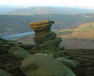
Millstone Grit is the name given to any of a number of coarse-grained sandstones of Carboniferous age which occur in the British Isles. The name derives from its use in earlier times as a source of millstones for use principally in watermills. Geologists refer to the whole suite of rocks that encompass the individual limestone beds and the intervening mudstones as the Millstone Grit Group. The term Millstone Grit Series was formerly used to refer to the rocks now included within the Millstone Grit Group together with the underlying Edale Shale Group.
Penmoelallt or Onllwyn is a hill in the northern part of the county borough of Rhondda Cynon Taff in south Wales. It lies within the Brecon Beacons National Park and Fforest Fawr Geopark. To its east lies the deep valley of Cwm Taf and to its north a rather shallower valley in which the Nant Cadlan originates. To the west is the hill known as Mynydd-y-glog and to the south are slopes draining into the River Taff and the Afon Cynon. The hill culminates in a broken plateau with several knolls rising above the 420m contour. Its afforested nature makes it difficult to determine the precise location of its highest point but this probably lies somewhere around OS grid ref SO 003096. Older maps indicate a spot height of 1376 ft above sea level at SO 000090.

The Marros Group is the name given to a suite of rocks of Namurian age laid down during the Carboniferous Period in South Wales. These rocks were formerly known as the Millstone Grit Series but are now distinguished from the similar but geographically separate rock sequences of the Pennines and Peak District of northern England and northeast Wales by this new name.

The Pennant Measures is the traditional name for a sequence of sedimentary rocks of the South Wales Coalfield. They were also referred to as the Upper Coal Measures and assigned to the Westphalian 'C' and Westphalian 'D' stages of the Carboniferous Period. The Pennant Measures were divided into the Lower Pennant Measures and the Upper Pennant Measures, differing from the underlying Middle and Lower Coal Measures in being principally of sandstone units – known collectively as the Pennant Sandstone – with mudstone being the subsidiary rock type. Numerous coal seams occur within the Pennant Measures though they are less common than in the underlying Coal Measures.

The Flintshire Coalfield in north-east Wales is one of the smaller British coalfields. It is in the county of Flintshire and extends from the Point of Ayr in the north, along the Dee Estuary through Connah's Quay to Caergwrle in the south. A small part extends onto the Wirral i.e. English coast of the estuary at Neston, Cheshire which was the site of a coalmine for a period. The coal-bearing strata continue southwards of Caergwrle as the Denbighshire Coalfield. Together the two coalfields are known as the North Wales Coalfield.
The geology of Monmouthshire in southeast Wales largely consists of a thick series of sedimentary rocks of different types originating in the Silurian, Devonian, Carboniferous, Triassic and Jurassic periods.
The Coal Measures Group is a lithostratigraphical term coined to refer to the coal-bearing succession of rock strata which occur in the United Kingdom within the Westphalian Stage of the Carboniferous Period. Other than in Northern Ireland the term is now obsolete in formal use and is replaced by the Pennine Coal Measures Group, Scottish Coal Measures Group and the South Wales Coal Measures Group for the three distinct depositional provinces of the British mainland.

The coal measures is a lithostratigraphical term for the coal-bearing part of the Upper Carboniferous System. In the United Kingdom, the Coal Measures Group consists of the Upper Coal Measures Formation, the Middle Coal Measures Formation and the Lower Coal Measures Formation. The group records the deposition of fluvio-deltaic sediments which consists mainly of clastic rocks interstratified with the beds of coal. In most places, the coal measures are underlain by coarser clastic sequences known as Millstone Grit, of Namurian age. The top of the coal measures may be marked by an unconformity, the overlying rocks being Permian or later in age. In some parts of Britain, however, the Coal Measures grade up into mainly coal-barren red beds of late Westphalian and possibly Stephanian age. Within the Pennine Basin these barren measures are now referred to as the Warwickshire Group, from the district where they achieve their thickest development.
The geology of Lancashire in northwest England consists in the main of Carboniferous age rocks but with Triassic sandstones and mudstones at or near the surface of the lowlands bordering the Irish Sea though these are largely obscured by Quaternary deposits.
The geology of Merseyside in northwest England largely consists of a faulted sequence of Carboniferous Coal Measures rocks overlain in the west by younger Triassic and Permian age sandstones and mudstones. Glaciation during the present Quaternary Period has left widespread glacial till as well as erosional landforms. Other post-glacial superficial deposits such as river and estuarine alluvium, peat and blown sand are abundant.
The Pennine Coal Measures Group is a lithostratigraphical term referring to the coal-bearing succession of rock strata which occur in the United Kingdom within the Westphalian Stage of the Carboniferous Period. In formal use, the term replaces the Coal Measures Group as applied to the succession of coal-bearing strata within the Pennine Basin which includes all of the coalfields of northern England and the English Midlands. It includes the largely concealed Canonbie Coalfield of southern Scotland and the coalfields of northeast Wales and the minor Anglesey coalfield. The sequence consists in the main of mudstones and siltstones together with numerous sandstones, the more significant ones of which are individually named. Some are laterally extensive, others are more restricted in their range. There are numerous coal seams, again with some being more laterally continuous than others. Those which were economically valuable were named though any individual seam may have attracted different names in different pits and different districts. Marine bands preserving distinctive and dateable marine fossils such as goniatites and brachiopods are widespread within the sequence and enable correlation to be made between sequences in one part of the basin and another and with other basins
The South Wales Coal Measures Group is a lithostratigraphical term referring to the coal-bearing succession of rock strata which occur in South Wales within the Westphalian Stage of the Carboniferous Period. The Group name is also applied to rocks of similar age across southern England from the Bristol Coalfield east to the concealed Oxfordshire, Berkshire and Kent Coalfields. In formal use, the term replaces the earlier Coal Measures Group The Group comprises the:
Mynydd Garnclochdy is a gentle summit on the long moorland ridge which extends south from Blorenge towards Pontypool and which defines the boundary between the modern county of Monmouthshire to the east and the county borough of Torfaen to the west though historically it was entirely within the traditional county of Monmouthshire. Its summit, at a height of 448 m (1407 ft), is marked by a small cairn. The summit and the eastern slopes of the hill fall within the Brecon Beacons National Park. A southern top of the hill, Mynydd Garn-wen achieves a height of 436m, and carries a trig point further south again at an elevation of 425m. To the north the broad moorland ridge runs via a poorly defined 425m top and a col at 404m elevation just south of a minor east–west road, into Mynydd y Garn-fawr, east of Blaenavon.
The geology of the Gower Peninsula in South Wales is central to its character and to its appeal to visitors. The peninsula is formed almost entirely from a faulted and folded sequence of Carboniferous rocks though both the earlier Old Red Sandstone and later New Red Sandstone are also present. Gower lay on the southern margin of the last ice sheet and has been a focus of interest for researchers and students in that respect too. Cave development and the use of some for early human occupation is a further significant aspect of the peninsula's scientific and cultural interest.

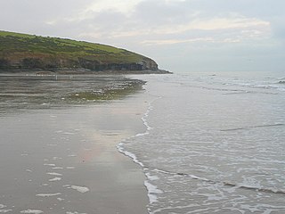
Telpyn Point is a headland on the Carmarthenshire coast, Wales. Set at the back of Carmarthen Bay, to its east are Marros Sands and to the west a beach which stretches in front of the Pembrokeshire village of Amroth. There are numerous sea caves in the quartzitic sandstone cliffs here. A path around the headland carries the Wales Coast Path. The Marros-Pendine Coast is protected as a 'mixed' Site of Special Scientific Interest, i.e. for its biological and geological interest. The good geological exposure of Carboniferous age rock strata at Telpyn Point has led to its name being given to the Telpyn Point Sandstone Formation, a sub-unit of the Marros Group, the modern scientific name for the Millstone Grit series of South Wales.
The geology of the Yorkshire Dales National Park in northern England largely consists of a sequence of sedimentary rocks of Ordovician to Permian age. The core area of the Yorkshire Dales is formed from a layer-cake of limestones, sandstones and mudstones laid down during the Carboniferous period. It is noted for its karst landscape which includes extensive areas of limestone pavement and large numbers of caves including Britain's longest cave network.
The geology of the Peak District National Park in England is dominated by a thick succession of faulted and folded sedimentary rocks of Carboniferous age. The Peak District is often divided into a southerly White Peak where Carboniferous Limestone outcrops and a northerly Dark Peak where the overlying succession of sandstones and mudstones dominate the landscape. The scarp and dip slope landscape which characterises the Dark Peak also extends along the eastern and western margins of the park. Although older rocks are present at depth, the oldest rocks which are to be found at the surface in the national park are dolomitic limestones of the Woo Dale Limestone Formation seen where Woo Dale enters Wye Dale east of Buxton.
The geology of Pembrokeshire in Wales inevitably includes the geology of the Pembrokeshire Coast National Park which extends around the larger part of the county’s coastline and where the majority of rock outcrops are to be seen. Pembrokeshire’s bedrock geology is largely formed from a sequence of sedimentary and igneous rocks originating during the late Precambrian and the Palaeozoic era, namely the Ediacaran, Cambrian, Ordovician, Silurian, Devonian and Carboniferous periods, i.e. between 635 and 299 Ma. The older rocks in the north of the county display patterns of faulting and folding associated with the Caledonian Orogeny. On the other hand, the late Palaeozoic rocks to the south owe their fold patterns and deformation to the later Variscan Orogeny.
References
- ↑ "Coal Measures". Fforest Fawr.
- ↑ Howells M.F. 2007, British Regional Geology: Wales, (Keyworth, Nottingham), British Geological Survey
- ↑ Barclay W.J. et al, 1989. Geology of the South Wales Coalfield, Part II, the country around Abergavenny, 3rd edn, Mem. Br. Geol. Surv. sheet 232 (E&W)