Moorhead is a city in and the county seat of Clay County, Minnesota, United States, on the banks of the Red River of the North. Located in the Red River Valley, an extremely fertile and active agricultural region, Moorhead is also home to several corporations and manufacturing industries. Across the river from Fargo, North Dakota, Moorhead forms part of the core of the Fargo–Moorhead ND-MN Metropolitan Area. The population was 44,505 at the 2020 census. Moorhead is notably a hub of higher education in Minnesota, home to Minnesota State University Moorhead, Concordia College, and a campus of Minnesota State Community and Technical College.

Fargo is the most populous city in the U.S. state of North Dakota and the county seat of Cass County. The population was 125,990 at the 2020 census, which was estimated to have grown to 133,188 in 2023, making it the 218th-most populous city in the United States. Fargo, along with its twin city of Moorhead, Minnesota, form the core of the Fargo–Moorhead metropolitan statistical area, which had a population of 248,591 in 2020.

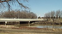
The Red River, also called the Red River of the North to differentiate it from the Red River in the south of the continent, is a river in the north-central United States and central Canada. Originating at the confluence of the Bois de Sioux and Otter Tail rivers between the U.S. states of Minnesota and North Dakota, it flows northward through the Red River Valley, forming most of the border of Minnesota and North Dakota and continuing into Manitoba. It empties into Lake Winnipeg, whose waters join the Nelson River and ultimately flow into Hudson Bay.

The Red River Floodway is an artificial flood control waterway in Western Canada. It is a 47 km (29 mi) long channel which, during flood periods, takes part of the Red River's flow around the city of Winnipeg, Manitoba to the east and discharges it back into the Red River below the dam at Lockport. It can carry floodwater at a rate of up to 140,000 cubic feet per second (4,000 m3/s), expanded in the 2000s from its original channel capacity of 90,000 cubic feet per second (2,500 m3/s).

The Red River flood of 1997 was a major flood that occurred in April and May 1997 along the Red River of the North in Minnesota, North Dakota, and southern Manitoba. It was the most severe flood of the river since 1826. The flood reached throughout the Red River Valley, affecting the cities of Fargo and Winnipeg, but none so greatly as Grand Forks and East Grand Forks, where floodwaters reached more than 3 miles (4.8 km) inland. They inundated virtually everything in the twin communities. Total damages for the Red River region were US$3.5 billion. The flood was the result of abundant snowfall and extreme temperatures.

KVRR is a television station in Fargo, North Dakota, United States, affiliated with the Fox network. Owned by Coastal Television Broadcasting Company, the station maintains studios on South 40th Street and South 9th Avenue in Fargo, and its transmitter is located near Tansem, Minnesota. KVRR also handles master control and some internal operations for sister station and fellow Fox affiliate KQDS-TV in Duluth, Minnesota.

The Crescent City Connection (CCC), formerly the Greater New Orleans (GNO) Bridge, is a pair of cantilever bridges that carry U.S. Highway 90 Business over the Mississippi River in New Orleans, Louisiana, United States. They are tied as the fifth-longest cantilever bridges in the world. Each span carries four general-use automobile lanes; additionally the westbound span has two reversible HOV lanes across the river.

KQDS-TV is a television station in Duluth, Minnesota, United States, affiliated with the Fox network. Owned by Coastal Television Broadcasting Company, the station has studios on London Road in Duluth, and its transmitter is located west of downtown in Hilltop Park. Master control and some internal operations are based out of the studio facilities of sister station and fellow Fox affiliate KVRR on South 40th Street and South 9th Avenue in Fargo, North Dakota.

WDAY is North Dakota's oldest radio station, having first signed on in 1922. WDAY is licensed to Fargo, North Dakota, owned by Forum Communications, and operated by Flag Family Media. The transmitter site is near 210th Street South in Barnesville, Minnesota, and studios are on 8th Street South in Fargo.

Interstate 94 (I-94) runs east–west for 352.4 miles (567.1 km) through the southern half of the US state of North Dakota, from the Montana state line east to the Red River at Fargo. The route generally follows the route of the Northern Pacific Railway.

The Fargo Marathon is an annual road running marathon in Fargo, North Dakota, first held in 2005. Most years, it begins and ends inside the Fargodome, and the course also travels through Moorhead, Minnesota, Fargo's twin city. The event weekend also hosts a half marathon, 10K, and 5K. The race is a USATF-qualified course, so marathon finish times can be used to qualify for the Boston Marathon. The event has been sponsored by Sanford Health.

The 2009 Red River flood along the Red River of the North in North Dakota and Minnesota in the United States and Manitoba in Canada brought record flood levels to the Fargo-Moorhead area. The flood was a result of saturated and frozen ground, spring snowmelt exacerbated by additional rain and snow storms, and virtually flat terrain. Communities along the Red River prepared for more than a week as the U.S. National Weather Service continuously updated the predictions for the city of Fargo, North Dakota, with an increasingly higher projected river crest. Originally predicted to reach a level of near 43 feet (13 m) at Fargo by March 29, the river in fact crested at 40.84 feet (12.45 m) at 12:15 a.m. March 28, and started a slow decline. The river continued to rise to the north as the crest moved downstream.
The US State of North Dakota experienced significant flooding in its major river basins in 2009, following abnormally heavy winter snows atop saturated and frozen ground.

MATBUS is a public transport bus system serving the Fargo, North Dakota and Moorhead, Minnesota Metropolitan Area.
The 1897 Red River flood took place in April 1897, along the Red River resulting in significant damage to the city of Fargo, North Dakota. The conditions which led to the flood of 1897 were similar to the conditions behind the 2009 flood, however the 1897 flood was different in terms of the human response to it. Although the river gauge was not installed on the Red River until 1901, other sources indicate that the crest of the 1897 flood at a site 1.5 miles (2.4 km) downstream from the present Fargo gauge would have been 40.10 ft according to the present datum.

The 2011 Red River flood took place along the Red River of the North in Manitoba in Canada and North Dakota and Minnesota in the United States beginning in April 2011. The flood was, in part, due to high moisture levels in the soil from the previous year, which meant that further accumulation would threaten the flood-prone region. Flood predictors in Winnipeg were worried that a dual crest of both the Assiniboine River and the Red might crest at the city at the same time. Beginning around April 8, 50 homes were evacuated and two more were flooded after an ice jam in St. Andrews, Manitoba caused the river to flood over its banks.

The 2016 North Dakota gubernatorial election was held on November 8, 2016, to elect the Governor and Lieutenant Governor of North Dakota, concurrently with the 2016 U.S. presidential election, as well as elections to the United States Senate, elections to the United States House of Representatives and various state and local elections. This would have been the first time North Dakotans selected a governor under new voter ID requirements, in which a student ID was insufficient identification to vote, but a court ruling in August 2016 struck the down the provision; the election was held under the 2013 rules.
The following is a timeline of the history of the city of Fargo, North Dakota, USA.

The Fargo-Moorhead (FM) Area Diversion project, officially known as the Fargo-Moorhead Metropolitan Area Diversion Flood Risk Management Project, is a large, regional flood control infrastructure project on the Red River of the North, which forms the border between North Dakota and Minnesota and flows north to Lake Winnipeg in Manitoba, Canada.

Selkirk Lift Bridge is a Vertical-Lift Bridge in Selkirk, Manitoba spanning the Red River. The Canadian government built the bridge as a work relief project during the Great Depression.