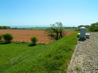
Farthing Common is an area of common land about 10 km northwest of Folkestone in East Kent. It is one of the highest points of the North Downs at 185 metres above sea level, and was the junction of the ancient trackway along the Downs from Folkestone, with the Roman road (now the B2068 Stone Street) between Lympne and Canterbury.
Folkestone is a port town on the English Channel, in Kent, south-east England. The town lies on the southern edge of the North Downs at a valley between two cliffs. It was an important harbour and shipping port for most of the 19th and 20th centuries.
The North Downs are a ridge of chalk hills in south east England that stretch from Farnham in Surrey to the White Cliffs of Dover in Kent. Westerham Heights, at the northern edge of the North Downs, near Bromley, South London, is the highest point in London at an elevation of 245 m (804 ft). The North Downs lie within two Areas of Outstanding Natural Beauty (AONBs), the Surrey Hills and the Kent Downs. The North Downs Way National Trail runs along the North Downs from Farnham to Dover.
Portus Lemanis, also known as Lemanae, was the Latin name of an ancient Roman fort, settlement and port in southern Kent. The modern village of Lympne derives its name from the ancient port.
From the common there are extensive views across Kent and on a clear day it is possible to see as far as the Cliffs at Fairlight in Sussex and even the South Downs. Just east of Farthing Common are Postling Downs which is a rich area of semi-improved chalk grassland with a variety of plant species including orchids.
Fairlight is a village in East Sussex, England within Rother district, three miles (5 km) to the east of Hastings. Fairlight is also the name of the civil parish forming part of the Rother district which includes the villages of Fairlight and Fairlight Cove. The village of Fairlight lies on a minor road between Ore, Pett and Winchelsea. St Andrew's Church has a tall tower and beacon turret, and can be seen for some distance around. The church is one of three in the United Benefice of Fairlight, Guestling and Pett. Richard D'Oyly Carte, founder of the Savoy Theatre, Savoy Hotel, and D'Oyly Carte Opera Company, which produced the Gilbert and Sullivan light operas, is buried in the churchyard. So also are Thomas Attwood Walmisley, and Sir James Roberts of Saltaire and his wife.
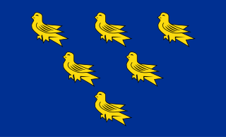
Sussex, from the Old English Sūþsēaxe, is a historic county in South East England corresponding roughly in area to the ancient Kingdom of Sussex. It is bounded to the west by Hampshire, north by Surrey, northeast by Kent, south by the English Channel, and divided for many purposes into the ceremonial counties of West Sussex and East Sussex. Brighton and Hove, though part of East Sussex, was made a unitary authority in 1997, and as such, is administered independently of the rest of East Sussex. Brighton and Hove was granted City status in 2000. Until then, Chichester was Sussex's only city.
The South Downs are a range of chalk hills that extends for about 260 square miles (670 km2) across the south-eastern coastal counties of England from the Itchen Valley of Hampshire in the west to Beachy Head, in the Eastbourne Downland Estate, East Sussex, in the east. The Downs are bounded on the northern side by a steep escarpment, from whose crest there are extensive views northwards across the Weald. The South Downs National Park forms a much larger area than the chalk range of the South Downs and includes large parts of the Weald.
Farthing Common saw the final King of the Mountains climb during the first stage of the 2007 Tour de France, which was held in Kent. The climb was taken by Stéphane Augé. [1]
The Tour de France is an annual men's multiple stage bicycle race primarily held in France, while also occasionally passing through nearby countries. Like the other Grand Tours, it consists of 21 day-long stages over the course of 23 days.
Stéphane Augé is a French former road racing cyclist. He is currently a sporting director for UCI Professional Continental team Cofidis. While he had a contract to ride competitively with them in the 2011 season, he chose instead to retire as a cyclist and fill an opening in the team's management. He was known to be part of the escapees in every first stage of the Tour de France.
Kent is a county in South East England and one of the home counties. It borders Greater London to the north-west, Surrey to the west and East Sussex to the south-west. The county also shares borders with Essex along the estuary of the River Thames, and with the French department of Pas-de-Calais through the Channel Tunnel. The county town is Maidstone.
The Downs are a roadstead in the southern North Sea near the English Channel off the east Kent coast, between the North and the South Foreland in southern England. In 1639 the Battle of the Downs took place here, when the Dutch navy destroyed a Spanish fleet which had sought refuge in neutral English waters. From the Elizabethan era onwards, the presence of the Downs helped to make Deal one of the premier ports in England, and in the 19th century, it was equipped with its own telegraph and timeball tower to enable ships to set their marine chronometers.
Folkestone & Hythe is a local government district in Kent, England, in the south-east of the county. Its council is based in the town of Folkestone. The authority was renamed from Shepway in April 2018, and therefore has the same name as the Folkestone and Hythe parliamentary constituency, although a somewhat narrower area is covered by the district.
The Borough of Ashford is a local government district with borough status in Kent, England. It borders five other Kent districts, as well as East Sussex to the south-west. Ashford Borough Council's main offices are in the town of Ashford. The borough was formed on 1 April 1974, by the merger of the then Borough of Tenterden with Ashford urban district as well as the Rural Districts of East Ashford, West Ashford and Tenterden. Covering 58,000 hectares, it is the largest district by area in Kent.
The A28 is a trunk road in southern England. It runs south-west from the seaside resort of Margate in Kent via Westgate and Birchington, reaching open countryside at Sarre. The road continues via Upstreet and Hersden to Sturry, and on to the cathedral city of Canterbury. It forms part of Canterbury's ring road before leaving via Wincheap and Thanington Without, where a sliproad linking to the A2 was completed in 2011, and passing between the North Downs via Chartham, Chilham, Godmersham and Bilting.
The Alkham Valley is in the Kent Downs, an Area of Outstanding Natural Beauty, in South East Kent, England. The valley lies between Folkestone and Dover.
Cheriton Hill is a hill overlooking the English Channel near Folkestone in the south-east corner of Kent, England. The relatively low-lying hill is covered with farmland, villages, narrow lanes, and footpaths. The highest point is on a covered reservoir next to the trig point; the highest natural point is nearby, probably close to the road to the village of Paddlesworth, near a transmitter mast, but the relatively flat summit gives no real impression of being on top of a hill.
Hawkinge is now a town and civil parish in the Folkestone and Hythe district of Kent, England. The original village of Hawkinge is actually just less than a mile due east of the present village centre ; the modern, much larger, village of Hawkinge was formed by the merging of Hawkinge and Uphill. Walking south from the village past it is possible to see stunning views of Cheriton, Folkestone and the Channel Tunnel complex.
Cheriton is a northern suburb of Folkestone in Kent. It is the location of the English terminal of the Channel Tunnel as well as of the major army barracks of Shorncliffe Camp.
Canterbury West railway station is the busier of the two stations in Canterbury in Kent, England. All services are operated by Southeastern with both main line and high speed trains serving the station.
Folkestone West railway station is on the South Eastern Main Line in England, serving the western area of Folkestone, Kent. It is 69 miles 22 chains (111.5 km) down the line from London Charing Cross and is situated between Sandling and Folkestone Central, the other station serving the town. Folkestone West and all trains that call are operated by Southeastern.
The Greensand Ridge is an extensive, prominent, often wooded, mixed greensand/sandstone escarpment in south-east England. It runs to and from the East Sussex coast, around the Weald, a former dense forest in Sussex, Surrey and Kent. It reaches its highest elevation, 294 metres (965 ft), at Leith Hill in Surrey—the second highest point in south-east England, while another hill in its range, Blackdown, is the highest point in Sussex at 280 metres (919 ft). The eastern end of the ridge forms the northern boundary of Romney Marsh.
The Elham Valley is a chalk valley carved by the River Nailbourne situated in the North Downs in East Kent. The valley is named after the settlement of Elham. Other settlements in the valley include Etchinghill, Lyminge, Barham, Kingston, Bishopsbourne and Bridge.
The 2007 Kent earthquake registered 4.3 on the Richter scale and struck south east Kent, South East England on 28 April 2007 at 07:18:12 UTC, at a shallow depth of 5.3 km.
The Folkestone Downs are an area of chalk downland above Folkestone, where the eastern end of the North Downs escarpment meets the English Channel. Part of the Downs is the Folkestone to Etchinghill Escarpment Site of Special Scientific Interest, designated for its geological and biological interest.
Stowting is a village and civil parish in the English county of Kent. It is 6 miles (9.7 km) east of Ashford, 7 miles (11 km) north-west of Folkestone and 10 miles (16 km) south of Canterbury.
The geology of Kent in southeast England largely consists of a succession of northward dipping late Mesozoic and Cenozoic sedimentary rocks overlain by a suite of unconsolidated deposits of more recent origin.
Coordinates: 51°7′22″N1°3′7″E / 51.12278°N 1.05194°E
A geographic coordinate system is a coordinate system that enables every location on Earth to be specified by a set of numbers, letters or symbols. The coordinates are often chosen such that one of the numbers represents a vertical position and two or three of the numbers represent a horizontal position; alternatively, a geographic position may be expressed in a combined three-dimensional Cartesian vector. A common choice of coordinates is latitude, longitude and elevation. To specify a location on a plane requires a map projection.