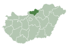
Felsőpetény

Last updated

Felsőpetény is a village in Nógrád County, Hungary with 768 inhabitants (2001).

Nógrád County Counties of Hungary in Northern Hungary

Nógrád is a county of Hungary.

Hungary Country in Central Europe

Hungary is a country in Central Europe. Spanning 93,030 square kilometres (35,920 sq mi) in the Carpathian Basin, it borders Slovakia to the north, Ukraine to the northeast, Austria to the northwest, Romania to the east, Serbia to the south, Croatia to the southwest, and Slovenia to the west. With about 10 million inhabitants, Hungary is a medium-sized member state of the European Union. The official language is Hungarian, which is the most widely spoken Uralic language in the world. Hungary's capital and its largest city and metropolis is Budapest. Other major urban areas include Debrecen, Szeged, Miskolc, Pécs and Győr.

Related Research Articles

Mátra mountain range in Hungary

The Mátra[ˈmaːtrɒ] is a mountain range in northern Hungary, between the towns Gyöngyös and Eger. The country's highest peak, Kékestető, belongs to this mountain range.
Nőtincs Place in Nógrád, Hungary

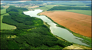
Nőtincs, a pictorial locality looking back on a thousand-year old history is in Nógrád county, Hungary. The village is located 51 km (32 mi) north of Budapest near the European route E77, halfway between Vác and Balassagyarmat. Nőtincs is seated at the border of Cserhát and Börzsöny hills. Its location determines the function of the village.
Fülöpháza Place in Bács-Kiskun, Hungary

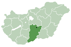
Fülöpháza is a village in Bács-Kiskun county, in the Southern Great Plain region of Hungary.

Napkor Place in Szabolcs-Szatmár-Bereg, Hungary

Napkor is a village in Szabolcs-Szatmár-Bereg county, in the Northern Great Plain region of eastern Hungary.

Tápiószele town in Hungary

Tápiószele is a town in Pest county, Hungary.

Pócspetri Place in Szabolcs-Szatmár-Bereg, Hungary

Pócspetri is a village in Szabolcs-Szatmár-Bereg county, in the Northern Great Plain region of eastern Hungary.

Porcsalma Place in Szabolcs-Szatmár-Bereg, Hungary

Porcsalma is a village in Szabolcs-Szatmár-Bereg county, in the Northern Great Plain region of eastern Hungary.

Kálmánháza Place in Szabolcs-Szatmár-Bereg, Hungary

Kálmánháza is a village in Szabolcs-Szatmár-Bereg county, in the Northern Great Plain region of eastern Hungary.

Nyírgyulaj Place in Szabolcs-Szatmár-Bereg, Hungary

Nyírgyulaj is a village in Szabolcs-Szatmár-Bereg county, in the Northern Great Plain region of eastern Hungary.

Egerszólát is a small village in Heves county, in the north-eastern part of Hungary, west of Eger. It is located in Eger wine region and is famous in Hungary for its white wine called 'Egerszóláti Olaszrizling'. As of 2015, it has a population of 1,000.

Kosd Place in Central Hungary, Hungary

Kosd is a village in Pest county, Hungary.

Kóspallag Place in Central Hungary, Hungary

Kóspallag is a village in Pest county, Hungary.

Letkés Place in Central Hungary, Hungary

Letkés is a village in Pest county, Hungary.

Márianosztra Place in Central Hungary, Hungary

Márianosztra is a village in Pest county, Hungary.

Tarnaszentmária is a village at the foot of the Mátra Mountains in Hungary, in Heves.

Hejőszalonta is a village in Borsod-Abaúj-Zemplén County in northeastern Hungary.

Oszlár is a village in Borsod-Abaúj-Zemplén County in northeastern Hungary.

Csatár Village in Western Transdanubia, Hungary

Csatár is a village in Zala County, Hungary.

Alsópetény is a village and municipality in the comitat of Nógrád, Hungary.

Buják is a village and municipality in the comitat of Nógrád, Hungary.

References

Coordinates: 47°53′N19°11′E / 47.883°N 19.183°E / 47.883; 19.183

Geographic coordinate system Coordinate system

A geographic coordinate system is a coordinate system that enables every location on Earth to be specified by a set of numbers, letters or symbols. The coordinates are often chosen such that one of the numbers represents a vertical position and two or three of the numbers represent a horizontal position; alternatively, a geographic position may be expressed in a combined three-dimensional Cartesian vector. A common choice of coordinates is latitude, longitude and elevation. To specify a location on a plane requires a map projection.