
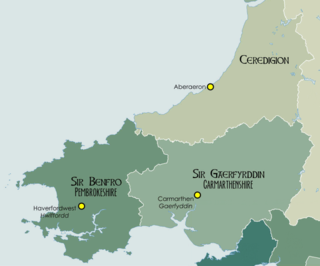
Ffoshelyg is a hamlet in Ceredigion, Wales.
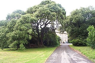
The estate at Ffoshelyg was once owned by Hugh Lloyd (fl. 1608). [1] [2] As of 2016 it is dominated by a family-run caravan park. [3]
Ffoshelyg is a hamlet in Ceredigion, Wales.
The estate at Ffoshelyg was once owned by Hugh Lloyd (fl. 1608). [1] [2] As of 2016 it is dominated by a family-run caravan park. [3]

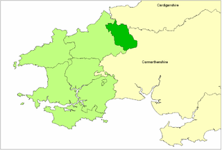
Pembrokeshire is a county in the south-west of Wales. It is bordered by Carmarthenshire to the east, Ceredigion to the northeast, and otherwise by the sea. Haverfordwest is the largest town and administrative headquarters of Pembrokeshire County Council.

Strumble Head is a rocky headland in the community of Pencaer in Pembrokeshire, Wales, within the Pembrokeshire Coast National Park. It marks the southern limit of Cardigan Bay. Three islands lie off the head: Ynys Meicel – 112 feet (34 m) – Ynys Onnen and Carreg Onnen.
West Wales is a region of Wales.

Newgale is a village with an almost two-mile (3 km) stretch of beach in the parish of Roch, Pembrokeshire, West Wales. The beach is situated in the Pembrokeshire Coast National Park and on the Pembrokeshire Coast Path and has rugged coastal scenery with the path winding up and down the cliffs.

Carew is a village, parish and community on an inlet of Milford Haven in the former Hundred of Narberth, Pembrokeshire, West Wales, 4 miles (6.4 km) east of Pembroke. The eastern part of the parish is in the Pembrokeshire Coast National Park.

The A485 is an A road linking Tanerdy near Carmarthen to Llanfarian near Aberystwyth in Wales.
The Hundred of Cilgerran was a hundred in the north of Pembrokeshire, Wales. It was formed by the Act of Union of 1536 from the commote of the pre-Norman cantref of Emlyn included by the Act in Pembrokeshire and is otherwise called in Welsh Emlyn Is Cuch, with the addition of the Cemais parish of Llantood. The area of the commote was about 106 km2: that of the hundred was 113 km2.
St Dogmells was a rural district in the administrative county of Pembrokeshire, Wales from 1894 to 1934.
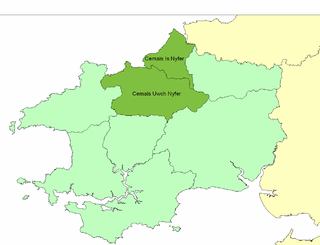
Cemais Is Nyfer was a mediaeval commote in the Dyfed cantref of Cemais, Wales. It consisted of the territory between the rivers Nyfer and Teifi, and comprised the parishes of Eglwyswrw, Monington, St Dogmaels, Llanfair-Nant-Gwyn, Llantood, Moylgrove and Bayvil, and parts of Nevern and Meline in what is now Pembrokeshire. Its area was about 100 km2 and its civil and ecclesiastical headquarters were at Nevern.

Brawdy is a village, parish and community in Pembrokeshire, Wales.

Afon Cych is a tributary of the River Teifi in south-west Wales. It is 13 km long, passes through a number of small settlements on the border between Pembrokeshire and Carmarthenshire, and is significant in Welsh legend.

Blue Lagoon Water Park is an indoor waterpark near Canaston Bridge, Narberth in Pembrokeshire, Wales in the Bluestone National Park Resort. It opened in 2008.

Pengelli National Nature Reserve is part of the largest block of ancient oak woodland in West Wales. It has survived for hundreds of years, despite being modified by people. Lying near the village of Eglwyswrw in the north of Pembrokeshire, it makes up part of the gentle agricultural landscape which lies between the foot of the Preseli hills and the sea. Species found in this rich woodland include badgers, polecats and the elusive dormouse.

Caerfai Bay is a rocky cove on the north coast of St Brides Bay near St Davids in Pembrokeshire, West Wales. It is enclosed by steep varicoloured cliffs and has a sandy beach at low tide accessed by pathway and steps. The beach is situated in the Pembrokeshire Coast National Park and on the Pembrokeshire Coast Path. There is free parking above the beach with picnic benches and views of the islands of Penpleidiau, Skomer and Skokholm.

Pencaer is a community which covers an area of dispersed settlement in Pembrokeshire, Wales, on the peninsula of Pen Caer and comprises the village of Llanwnda and the smaller settlements of Granston, Llangloffan, St Nicholas (Tremarchog) and Trefasser. The population of the community taken at the 2011 census was 474.
Scolton Manor is a Victorian country house and country park located in Pembrokeshire, West Wales northeast of Haverfordwest and on the borders of the Pembrokeshire Coast National Park. Built as a home, it is now a museum and is a Grade II* listed building. The stable court, some 120 m (130 yd) to the north, is also a Grade II listed building and both are owned by Pembrokeshire County Council. The gardens and parkland are listed on the Cadw/ICOMOS Register of Parks and Gardens of Special Historic Interest in Wales. The house, grounds and a number of exhibits are open to the public.

Ceibwr Bay is a bay opening into the Irish Sea in Pembrokeshire, west Wales. It is about 7 km west of Cardigan, and 3 km south of the headland of Cemaes Head. A part of it known as the Moyle is owned by the National Trust, and lies within the Pembrokeshire Coast National Park and on the Pembrokeshire Coast Path.

Dinas Island is a peninsula, partially detached from the mainland, in the community of Dinas Cross between Fishguard and Newport, Pembrokeshire, in southwest Wales. A triangulation point shows 466 feet (142 m) above sea level at Pen-y-fan. Although Dinas Head is the northernmost part of the promontory where the cliffs meet the sea, the name is sometimes loosely used to refer to this highest point. Dinas Island is contained within the Pembrokeshire Coast National Park and the headland is under the care of the National Trust.

Fishguard and Goodwick is the name of a community that wraps around Fishguard Bay, on the northern coast of Pembrokeshire, Wales. It comprises the two towns of Fishguard and Goodwick, with their neighbourhoods of Dyffryn, Harbour Village, Penyraber, Lower Town, and Stop-and-Call. Within the community are two railway stations and Goodwick Ferry Terminal, which is the terminus of the A40 London to Fishguard Trunk Road.
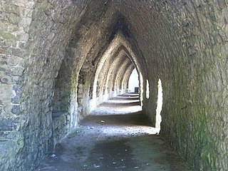
The limekilns at Kiln Park are heritage listed disused limekilns now located in the grounds of a holiday park, Kiln Park, near the village of Penally, Pembrokeshire, Wales. The western set of kilns have a Grade II* heritage listing.
52°13′43″N4°10′07″W / 52.22853°N 4.16852°W
| | This Ceredigion location article is a stub. You can help Wikipedia by expanding it. |