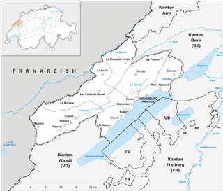
The Republic and Canton of Neuchâtel is a mostly French-speaking canton in western Switzerland. In 2007, its population was 169,782, of whom 39,654 were foreigners. The capital is Neuchâtel.

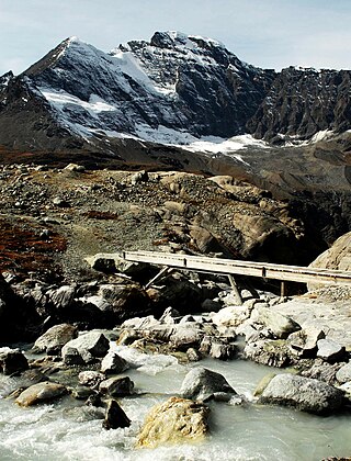
The Grand Combin is a mountain massif in the western Pennine Alps in the canton of Valais. At a height of 4,314 metres (14,154 ft) the summit of Combin de Grafeneire is one of the highest peaks in the Alps and the second most prominent of the Pennine Alps. The Grand Combin is also a large glaciated massif consisting of several summits, among which three are above 4000 metres. The highest part of the massif is wholly in Switzerland, although the border with Italy lies a few kilometres south.

Bagnes is a former municipality in the district of Entremont in the canton of Valais in Switzerland. On 1 January 2021 the former municipalities of Bagnes and Vollèges merged to form the new municipality of Val de Bagnes.

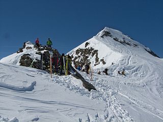
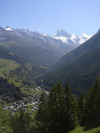
Verbier is a village located in south-western Switzerland in the canton of Valais. It is a holiday resort and ski area in the Swiss Alps and is recognised as one of the premier off-piste resorts in the world. Some areas are covered with snow all year. Skiers have settled in the Verbier area in order to take advantage of the steep slopes, varied conditions, and resort culture.

Arolla is a village in the municipality of Evolène in the Swiss canton of Valais. It is situated at the end of the Val d'Hérens, south of the cantonal capital, Sion.
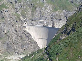
Mauvoisin Dam is a concrete variable radius arch dam across the Val de Bagnes on the Dranse de Bagnes stream, in the canton of Valais, Switzerland. Initial construction on the dam commenced in 1951 and was completed in 1957, with the reservoir filling by 1958. In 1991, the dam was raised to increase the capacity of the reservoir for winter storage. The dam's primary purpose is hydroelectric power generation.

Val Poschiavo is a valley in the southern, Italian-speaking part of the Swiss canton of Graubünden (Grisons). The main town is Poschiavo.
The Rosablanche is a mountain of the Swiss Pennine Alps, overlooking the Lac des Dix in the canton of Valais. It lies on the range between the valleys of Bagnes (west) and Hérémence (east), north of Le Pleureur.

Le Parrain is a mountain of the Swiss Pennine Alps, located east of Fionnay in the canton of Valais. Its summit lies within the valley of Bagnes but near the watershed with the valley of Hérens.
The Chanrion Hut French: is a mountain hut located in the upper Val de Bagnes in the canton of Valais in Switzerland. It lies in an isolated area south of Lac de Mauvoisin at an altitude of 2,462 metres, at the foot of Pointe d'Otemma. The easiest access is from the north.

Morgins is a village in the municipality of Troistorrents in the district of Monthey in the canton of Valais in southern Switzerland.

The Rein da Medel is the longest headwater of the Rhine. It is located in the Swiss cantons of Ticino and Graubünden and flows through the valleys Val Cadlimo and Val Medel. Rein da Medel is the local Sursilvan, name in Graubünden, which is commonly used to denote the ticinese part as well.
The Vals Valley is located in the canton of Graubünden in Switzerland.
Les Haudères is a village in the Swiss Alps, located in the canton of Valais. The village is situated in the central part of the canton, in the Val d'Hérens, south of Sion. It belongs to the municipality of Evolène.

Vercorin is a village in the Swiss Alps, located in the canton of Valais. The village is situated in the central part of the canton near Sierre, at a height of 1,320 metres (4,330 ft), on a plateau overlooking the Rhone valley. It belongs to the municipality of Chalais.
The Couches de Saint Christophe are a sedimentary formation deposited between the Late Cretaceous and the Paleogene. It is a very monotonous sequence of calcitic sandstones and black schists. These are interpreted as a turbidite sequence. The average thickness of the unit is 500 m. The Couches de Saint Christophe are a post-rift sequence that overlies the Couches des Marmontains.
The Col de Crête Sèche is a mountain pass in the Alps, located between Switzerland and Italy. It lies at a height of 2,896 metres (9,501 ft) above sea level, between the massifs of Mont Gelé and Bec d'Epicoune, in the Pennine Alps. It connects Fionnay in the Swiss canton of Valais on its northern side to Bionaz in the Italian region of the Aosta Valley on its southern side. The Col de Crête Sèche is the second-lowest pass between the valleys of Bagnes and Valpelline, after the Fenêtre de Durand which lies about one hundred metres lower west of Mont Gelé.

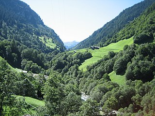
Val de Bagnes, also called the Vallée de Bagnes is a valley located in the Entremont District in the Canton of Valais of Switzerland.

Val de Bagnes is a municipality in the district of Entremont in the canton of Valais in Switzerland. It is named after the eponymous Val de Bagnes.

