Related Research Articles

The Salt River is a river in Gila and Maricopa counties in Arizona, United States, that is the largest tributary of the Gila River. The river is about 200 miles (320 km) long. Its drainage basin is about 13,700 square miles (35,000 km2) large. The longest of the Salt River's many tributaries is the 195-mile (314 km) Verde River. The Salt's headwaters tributaries, the Black River and East Fork, increase the river's total length to about 300 miles (480 km). The name Salt River comes from the fact that the river flows over large salt deposits shortly after the merging of the White and Black Rivers.

The Tioga River is a tributary of the Chemung River, approximately 58 miles (93 km) long, in northern Pennsylvania and western New York in the United States. It drains a region of ridges in the northern Allegheny Plateau in the watershed of the Susquehanna River. It is a Northern flowing river

The Feather River is the principal tributary of the Sacramento River, in the Sacramento Valley of Northern California. The river's main stem is about 73 miles (117 km) long. Its length to its most distant headwater tributary is just over 210 miles (340 km). The main stem Feather River begins in Lake Oroville, where its four long tributary forks join—the South Fork, Middle Fork, North Fork, and West Branch Feather Rivers. These and other tributaries drain part of the northern Sierra Nevada, and the extreme southern Cascades, as well as a small portion of the Sacramento Valley. The total drainage basin is about 6,200 square miles (16,000 km2), with approximately 3,604 square miles (9,330 km2) above Lake Oroville.

The Savage River is a 29.5-mile-long (47.5 km) river in Garrett County, Maryland, and is the first major tributary of the North Branch Potomac River from its source. The river was named for 18th century surveyor John Savage.
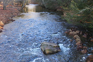
Harveys Creek is a tributary of the Susquehanna River in Luzerne County, Pennsylvania, in the United States. It is approximately 14.5 miles (23.3 km) long and flows through Harveys Lake, Lake Township, Lehman Township, Jackson Township, and Plymouth Township. The creek's watershed has an area of 46.3 square miles (120 km2). The creek has four named tributaries, which are known as Bear Hollow Creek, Paint Spring Run, Pikes Creek, and East Fork Harveys Creek. The watershed is designated as a High-Quality Coldwater Fishery and a Migratory Fishery above Pikes Creek and as a Coldwater Fishery and a Migratory Fishery below it. The creek's source is Harveys Lake, the largest natural lake in Pennsylvania.

Union Valley Reservoir is a reservoir in eastern El Dorado County, California, about 20 miles (32 km) northeast of Placerville. The 277,000 acre-feet (342,000,000 m3) lake is in Eldorado National Forest in the Sierra Nevada at an elevation of 4,870 feet (1,480 m).
Crooked Creek is a 26.3-mile-long (42.3 km) tributary of the Tioga River located entirely in Tioga County, Pennsylvania in the United States.

Kettle Creek State Park is a 1,793-acre (726 ha) Pennsylvania state park in Leidy Township, Clinton County, Pennsylvania in the United States. The park is in a valley and is surrounded by mountains and wilderness. It features the Alvin R. Bush Dam built in 1961 by the U.S. Army Corps of Engineers as a flood control measure in the West Branch Susquehanna River basin. Many of the recreational facilities at the park were built during the Great Depression by the young men of the Civilian Conservation Corps. Kettle Creek State Park is seven miles (10 km) north of Westport and Pennsylvania Route 120. It is largely surrounded by Sproul State Forest.

Sinnemahoning State Park is a 1,910-acre (773 ha) Pennsylvania state park in Grove Township, Cameron County and Wharton Township, Potter County, Pennsylvania, in the United States. The park is surrounded by Elk State Forest and is mountainous with deep valleys. The park is home to the rarely seen elk and bald eagle. Sinnemahoning State Park is on Pennsylvania Route 872, eight miles (13 km) north of the village of Sinnamahoning. In 1958, the park opened under the direction of the Pennsylvania Bureau of Forestry: it became a Pennsylvania State Park in 1962.
Wallenpaupack Creek is a 30.0-mile-long (48.3 km) tributary of the Lackawaxen River in the Pocono Mountains of eastern Pennsylvania in the United States.

Sinnemahoning Creek is a 15.7-mile-long (25.3 km) tributary of the West Branch Susquehanna River in Cameron and Clinton counties, Pennsylvania, in the United States.
Laurel Run is a 16.5-mile-long (26.6 km) tributary of the Bennett Branch Sinnemahoning Creek in Clearfield and Elk counties, Pennsylvania in the United States. Via the Bennett Branch, Sinnemahoning Creek, and the West Branch Susquehanna River, it is part of the Susquehanna River watershed flowing to Chesapeake Bay.
Huntington Creek is a tributary of Fishing Creek in Luzerne and Columbia counties, Pennsylvania, in the United States. It is approximately 29.5 miles (47.5 km) long.

The Crooked River is a tributary, 125 miles (201 km) long, of the Deschutes River in the U.S. state of Oregon. The river begins at the confluence of the South Fork Crooked River and Beaver Creek. Of the two tributaries, the South Fork Crooked River is the larger and is sometimes considered part of the Crooked River proper. A variant name of the South Fork Crooked River is simply "Crooked River". The Deschutes River flows north into the Columbia River.
The North Fork Malheur River is a 59-mile (95 km) tributary of the Malheur River in eastern Oregon in the United States. Rising in Big Cow Burn in the Blue Mountains, it flows generally south to join the larger river at Juntura. The upper 25.5 miles (41.0 km) of the river have been designated Wild and Scenic. This part of the river basin offers camping, hiking, and fishing opportunities in a remote forest setting. The lower river passes through Beulah Reservoir, which stores water for irrigation and has facilities for boaters.

The South Fork McKenzie River is a tributary, about 31 miles (50 km) long, of the McKenzie River in the U.S. state of Oregon. It begins at about 4,500 feet (1,400 m) above sea level near Mink Lake in the Three Sisters Wilderness of the Cascade Range. Flowing northwest within Lane County, it meets the McKenzie River about 60 miles (97 km) from the larger river's confluence with the Willamette River.

Briar Creek is a tributary of the Susquehanna River in Columbia County, Pennsylvania, in the United States. It is 7.77 miles (12.50 km) in length. The stream has a watershed area of 33.0 square miles. It flows through Briar Creek Township and the borough of Briar Creek. The area near the creek was originally inhabited by the Lenni Lenape and the Shawanese. European settlers arrived in the 1770s.
Bennett Branch Sinnemahoning Creek is a tributary of Sinnemahoning Creek in the U.S. state of Pennsylvania.
Driftwood Branch Sinnemahoning Creek is a tributary of Sinnemahoning Creek in the U.S. state of Pennsylvania. This stream once called simply "Driftwood Creek" was so named for the driftwood which accumulated there.

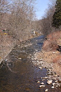
Pikes Creek is a tributary of Harveys Creek in Luzerne County, Pennsylvania, in the United States. It is approximately 8.9 miles (14.3 km) long and flows through Lake Township, Lehman Township, Jackson Township, and Plymouth Township. The watershed of the creek has an area of 11.6 square miles (30 km2). It is designated as a High-Quality Coldwater Fishery and a Migratory Fishery, as well as being Class A Wild Trout Waters for part of its length. The creek has a 400-acre reservoir, which is known as the Pikes Creek Reservoir and supplies water to tens of thousands of people. A number of bridges have been constructed over the creek.
References
- ↑ Gertler, Edward. Keystone Canoeing, Seneca Press, 2004. ISBN 0-9749692-0-6
- 1 2 3 U.S. Geological Survey. National Hydrography Dataset high-resolution flowline data. The National Map Archived 2012-03-29 at the Wayback Machine , accessed August 8, 2011