Location and countryside
The Fischbach Alps are a gentle, elongated mountain range in the Alps, with the character of a low mountain range and covered in forests and Alpine meadows. They are located in the Styria in Austria, south of the Mürz. They are the eastern outliers of the Central Alps and part of the Styrian Prealps.
They extend from the water gap of the Mur in the west to the Feistritz Saddle in the east. Their highest summit is the Stuhleck (1,782 m (AA) ). Other high points are the Pretul (1,656 m) and Amundsenhöhe (1,666 m), the Teufelstein (1,498 m), the Stanglalpe (1,490 m), the Sauernkogel (1,451 m), the Steinriegel (1,577 m), the Hochschlag (1,580 m) and the Rennfeld (1,629 m).
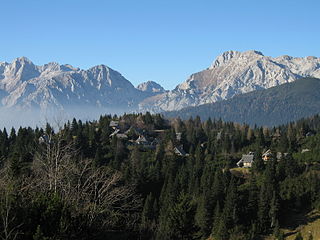
The Kamnik–Savinja Alps are a mountain range of the Southern Limestone Alps. They lie in northern Slovenia, except for the northernmost part, which lies in Austria.

Bavarian Alps is a summarizing term of several mountain ranges of the Northern Limestone Alps in the German state of Bavaria.

The Tux Alps or Tux Prealps are a sub-group of the Austrian Central Alps, which in turn form part of the Eastern Alps within Central Europe. They are located entirely within the Austrian federal state of Tyrol. The Tux Alps are one of three mountain ranges that form an Alpine backdrop to the city of Innsbruck. Their highest peak is the Lizumer Reckner, 2,886 m (AA), which rises between the glen of Wattentaler Lizum and the valley of the Navisbach. Their name is derived from the village of Tux which is tucked away in a side valley of the Zillertal.

The Noric Alps is a collective term denoting various mountain ranges of the Eastern Alps. The name derives from the ancient Noricum province of the Roman Empire on the territory of present-day Austria and the adjacent Bavarian and Slovenian area.
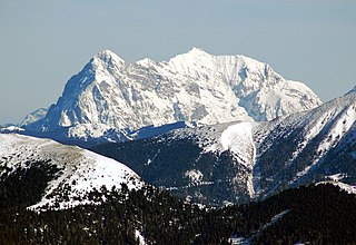
The Ennstal Alps, the Alps of the Enns valley, are a mountain range of the Northern Limestone Alps System. They are located primarily in the Austrian state of Styria, and also into the state of Upper Austria.

The Alpine foothills, or Prealps can refer generally to any foothills at the base of the European Alps. They are the transition zone between the High Alps to the Swiss Plateau and the Bavarian Alpine Foreland in the north, as well as to the Pannonian Basin (Alpokalja) in the east, the Padan Plain in the south and the Rhone Valley in the west.
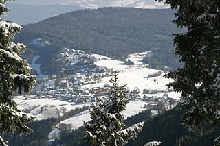
Fischbach is a municipality in the district of Weiz in Styria, Austria. On 27 February 2003, it was officially recognized as a climatic spa by the Styrian government. Fischbach is the highest place in East Styria.

The Chiemgau Alps are a mountain range in the Northern Limestone Alps and therefore belong to the Eastern Alps. Their major part is situated in Bavaria, Germany and only a small section crosses the Austrian border into the states of Salzburg and Tirol. They reach their highest elevation (1961 m) in the Sonntagshorn, a peak straddling the German-Austrian border.

The Hochschwab, Hochschwab Mountains, Hochschwab Alps or Hochschwab Group is a mountain range in the Northern Limestone Alps of Austria. The range is in the Styria. The highest peak is also called Hochschwab and is 2,277 metres above the Adriatic.
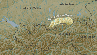
The Bavarian Prealps are a mountain range within the Northern Limestone Alps in south Germany. They include the Bavarian Prealp region between the river Loisach to the west and the river Inn to the east; the range is about 80 kilometres (50 mi) long and 20–30 kilometres (12–19 mi) wide. The term is not defined politically, but alpine-geographically because small areas of the Bavarian Prealps lie in Tyrol.

The Ammergau Alps are a mountain range in the Northern Limestone Alps in the states of Bavaria (Germany) and Tyrol (Austria). They cover an area of about 30 x 30 km and begin at the outer edge of the Alps. The highest summit is the Daniel which has a height of 2,340 metres (7,680 ft).

The Brandenberg Alps are a sub-group of the Northern Limestone Alps, that run in front of the Eastern Alps for their whole length. They lie entirely in Austria between Achensee in Tyrol, the Inn Valley and the Bavarian Prealps.

The Mürzsteg Alps or Mürztal Alps are a mountain range in the Eastern Alps, which lie in the Austrian state of Styria, with a small part of the range in Lower Austria. The highest peak is the Hohe Veitsch in the centre of the group, while largest massif is the Schneealpe in the northwest, near the Rax.

The Prealps East of the Mur are the easternmost mountain range of the Central Eastern Alps. They comprise the eastern foothills of the Alpine crest beyond the Mur river and the adjacent southeastern Alpine Foreland.

The Carnic and Gailtal Alps is a geographic grouping of mountain ranges belonging to the Southern Limestone Alps. They are located in Austria and Italy.

The Carnic Prealps or Southern Carnic Alps are a mountain range in the Southern Limestone Alps, part of the larger Carnic and Gailtal Alps group. They are located in Friuli-Venezia Giulia, in the northern part of Italy.

The Gurktal Alps are a mountain range of the Central Eastern Alps in Austria, named after the valley of the Gurk River.

Stuhleck is a mountain in Steiermark, Austria. It is the highest mountain of the Fischbach Alps and of the Prealps east of the Mur.
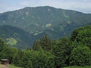
Rennfeld is a mountain in the Fischbach Alps, part of the Prealps east of the Mur. It is the westernmost peak of the range.

The Joglland is a heavily forested low mountain region in northeastern Styria in the districts of Hartberg-Fürstenfeld and Weiz. Today it forms the tourist region of Joglland–Waldheimat .
This page is based on this
Wikipedia article Text is available under the
CC BY-SA 4.0 license; additional terms may apply.
Images, videos and audio are available under their respective licenses.


