Cloud Peak is the highest peak within the Bighorn Mountains in the U.S. state of Wyoming.
Black Mountain is a mountain located in Catron County, New Mexico, on the northern boundary of the Gila Wilderness and in the Gila National Forest.

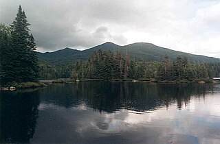
Seymour Mountain is a mountain located in Franklin County, New York, named after Horatio Seymour (1810–1886), Governor of New York. The mountain is part of the Seward Mountains of the Adirondacks. Seymour Mountain faces Seward Mountain to the west across Ouluska Pass.

MacNaughton Mountain is a mountain located in Essex County, New York, named after James MacNaughton (1851–1905), the grandson of Archibald McIntyre. The mountain is part of the Street Range of the Adirondack Mountains.
West Kill Mountain, or Westkill Mountain, is located in Greene County, New York. The mountain is named after the West Kill stream which flows along its northern side, and is part of the Devil's Path range of the Catskill Mountains. To the east, West Kill Mountain faces Southwest Hunter Mountain across 800-foot-deep (240 m) Diamond Notch; to the west, West Kill faces North Dome across Mink Hollow.

Plateau Mountain is located in the town of Hunter in Greene County, New York, United States. It is part of the Devil's Path range of the Catskill Mountains. Plateau has a two-mile-long (3.2 km) summit ridge above 3,500 feet (1,100 m). The highest point, at least 3,840 feet (1,170 m), is at the southeast end, facing Sugarloaf Mountain to the east across Mink Hollow Notch. It is the 12th-highest peak in the range Devils Tombstone is located west of Plateau Mountain. The northwest end faces Hunter Mountain to the west across 1,400-foot deep (430 m) Stony Clove Notch.

The MacIntyre Mountains or MacIntyre Range is a range of mountains in the High Peaks region of the Adirondacks, due west of Mount Marcy, in northeastern New York State. The range runs 8 miles (13 km) from southwest to northeast. Its sheer southwest slope makes up one side of Indian Pass, and a northeastern spur forms the cliffs of Avalanche Pass. From southwest to northeast, the range includes Mount Marshall, Iroquois Peak, Boundary Peak, Algonquin Peak, and Wright Peak. Algonquin is the second-highest peak in the Adirondacks.

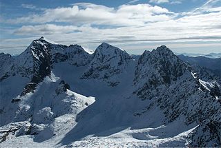
Aiguille du Belvédère is a mountain of Haute-Savoie, France. It is the highest peak in the Aiguilles Rouges range of the French Prealps and has an altitude of 2,965 metres (9,728 ft) above sea level.

The Hochgolling is a mountain of the Eastern Alps, located on the border of Steiermark and Salzburg, Austria, near the ski resort of Schladming. It is the highest peak of the Lower Tauern range.

The Hochalmspitze is located east of Mallnitz in the Austrian state of Carinthia. It is sometimes called "Tauern Queen" as a counterpart to the "Tauern King", the Grossglockner.

Petzeck (3,283m) is the highest mountain of the Schober Group in the High Tauern range, Austria. The mountain has a 1,000m high north face but its southern slope is more gentle, with lakes such as Kreuzsee and Wangenitzsee on its slopes. Its south western slope is glaciated.

Hohe Gaisl, (3,146m) is a mountain in the northern Dolomites, on the border of South Tyrol and Veneto, in northern Italy, located between the Braies Valley and the Val di Landro.

Testa del Rutor or Tête du Ruitor (3,486m) is a mountain of the Graian Alps in Aosta Valley, north-western Italy. It is the highest summit of the Rutor-Léchaud Group, lying roughly between the Mont Blanc Massif and the Vanoise Massif. The huge Glacier del Rutor lies on its slopes. The mountain is rarely climbed except by Italy's mountain troops, the Alpini, who use it for training.

Hochiss or Hochriss is a mountain in Tyrol, Austria. Rising some 2,299 metres (7,543 ft), it is the highest mountain of the Brandenberg Alps and is located near the tourist hot spot Achensee. Its steep north face is popular with rock climbers and its other slopes are a popular destination for hiking and paragliding as well as snowshoeing and ski touring in the winter.

Cima Bocche is a mountain of the Dolomites in Trentino, Italy. It is the highest peak of a small group that is located between the San Pellegrino Pass and the Predazzo valley. The mountain has a vertical 400m north face, whereas its southern slopes are far more gentle, making it an easy climb from this direction. Despite being geographically part of the Dolomites, the mountain is not geologically part of the range, as it is formed of Porphyry rather than dolomite.

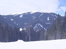
Gartnerkofel is a mountain of the Carnic Alps in Carinthia, Austria. It is located on the main chain of the Carnics above the Naßfeld Pass, near the border with Italy. The nearest town is Hermagor-Pressegger See. The mountain has two summits, and ravines fall down from its northern slopes, which are separated by rocky ridges. The normal route is from the northwest, from where it an easy climb across the ridge to the summit. The mountain is also a popular ski touring destination.

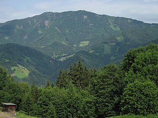
Rennfeld is a mountain in the Fischbach Alps, part of the Prealps east of the Mur. It is the westernmost peak of the range.

The Blackjack Mountains are a mountain range located in Gila County, Arizona. They have a maximum elevation of 6,942 ft (2,116 m) at Apache Peaks and a prominence of 2,580 ft (790 m). The peak has a topographic isolation of 17.88 miles (29 km), with the nearest higher peak lying to the south in the Pinal Mountains. The Blackjack mountains are located within the Tonto National Forest and are north of Globe, Arizona. The high point of the range, Apache Peaks, is ranked 36th in prominence for Arizona's most prominent peaks.
Harbin Mountain is a mountain in Lake County, California. It may be seen as a high point on a spur of Boggs Mountain or as a connected mountain to the southeast of Boggs Mountain.

Punta Minuta is a 2,556 metres (8,386 ft) mountain in the department of Haute-Corse on the island of Corsica, France. It is in the Monte Cinto massif.


