
Route 73 is a state highway in the southern part of the U.S. state of New Jersey. It runs 34.64 mi (55.75 km) as an outer bypass of the Camden area from an intersection with U.S. Route 322 (US 322) in Folsom, Atlantic County, north to the Tacony–Palmyra Bridge in Palmyra, Burlington County, where the road continues into Philadelphia, Pennsylvania, as Pennsylvania Route 73. South of the interchange with the Atlantic City Expressway in Winslow Township, Camden County, Route 73 is a two-lane undivided county-maintained road and is signed as County Route 561 Spur, a spur of CR 561. North of the Atlantic City Expressway, the route is maintained by the New Jersey Department of Transportation and is mostly four lanes, with the portion north of the CR 561 concurrency a divided highway. North of the US 30 interchange near Berlin, Route 73 runs through suburban areas of the Delaware Valley metropolitan area, intersecting Route 70 in Marlton, the New Jersey Turnpike and Interstate 295 (I-295) in Mount Laurel Township, Route 38 and Route 41 in Maple Shade Township, Route 90 in Cinnaminson Township, and US 130 in Pennsauken Township.

The Tacony–Palmyra Bridge is a combination steel tied-arch and double-leaf bascule bridge across the Delaware River that connects New Jersey Route 73 in Palmyra, New Jersey with Pennsylvania Route 73 in the Tacony section of Philadelphia. The bridge, designed by Polish-born architect Ralph Modjeski, has a total length of 3,659 feet (1,115 m) and spans 2,324 feet (708 m). After one and a half years of construction, it opened on August 14, 1929, replacing ferry service that had operated between Tacony and Palmyra since May 6, 1922.

The Betsy Ross Bridge is a continuous steel truss bridge spanning the Delaware River from Philadelphia, Pennsylvania to Pennsauken, New Jersey. It was built from 1969 to 1974, and opened in April 1976, during the American Bicentennial Year. It was originally planned to be named as the "Delair Bridge", after a paralleling vertical lift bridge owned by Pennsylvania Railroad, which is now used by Conrail Shared Assets Operations and New Jersey Transit's Atlantic City Line, but was instead later named for Betsy Ross, a Philadelphia seamstress and reputed creator of the first American flag in 1776. It was the first automotive bridge named for a woman in the United States, and the second U.S. bridge overall named for a woman after Iowa's Boone High Bridge was renamed the Kate Shelley High Bridge in 1912.

Poquessing Creek is a 10.3-mile-long (16.6 km) creek, a right tributary of the Delaware River, that forms the boundary between Philadelphia and Bensalem Township, which borders it to the northeast along the Delaware. It has defined this boundary between Bucks and Philadelphia counties since 1682.

Frankford Creek is a minor tributary of the Delaware River in southeast Pennsylvania. It derived its name from today's Frankford, Philadelphia neighborhood.

Juniata is a working class, predominantly Hispanic and Caucasian neighborhood in North Philadelphia, which is a section of the city of Philadelphia, Pennsylvania, United States. Juniata is located south of the Juniata Golf Club in Tacony Creek Park. It is bordered to the east by Frankford, to the west by Feltonville, and to the south by Harrowgate and Port Richmond. The neighborhood is bordered by G Street to the west, Juniata Park to the north, Tacony Creek to the east, and by SEPTA rail tracks to the south. Juniata shares the ZIP code of 19124 with the nearby neighborhood of Frankford.
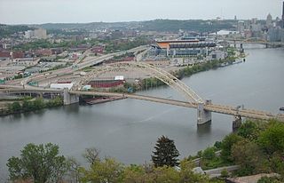
The West End Bridge is a steel tied-arch bridge over the Ohio River in Pittsburgh, Pennsylvania, approximately 1 mile (1.6 km) below the confluence of the Allegheny and Monongahela Rivers. It connects the West End to the Chateau neighborhood on the North Side of Pittsburgh.
Wingohocking Creek was once a major tributary of another Philadelphia, Pennsylvania stream, Frankford Creek, which flows into the Delaware River. Frankford Creek was formed by the confluence of Wingohocking Creek and Tacony Creek. Since Wingohocking Creek is now obliterated, having been piped underground in the late 19th century, it can be confusing to look at a modern map, which shows Tacony Creek suddenly changing names "in the middle of the stream," so to speak, and becoming Frankford Creek. The point at which the name changes is near the present intersection of I and Ramona Streets, where the Wingohocking once joined the Tacony to form the Frankford Creek. What was once a major stream and the site of many mills and factories has been completely wiped off the map—all but the city's sewer maps, that is. The outlet of the Wingohocking Sewer is the largest in the Philadelphia sewer system, about 24 feet (7.3 m) high. It is visible from various points in the Juniata neighborhood and the adjoining golf course.

Oxford Circle is a neighborhood in the lower Northeast section of Philadelphia, Pennsylvania, United States. Its namesake is the much used traffic circle at Roosevelt Boulevard and Oxford Avenue. The Oxford Circle neighborhood has traditionally included the areas up to Rhawnhurst and Mayfair but does not really have a fixed boundary, other than in publications about Philadelphia which are of a public relations or informational nature.

Interstate 95 (I-95) is a major north–south Interstate Highway that runs along the East Coast of the United States from Miami, Florida, north to the Canada–United States border at Houlton, Maine. In the state of Pennsylvania, it runs 51.00 miles (82.08 km) from the Delaware state line near Marcus Hook in Delaware County in the southeastern part of the state northeast to the Delaware River–Turnpike Toll Bridge at the New Jersey state line near Bristol in Bucks County, closely paralleling the New Jersey state line for its entire length through Pennsylvania.

Pennsylvania Route 73 (PA 73) is a 62.32-mile (100.29 km) long east–west state highway in southeastern Pennsylvania. It runs from PA 61 near Leesport southeast to the New Jersey state line on the Tacony–Palmyra Bridge over the Delaware River in Philadelphia, where the road continues south as New Jersey Route 73. The route passes through rural areas of Berks County, crossing U.S. Route 222 (US 222) in Maiden Creek before heading southeast through Oley and Boyertown. PA 73 continues into Montgomery County and intersects PA 100 in Gilbertsville and PA 29 in Schwenksville before it heads into the northwest suburbs of Philadelphia. The route passes through Skippack and intersects US 202 in Center Square, PA 309 in Springfield Township, and PA 611 near Jenkintown. PA 73 continues through Northeast Philadelphia on Cottman Avenue, crossing US 1 and US 13 before coming to an interchange with Interstate 95 (I-95) near the Tacony–Palmyra Bridge.

The Hares Hill Road Bridge is a single-span, wrought iron, bowstring-shaped lattice girder bridge. It was built in 1869 by Moseley Iron Bridge and Roof Company and is the only known surviving example of this kind. The bridge spans French Creek, a Pennsylvania Scenic River.

The Walnut Lane Bridge is a concrete arch bridge located in Northwest Philadelphia that connects the Germantown and Roxborough neighborhoods across the Wissahickon Creek in Fairmount Park. While drivers may cross the bridge too quickly to notice, the view from underneath the bridge has inspired many artists and writers, such as Christopher Morley. The design was copied from Pont Adolphe in Luxembourg.

The Adams Avenue Bridge is a historic bridge in Philadelphia, Pennsylvania. It carries Adams Avenue over the Tacony Creek in Tacony Creek Park.

The Holme Avenue Bridge is a closed-spandrel concrete arch bridge that carries Holme Avenue across Wooden Bridge Run in Philadelphia, Pennsylvania. Owned by the Commonwealth of Pennsylvania's Department of Transportation, it should not be confused with the other "Holme Avenue Bridge" over Pennypack Creek about 1,000 yards west of Wooden Bridge Run.
Plunketts Creek Bridge No. 3 was a rubble masonry stone arch bridge over Plunketts Creek in Plunketts Creek Township, Lycoming County in the U.S. state of Pennsylvania. It was built between 1840 and 1875, probably closer to 1840, when the road along the creek between the unincorporated villages of Barbours and Proctor was constructed. Going upstream from the mouth, the bridge was the third to cross the creek, hence its name.

The Wissahickon Memorial Bridge, originally called and still also known as the Henry Avenue Bridge, is a stone and concrete bridge that carries Henry Avenue over Wissahickon Creek and Lincoln Drive in Fairmount Park in Philadelphia, Pennsylvania.

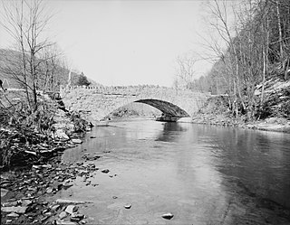
The Perkiomen Bridge, originally built 1798-99 and widened in 1928, is one of the oldest stone arch bridges in the United States still in use. It crosses Perkiomen Creek near Collegeville, Pennsylvania. The bridge's six semi-circular arches cover a total of over 300 feet (91 m). The longest arch spans 76 feet (23 m). Its decorative piers and belt courses are unusual for a bridge this old. A lottery financed $20,000 of the original construction. The bridge carried the main road from Philadelphia to Reading, known at various times as the Manatawny Pike, Germantown Pike, the Philadelphia-Reading Pike, and US 422. Since the construction of the US 422 bypass, the road has been known as Ridge Pike or Old US 422.
Rowlandville was a North Philadelphia neighborhood along the Tacony Creek near present-day Wyoming Avenue. The name Rowlandville is no longer used; the neighborhood has been absorbed into present-day Juniata Park and Feltonville.


