Five Mile Pass, Utah | |
---|---|
Coordinates | 40°16′0″N112°5′0″W / 40.26667°N 112.08333°W Coordinates: 40°16′0″N112°5′0″W / 40.26667°N 112.08333°W |
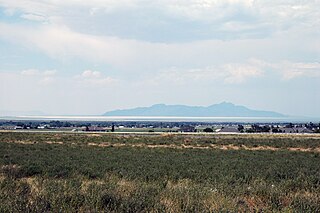
Five Mile Pass is a high arid region ~14 miles (23 km) west of Eagle Mountain, Utah, that is managed by the Bureau of Land Management and is popular for motocross, off highway vehicle recreation, mountain biking, hiking, and camping. [1]
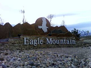
Eagle Mountain is a city in Utah County, Utah, United States. It is part of the Provo–Orem, Utah Metropolitan Statistical Area. The city is located to the west as well as north of the Lake Mountains, which are west of Utah Lake. It was incorporated December 3, 1996 and has been rapidly growing ever since. The population was 21,415 at the 2010 census. Although Eagle Mountain was a town in 2000, it has since been classified as a fourth-class city by state law. In its short history, the city has quickly become known for its rapid growth.
The Bureau of Land Management (BLM) is an agency within the United States Department of the Interior that administers more than 247.3 million acres (1,001,000 km2) of public lands in the United States which constitutes one eighth of the landmass of the country. President Harry S. Truman created the BLM in 1946 by combining two existing agencies: the General Land Office and the Grazing Service. The agency manages the federal government's nearly 700 million acres (2,800,000 km2) of subsurface mineral estate located beneath federal, state and private lands severed from their surface rights by the Homestead Act of 1862. Most BLM public lands are located in these 12 western states: Alaska, Arizona, California, Colorado, Idaho, Montana, Nevada, New Mexico, Oregon, Utah, Washington and Wyoming.
The area is on the Utah County and Tooele County line, and the Pony Express passed through the area during 1860-1861. The area also was traveled by the stagecoach and pioneer families heading west for Nevada and California. Other historical activities in the area include mineral mining and quarrying.
The Pony Express was a mail service delivering messages, newspapers, and mail.
Nevada is a state in the Western United States. It is bordered by Oregon to the northwest, Idaho to the northeast, California to the west, Arizona to the southeast and Utah to the east. Nevada is the 7th most extensive, the 32nd most populous, but the 9th least densely populated of the U.S. states. Nearly three-quarters of Nevada's people live in Clark County, which contains the Las Vegas–Paradise metropolitan area where three of the state's four largest incorporated cities are located. Nevada's capital, however, is Carson City.
California is a state in the Pacific Region of the United States. With 39.6 million residents, California is the most populous U.S. state and the third-largest by area. The state capital is Sacramento. The Greater Los Angeles Area and the San Francisco Bay Area are the nation's second and fifth most populous urban regions, with 18.7 million and 9.7 million residents respectively. Los Angeles is California's most populous city, and the country's second most populous, after New York City. California also has the nation's most populous county, Los Angeles County, and its largest county by area, San Bernardino County. The City and County of San Francisco is both the country's second-most densely populated major city after New York City and the fifth-most densely populated county, behind only four of the five New York City boroughs.
Iron County is a county in southwestern Utah, United States. As of the 2010 United States Census, the population was 46,163. Its county seat is Parowan, and the largest city is Cedar City.
Weber County is a county in the U.S. state of Utah. As of the 2010 census, the population was 231,236, making it Utah's fourth-most populous county. Its county seat and largest city is Ogden, the home of Weber State University. The county was named for the Weber River.
Green River is a city in Emery County, Utah, United States. The population was 952 at the 2010 census.
Park City is a city in Summit County, Utah, United States. It is considered to be part of the Wasatch Back. The city is 32 miles (51 km) southeast of downtown Salt Lake City and 20 miles (32 km) from Salt Lake City's east edge of Sugar House along Interstate 80. The population was 7,558 at the 2010 census. On average, the tourist population greatly exceeds the number of permanent residents.
The Wasatch Range is a mountain range that stretches approximately 160 miles (260 km) from the Utah-Idaho border, south through central Utah in the western United States. It is the western edge of the greater Rocky Mountains, and the eastern edge of the Great Basin region. The northern extension of the Wasatch Range, the Bear River Mountains, extends just into Idaho, constituting all of the Wasatch Range in that state.
The Wasatch Front is a metropolitan region in the north-central part of the U.S. state of Utah. It consists of a chain of contiguous cities and towns stretched along the Wasatch Range from approximately Nephi in the south to Brigham City in the north. Roughly 80% of Utah's population resides in this region, which contains the major cities of Salt Lake City, West Valley City, Provo, West Jordan, Layton, and Ogden.
Ben Lomond, just north of Ogden, Utah, is a peak in the northern portion of the Wasatch Mountains. A popular trail passes over its summit, accessible from four different trailheads to the north, south, and east.
Vail Pass is a 10,662-foot-high (3,250 m) mountain pass in the Rocky Mountains of central Colorado. The pass was named for Charles Vail, a highway engineer and director of the Colorado State Highway Department from 1930 to 1945.
Dead Horse Point State Park is a state park of Utah in the United States, featuring a dramatic overlook of the Colorado River and Canyonlands National Park. The park covers 5,362 acres (2,170 ha) of high desert at an altitude of 5,900 feet (1,800 m).
The Slickrock Trail, is a popular mountain biking destination with worldwide fame that is located in Grand County, Utah United States, just northeast of the city of Moab. This 10.5-mile (16.9 km) loop takes intrepid riders over a landscape of "petrified" sand dunes and the eroded remnants of ancient sea beds. The Slickrock Trail is one of the more difficult rides in the Moab area, both technically and cardiovascularly, and is not suitable for novice riders.
Big Cottonwood Canyon is a canyon in the Wasatch Range 12 miles (19 km) southeast of Salt Lake City in the U.S. state of Utah. The 15-mile (24 km)-long canyon provides hiking, biking, picnicking, rock-climbing, camping and fishing in the summer. Its two ski resorts, Brighton and Solitude, are popular among skiers and snowboarders. The canyon is accessed by The Big Cottonwood Canyon Scenic Byway (SR-190), which runs its length to Guardsman Pass at the top of the canyon, allowing travel to Park City in the summer months.
Snow Canyon State Park is a state park of Utah, USA, featuring a canyon carved from the red and white Navajo sandstone in the Red Mountains. The park is located near Ivins, Utah and St. George in Washington County. Other geological features of the state park include extinct cinder cones, lava tubes, lava flows, and sand dunes.
Park City Mountain Resort is a ski resort in the western United States in Park City, Utah, located 32 miles (51 km) east of Salt Lake City. Park City, as the ski resort and area is known, contains several training courses for the U.S. Ski Team, including slalom and giant slalom runs. During the 2002 Winter Olympics the resort hosted the snowboarding events and the men's and women's alpine giant slalom events.
Alafia River State Park is a Florida State Park, located near Picnic in Hillsborough County in central Florida, 10 miles southeast of Tampa on County Road 39. Even before it became a park, the area, and particularly Hurrah Lake, was the center of leisure activities since the early 1880s.
The Kokopelli's Trail is a 142-mile (229 km) multi-use trail in the Western U.S. states of Colorado and Utah. The trail was named in honor of its mythic muse, Kokopelli. The trail was created by the Colorado Plateau Mountain Bike Trail Association (COPMOBA) in cooperation with the United States Bureau of Land Management (BLM) and the United States Forest Service (NFS) in 1989.
Interstate 15 (I-15) runs north–south in the U.S. state of Utah through the southwestern and central portions of the state, passing through many of the population centers of the state, including St. George, Provo, Salt Lake City, and Ogden, the latter three being part of the urban area known as the Wasatch Front. It is the primary north–south highway in Utah, as the majority of the state's population lives along its corridor. The only Metropolitan Statistical Area in Utah not connected by I-15 is the Logan Utah-Idaho Metropolitan Statistical Area. In 1998, the Utah Legislature designated the entire length within Utah as the Veterans Memorial Highway.
Park Valley is an unincorporated community in north-central Box Elder County, Utah, United States.
Stansbury Island is the second largest island within the Great Salt Lake in the U.S. state of Utah. Located in Tooele County, it is considered an island even though a dirt causeway connects it to the mainland. Stansbury Island was named after Howard Stansbury, the leader of a government expedition that surveyed the lake in 1849.
The Paradox Trail is located in western Montrose County, Colorado and traverses a route of over 118 miles (190 km) through various terrain. The trail was rerouted 17 miles due to a trespass issue near the Tabeguache area north of Nucla in 2017. The trail links with two other long distant trails in the region, the Tabeguache Trail to the east on the Uncompahgre Plateau and the Kokopelli Trail to the west in the La Sal Mountains of Utah. These three trails together form the "Grand Loop", a grueling 360 mile course.