Gerardus Mercator was a Flemish geographer, cosmographer and cartographer. He is most renowned for creating the 1569 world map based on a new projection which represented sailing courses of constant bearing as straight lines—an innovation that is still employed in nautical charts.

Ninove is a city and municipality in the Flemish province of East Flanders in Belgium. It is on the river Dender, and is part of the Denderstreek. The municipality comprises the city of Ninove proper and since the 1976 merger of the towns of Appelterre-Eichem, Aspelare, Denderwindeke, Lieferinge, Meerbeke, Nederhasselt, Neigem, Okegem, Outer, Pollare and Voorde. On 1 January 2023 Ninove had a total population of 40.090. The total area is 72.57 km2 which gives a population density of 553 inhabitants per km2.

Lokeren is a city and municipality located in the Belgian province of East Flanders, and belongs to the Waasland, also called Land van Waas, of which it is the second most important city after Sint-Niklaas. The city, located on the river Durme, the Lede, and the E17 motorway, has more than 42,100 inhabitants who are called Lokeraars or Rapenfretters. Because Lokeren is located on the Durme, Lokeren is often called "The Durme City". Horse sausages are officially recognized as a regional product.

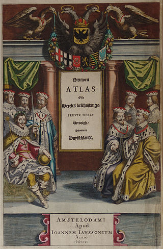
Johannes Janssonius was a Dutch cartographer and publisher who lived and worked in Amsterdam in the 17th century.

Adriaen Isenbrandt or Adriaen Ysenbrandt was a painter in Bruges, in the final years of Early Netherlandish painting, and the first of the Dutch and Flemish Renaissance painting of the Northern Renaissance. Documentary evidence suggests he was a significant and successful artist of his period, even though no specific works by his hand are clearly documented. Art historians have conjectured that he operated a large workshop specializing in religious subjects and devotional paintings, which were executed in a conservative style in the tradition of the Early Netherlandish painting of the previous century. By his time, the new booming economy of Antwerp had made this the centre of painting in the Low Countries, but the previous centre of Bruges retained considerable prestige.

Jodocus Hondius was a Flemish and Dutch engraver and cartographer. He is sometimes called Jodocus Hondius the Elder to distinguish him from his son Jodocus Hondius II. Hondius is best known for his early maps of the New World and Europe, for re-establishing the reputation of the work of Gerard Mercator, and for his portraits of Francis Drake. He inherited and republished the plates of Mercator, thus reviving his legacy, also making sure to include independent revisions to his work. One of the notable figures in the Golden Age of Dutch cartography, he helped establish Amsterdam as the center of cartography in Europe in the 17th century.

Antonius Sanderus was a Flemish Catholic cleric and historian.

Jules, Baron de Saint-Genois was a Belgian liberal politician, historian, librarian and professor at the University of Ghent. He was the first President of the Willemsfonds and a prolific contributor to the early volumes of the Biographie Nationale de Belgique, serving as president of the editorial committee.
Henricus Hondius II was a Dutch engraver, cartographer, and publisher.

Frederik de Wit was a Dutch cartographer and artist.

Liber Floridus is a medieval encyclopedia that was compiled between 1090 and 1120 by Lambert, Canon of Saint-Omer. The text compiles extracts from some 192 or so different works.
Aernout van Buchel was a Dutch antiquarian and humanist, specialising in genealogy and heraldry.

Claes Janszoon Visscher was a Dutch Golden Age draughtsman, engraver, mapmaker, and publisher. He was the founder of the successful Visscher family mapmaking business. The firm that he established in Amsterdam would be passed down his generations until it was sold to Peter Schenk.

Hendrik Hondius I was a Flemish-born and trained engraver, cartographer, and publisher who settled in the Dutch Republic in 1597.
Justus de Harduwijn, also written Hardwijn, Herdewijn, Harduyn or Harduijn, was a 17th-century Roman Catholic priest and poet from the Southern Netherlands. He was the poetic link between the Renaissance and the Counter-Reformation in the Netherlands.

The lords of Gruuthuse were one of the noble families of Bruges in the medieval period. It was one of several families bearing the title of "lords of Bruges" Their heraldic motto was Plus est en vous – Meer is in u.
The Genealogia comitum Flandrensium, also called the Genealogia Bertiniana, is a short text containing a genealogy of the counts of Flanders. It exists today in three versions, all based on an archetype produced probably at Saint Peter's Abbey in Ghent shortly after the death of Count Baldwin V in 1067. The three versions are all identical up to the 1067, thereafter they diverge. The first version, 204 words in length, continues the genealogy to the death of Robert II (1111); the second, 243 words, to that of Baldwin VII (1119); and the third, 337 words, to that of Theoderic (1168). The complete, 337-word text with variants was edited by Ludwig Bethmann and published in the Monumenta Germaniae Historica. It was published under the title Genealogia comitum Flandriae Bertiniana because Bethmann mistakenly believed it to originate in the Abbey of Saint-Bertin.
Events in the year 1865 in Belgium.

The Castle of Temse also known as 'the (old) castle', 'Arcques', 'Hercken' or 'Herkenstein', was a castle/moated castle that was located on the left bank of the Scheldt in Temse. It existed before the 12th century and was demolished in 1782. More to the north of the old castle, a new castle was built from 1783 to 1787 in classicist style, which in turn was demolished in 1965 to make way for the swimming pool of Temse. There are no remnants of the old castle, except for the current Scheldt Park, which belonged to the domain of the old and new castle. A model of the old castle can be seen in the municipal museum of Temse.


