
Clutha District is a local government district of southern New Zealand, with its headquarters in the Otago town of Balclutha. The Clutha District has a land area of 6,362.86 km² and a 2006 census population of 16,839 usual residents. Clutha District occupies the majority of the geographical area known as South Otago.
The Catlins River flows southeastward through The Catlins, an area of the southern South Island of New Zealand. Its total length is 42 kilometres (26 mi), and it flows into the Pacific Ocean at Pounawea, 28 kilometres (17 mi) south of Balclutha. Its upper estuary is called Catlins Lake, and its lower estuary is shared with the Owaka River.
The Catlins Ranges are a series of rugged, roughly parallel hill ranges in the southeastern corner of New Zealand's South Island.
Pounawea is a small settlement in The Catlins, an area of the southern South Island of New Zealand. It is located four kilometres southwest of Owaka, at the mouth of the Catlins River. It is a popular holiday spot with a seasonal population, there are numerous cribs at the settlement.

Maclennan is a small settlement in The Catlins, an area of the southern South Island of New Zealand. It is located 20 kilometres southwest of Owaka. From 1915 until its closure on 27 February 1971, the Catlins River Branch railway passed through the village, and the station building and goods shed still stand today.
Glenomaru is a small settlement in The Catlins, an area of the southern South Island of New Zealand. It is located 10 kilometres north of Owaka on the main road to Balclutha. On 7 July 1891, a branch line railway from the Main South Line in Balclutha was opened to Glenomaru, and the village remained the terminus of the line until it was extended to Tahora on 16 December 1895. This line ultimately terminated in Tahakopa and was known as the Catlins River Branch. It closed on 27 February 1971 and a sawmill now exists on the site of Glenomaru station, though some of the railway's old formation can be seen in the surrounding area and the Hunts Road tunnel is in the vicinity and can be walked.

The Cathedral Caves are one of the thirty longest sea caves in the world, located on Waipati Beach, 15 kilometres (9.3 mi) south of Papatowai, on the Catlins Coast in the southeast corner of the South Island, New Zealand. They are one of the most popular tourist attractions in the area, along with the McLean Falls, the highest water falls in the Catlins, located 4.9 kilometres (3.0 mi) away. The two main cave systems join together within the cliff and one has a 30 metres (98 ft) high ceiling. Often blue penguins and fur seals will emerge from the gloom at the far end of the cave.
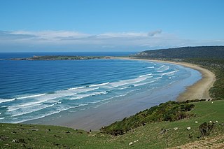
Tautuku Peninsula is a rocky headland in the Catlins on the south coast of Otago on the South Island of New Zealand. It is located 25 km (15 mi) east of Waikawa, at the western end of Tautuku Bay.
Tahakopa is a small settlement in The Catlins, an area of the southern South Island of New Zealand. It is located 25 kilometres northeast of Waikawa on the Tahakopa River. On 17 February 1915, Tahakopa became the terminus of the Catlins River Branch railway and retained this status until the branch line was closed on 27 February 1971. From the line's opening until 12 August 1956, a railway locomotive depot was based in the village. The old station building and goods shed still stand today.
Mount Pye is a rugged hill in the southeast of the South Island of New Zealand. It is the highest point in the area known as the Catlins, rising to 720 m (2361 ft). It is located 40 km (25 mi) southeast of Gore, and forms part of the border between the Otago and Southland regions. The headwaters of many of the Catlins' rivers are located on the slopes of Mount Pye.

Waikawa is a small settlement in Southland, New Zealand, at the southwestern edge of The Catlins.
The Purakaunui River is a river in the western Catlins, New Zealand. It rises west of Houipapa and flows into the Pacific Ocean at Purakaunui Bay.
The Waipati River, alternatively known as the Chaslands River is a river in the eastern Catlins, New Zealand. It rises in the Maclennan Range and flows south-eastward into the Waipati Beach north of Chaslands Mistake.
The Waitahuna River is a river in New Zealand, a tributary of the Clutha River.

The McLean Falls on the Tautuku River in Catlins Forest Park descend a number of steep drop offs and terraces, with the very top of the waterfall, where it meets its first waterpool being 22-metres. It then descends for many more metres over a series of terraces. The McLean Falls are often described as the most spectacular in the region, with its sister waterfall, Purakanui being the most visited, due to it being more easily accessible.
The small settlement of Caberfeidh is located in The Catlins, in the Otago region of New Zealand's South Island. The site of a former railway station on the Catlins Branch Line, it is sited close to a tributary of the Maclennan River, 5 kilometres north of the coast at Tahakopa Bay and 12 kilometres southwest of Owaka.
Waiwera South is a small settlement in the South Island of New Zealand, close to the boundary between the Otago and Southland regions. The settlement is located between Balclutha and Clinton, immediately to the south of State Highway 1, between branches of the Waiwera River and Kaihiku Stream, two minor tributaries of the Clutha River. The South Island Main Trunk railway also runs through the township. The settlement's population is around 100.
Port Molyneux is a tiny settlement on the coast of South Otago, New Zealand, close to the northeasternmost point of The Catlins. Now home only to farmland, it was a thriving port in the early years of New Zealand's European settlement.


