Kent is a county in the South East England region, the closest county to continental Europe. It borders Essex across the entire estuary of the River Thames to the north; the French department of Pas-de-Calais across the Strait of Dover to the south-east; East Sussex to the south-west; Surrey to the west and Greater London to the north-west. The county town is Maidstone.

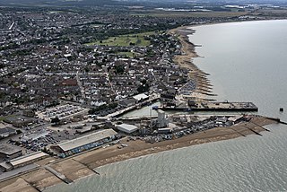
Folkestone is a coastal town on the English Channel, in Kent, south-east England. The town lies on the southern edge of the North Downs at a valley between two cliffs. It was an important harbour, shipping port, and fashionable coastal resort for most of the 19th and mid-20th centuries.

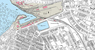
Whitstable is a town in the Canterbury district, on the north coast of Kent adjoining the convergence of the Swale Estuary and the Greater Thames Estuary in southeastern England, five miles north of Canterbury and two miles west of Herne Bay. The 2011 Census reported a population of 32,100.

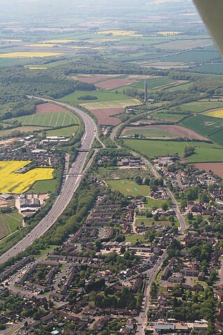
Stokenchurch is a village and civil parish in south-west Buckinghamshire, England. It is located in the Chiltern Hills, about 3 miles (5 km) south of Chinnor in Oxfordshire and 6 miles (10 km) west of High Wycombe. Stokenchurch is a commuter village, served by junction 5 of the M40 motorway to London, Oxford and Birmingham. The Stokenchurch BT Tower, to the west of the village, is a highly visible landmark on the edge of the Chilterns and pinpoints the village's location for miles ahead.

Faversham is a market town in Kent, England, 8 miles (13 km) from Sittingbourne, 48 miles (77 km) from London and 10 miles (16 km) from Canterbury, next to the Swale, a strip of sea separating mainland Kent from the Isle of Sheppey in the Thames Estuary. It is close to the A2, which follows an ancient British trackway which was used by the Romans and the Anglo-Saxons, and known as Watling Street. The name is of Old English origin, meaning "the metal-worker's village".

Canterbury, also known as the City of Canterbury, is a local government district with city status in Kent, England. It is named after its largest settlement, Canterbury, where the council is based. The district also includes the towns of Fordwich, Herne Bay and Whitstable, along with numerous villages and surrounding rural areas. Parts of the district lie within the designated Area of Outstanding Natural Beauty of the Kent Downs.

Leigh, historically spelled Lyghe, is a village and a civil parish located in the Sevenoaks district of Kent, England. It is located six miles (10 km) south of Sevenoaks town and three miles (5 km) west of Tonbridge.

A heraldic badge, emblem, impresa, device, or personal device worn as a badge indicates allegiance to, or the property of, an individual, family or corporate body. Medieval forms are usually called a livery badge, and also a cognizance. They are para-heraldic, not necessarily using elements from the coat of arms of the person or family they represent, though many do, often taking the crest or supporters. Their use is more flexible than that of arms proper.

Canterbury West railway station is a Grade II listed railway station, and the busier of the two stations in Canterbury in Kent, England. The station as well as all services are operated by Southeastern with both main line and high speed trains serving the station.

The Canterbury and Whitstable Railway, sometimes referred to colloquially as the "Crab and Winkle Line", was an early British railway that opened in 1830 between Canterbury and Whitstable in the county of Kent, England.

Stagecoach South East is the trading name of East Kent Road Car Company Limited, a bus operator based in Canterbury providing services in Kent and East Sussex in the south east of England. It is a subsidiary of Stagecoach Group.
The Fleur-de-lis is a stylized design often used in heraldry or as a political symbol.

The East Kent Road Car Company Ltd is a bus company formed in 1916 and based in Canterbury, Kent. The company operated bus and coach services in Kent. In 1993 it was one of the first companies to be acquired by the Stagecoach Group, which eventually rebranded the operation as Stagecoach in East Kent, and made it part of the Stagecoach South East bus division.

Seasalter is a village in the Canterbury district of Kent, England. Seasalter is on the north coast of Kent, between the towns of Whitstable and Faversham, facing the Isle of Sheppey across the estuary of the River Swale. The settlement of Yorkletts is included in the ward. It is approximately 6 miles (10 km) north of Canterbury.
Counties 4 Kent is an English level 10 Rugby Union League and is made up of teams predominantly from south-east London and Kent. The teams play home and away matches from September through to April. Currently promoted teams move up to Kent 1 and there is no relegation although until the 2007–08 season teams could drop down to Kent 3. Now a single division, in the past Kent 2 was divided into regional divisions - Kent 2 East and Kent 2 West. Relegated teams drop down to Counties 5 Kent. Following the RFU's Adult Competition Review, from season 2022-23 it adopted its current name Counties 4 Kent.
The Kent League was a football league which existed from 1894 until 1959, based in the English county of Kent. Another, unrelated, Kent League was formed in 1966, and is now known as the Southern Counties East Football League.
The 1999–2000 Kent Football League season was the 34th in the history of Kent Football League a football competition in England.
The 1997–98 Kent Football League season was the 32nd in the history of the Kent Football League, a football competition in England.
The 1991–92 Kent Football League season was the 26th in the history of the Kent Football League, a football competition in England, featuring clubs from Kent and the adjacent area.


