Related Research Articles

Killester railway station serves the suburbs of Killester and Donnycarney, as well as parts of Artane, in Dublin.
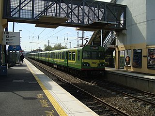
Clontarf Road railway station is a railway station in Dublin, Ireland, on the DART commuter rail line.
Clonsilla railway station is a railway station that serves Clonsilla, in Fingal, Ireland.

Ballyduff is a village in County Waterford, Ireland. It is also a parish in the Roman Catholic Diocese of Waterford and Lismore.

Park West and Cherry Orchard railway station is an Iarnród Éireann railway station in Ballyfermot, Dublin, Ireland, serving the Park West and the Cherry Orchard area.

Westport railway station serves the town of Westport, County Mayo, Ireland.

Inch is located in County Wexford, Ireland on the R772 road between Arklow and Gorey. In September 2007 Inch was bypassed, having formerly been on the N11 Dublin to Wexford road. There is a creamery in Inch run by Glanbia.

Gort railway station is a railway station that serves the town of Gort in County Galway, Ireland.
Oranmore railway station is a railway station that serves the town of Oranmore and its surrounding areas in County Galway.

Drumhawnagh (Drumhowna) Railway Station near Loughduff in County Cavan, Ireland was a former station on the Inny Junction to Cavan branch of the Midland Great Western Railway, Ireland. It opened in 1877 and closed in 1947. The previous station along the dismantled branch was Ballywillan whereas the next station along the dismantled branch to Cavan is Crossdoney.
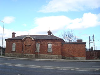
Crossdoney railway station was a station on the Inny Junction to Cavan branch of the Midland Great Western Railway, Ireland 3/4 mile from the village of Crossdoney County Cavan. It was also the junction for the branch line to Killashandra, the only intermediate station being Arva Road. The line opened in 1856 after the well known architect George Wilkinson designed the station building in the modest Italianate style. The line closed to passenger traffic in 1947 and finally to goods traffic in January 1960. The previous station along the dismantled branch was Drumhawnagh whereas the next station along the branch is Cavan.
Arva Road railway station in County Cavan, Ireland was a former station on the Killashandra branch of the Midland Great Western Railway, Ireland.

Tivoli is an eastern suburb of Cork in Ireland. Tivoli is in the Dáil constituency of Cork North-Central. A station on the former Cork and Youghal Railway served the area between the 1860s and 1930s.

Crusheen railway station is a closed railway station in the village of Crusheen, County Clare in Ireland. The station, which was originally built in the 1860s, was closed in 1976 for passenger traffic and in the 1990s for freight traffic.
Bantry railway station was on the Cork and Bandon Railway in County Cork, Ireland.
Bantry Pier railway station was on the Cork and Bandon Railway in County Cork, Ireland.

Ballyhaise was a former junction station on the Cavan to Clones Great Northern Railway (Ireland) line six and a half miles north east of the town of Cavan. The station building and platform is still extant though in private ownership. Until 1885 it was known as Belturbet Junction.
Redhills was a former station on the Cavan to Clones Great Northern Railway (Ireland) line eight and a half miles north east of the town of Cavan opened on 1 December 1873.
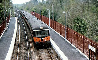
Merrion is a former railway station in Dublin. The disused station building lies to the immediate south of Merrion Gates on the DART line. The station originally opened in early 1835, shortly after the completion of the Dublin and Kingstown Railway line. It closed in 1935.
References
- ↑ "Float station" (PDF). Railscot - Irish Railways. Retrieved 11 July 2011.
- ↑ "Eiretrains". Photo gallery. Retrieved 11 July 2011.
http://eiretrains.com/Photo_Gallery/Railway%20Stations%20F/Float/IrishRailwayStations.html Ordnance Survey of Ireland 1: 50,000 Discovery Series map no. 41 shows the station locale.
This Ireland railway station-related article is a stub. You can help Wikipedia by expanding it. |