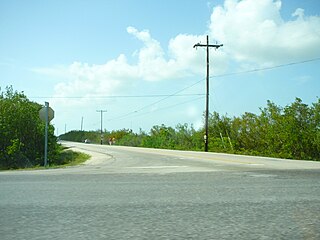
Little Torch Key is an island in the lower Florida Keys. It is a small, quiet Key with easy access to Key West. For divers, the incredible corals of Looe Key National Marine Sanctuary are only a few miles away. The exclusive resort, Little Palm Island, is located just offshore of Little Torch Key. U.S. Route 1, crosses the key at approximately mile markers 28—29. It is immediately preceded to the northeast by Big Pine Key, and is followed by Middle Torch Key to the southwest.
Middle Torch Key is an island in the lower Florida Keys.

Looe Key is a coral reef located within the Florida Keys National Marine Sanctuary. It lies to the south of Big Pine Key. This reef is within a Sanctuary Preservation Area (SPA). Part of Looe Key is designated as "Research Only," an area which protects some of the patch reefs landward of the main reef.
Eastern Dry Rocks is a coral reef located within the Florida Keys National Marine Sanctuary. It lies to the southwest of Key West, within the Key West National Wildlife Refuge. This reef is within a Sanctuary Preservation Area (SPA).
Carysfort is a coral reef located within the Florida Keys National Marine Sanctuary. It lies to the east of Key Largo, within the Key Largo Existing Management Area, which is immediately to the east of John Pennekamp Coral Reef State Park. This reef is within a Sanctuary Preservation Area (SPA). The reef is northeast of The Elbow.

The Elbow is a coral reef located within the Florida Keys National Marine Sanctuary. It lies to the east of Key Largo, within the Key Largo Existing Management Area, which is immediately to the east of John Pennekamp Coral Reef State Park. This reef is within a Sanctuary Preservation Area (SPA). The Elbow is southwest Carysfort and east of Dry Rocks reefs.
Grecian Rocks is a coral reef located within the Florida Keys National Marine Sanctuary. It lies to the east of Key Largo, within the Key Largo Existing Management Area, which is immediately to the east of John Pennekamp Coral Reef State Park. This reef is within a Sanctuary Preservation Area (SPA).
Hen and Chickens is a shallow coral reef located within the Florida Keys National Marine Sanctuary. It lies to the southeast of Plantation Key. This reef lies within a Sanctuary Preservation Area (SPA).
Cheeca Rocks is a shallow coral reef located within the Florida Keys National Marine Sanctuary. It lies approximately one mile to the southeast of Upper Matecumbe Key. This reef lies within a Sanctuary Preservation Area (SPA).
Alligator Reef is a coral reef located within the Florida Keys National Marine Sanctuary. It lies to the southeast of Upper Matecumbe Key. This reef lies within a Sanctuary Preservation Area (SPA).
Coffins Patch is a shallow coral reef located within the Florida Keys National Marine Sanctuary. It lies to the southeast of Bamboo Key. This reef lies within a Sanctuary Preservation Area (SPA).
Sombrero Key is a coral reef in the Florida Reef. It lies to the south of Vaca Key.
Newfound Harbor Key is a shallow coral reef located within the Florida Keys National Marine Sanctuary. It lies to the south of Big Pine Key, and north of Looe Key. This reef is within a Sanctuary Preservation Area (SPA).
Eastern Sambo is a coral reef located within the Florida Keys National Marine Sanctuary. It lies to the south of Boca Chica Key. It is designated "Research Only".
Western Sambo is a coral reef located within the Florida Keys National Marine Sanctuary. It lies to the south of Boca Chica Key, within Western Sambos Ecological Reserve. The reef itself lies along the southern edge of the reserve boundary.
Rock Key is a coral reef located within the Florida Keys National Marine Sanctuary. It lies to the southwest of Key West, within the Key West National Wildlife Refuge. This reef is within a Sanctuary Preservation Area (SPA).
Sand Key is a coral reef located within the Florida Keys National Marine Sanctuary. It lies to the southwest of Key West, within the Key West National Wildlife Refuge. This reef is within a Sanctuary Preservation Area (SPA).
9-foot Stake is a coral reef located within the Florida Keys National Marine Sanctuary. It lies to the south of Key West, and is west of Marker 32 reef. Unlike many reefs in the Sanctuary, it is not within a Sanctuary Preservation Area (SPA).
Marker 32 is a coral reef located within the Florida Keys National Marine Sanctuary. It lies to the south of Key West, and is between Western Sambo reef and 9-Foot Stake reef. Unlike many reefs in the Sanctuary, it is not within a Sanctuary Preservation Area (SPA).
Ajax Reef is a coral reef located within the Florida Keys National Marine Sanctuary and also within Biscayne National Park. Unlike many reefs within the National Marine Sanctuary, this reef is not within a Sanctuary Preservation Area (SPA). It is north of Pacific Reef.


