
The Everglades is a natural region of flooded grasslands in the southern portion of the U.S. state of Florida, comprising the southern half of a large drainage basin within the Neotropical realm. The system begins near Orlando with the Kissimmee River, which discharges into the vast but shallow Lake Okeechobee. Water leaving the lake in the wet season forms a slow-moving river 60 miles (97 km) wide and over 100 miles (160 km) long, flowing southward across a limestone shelf to Florida Bay at the southern end of the state. The Everglades experiences a wide range of weather patterns, from frequent flooding in the wet season to drought in the dry season. Throughout the 20th century, the Everglades suffered significant loss of habitat and environmental degradation.

Everglades National Park is a national park of the United States that protects the southern twenty percent of the original Everglades in Florida. The park is the largest tropical wilderness in the United States and the largest wilderness of any kind east of the Mississippi River. An average of one million people visit the park each year. Everglades is the third-largest national park in the contiguous United States after Death Valley and Yellowstone. UNESCO declared the Everglades & Dry Tortugas Biosphere Reserve in 1976 and listed the park as a World Heritage Site in 1979, and the Ramsar Convention included the park on its list of Wetlands of International Importance in 1987. Everglades is one of only three locations in the world to appear on all three lists.

Lake Okeechobee is the largest freshwater lake in the U.S. state of Florida. It is the eighth-largest natural freshwater lake among the 50 states of the United States and the second-largest natural freshwater lake contained entirely within the contiguous 48 states, after Lake Michigan.

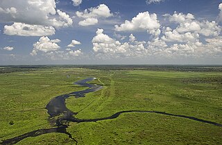
The Kissimmee River is a river in south-central Florida, United States that forms the north part of the Everglades wetlands area. The river begins at East Lake Tohopekaliga south of Orlando, flowing south through Lake Kissimmee into the large, shallow Lake Okeechobee. Hurricane-related floods in 1947 prompted channelization of the meandering lower stretch, completed by 1970. The straightened course reduced wetland habitat and worsened pollution. In response, efforts since the 1990s have partially restored the river's original state and revitalized the ecosystem, as part of the broader restoration of the Everglades.

The Arthur R. Marshall Loxahatchee National Wildlife Refuge is a 145,188-acre (587.55 km2) wildlife sanctuary is located west of Boynton Beach, in Palm Beach County, Florida. It is also known as Water Conservation Area 1 (WCA-1). It includes the most northern remnant of the historic Everglades wetland ecosystem.
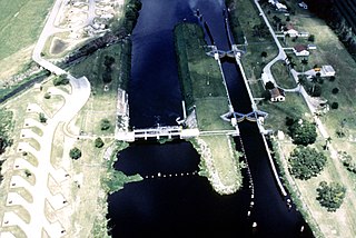
The Okeechobee Waterway or Okeechobee Canal is a relatively shallow artificial waterway in the United States, stretching across Florida from Fort Myers on the west coast to Stuart on Florida's east coast. The waterway can support tows such as barges or private vessels up to 50 feet wide x 250 feet long which draw less than 10 feet, as parts of the system, especially the locks may have low water depths of just ten feet. The system of channels runs through Lake Okeechobee and consists of the Caloosahatchee River to the west of the lake and the St. Lucie Canal east of the lake.

The Hillsboro Canal is located in the southeastern portion of Florida within the South Florida Water Management District, and for much of its length forms the border between Broward and Palm Beach counties; however, its western end was entirely in Palm Beach County, until being recently annexed to Parkland in Broward County. It begins at Lake Okeechobee at the S-2 water control structure in South Bay west of Belle Glade, Florida.

The Herbert Hoover Dike is a dike around the waters of Lake Okeechobee in Florida.

The St. Lucie River is a 35-mile-long (56 km) estuary linked to a coastal river system in St. Lucie and Martin counties in the U.S. state of Florida. The St. Lucie River and St. Lucie Estuary are an "ecological jewel" of the Treasure Coast, central to the health and well-being of the surrounding communities. The river is part of the larger Indian River Lagoon system, the most diverse estuarine environment in North America with more than 4,000 plant and animal species, including manatees, oysters, dolphins, sea turtles and seahorses.
The Comprehensive Everglades Restoration Plan (CERP) is the plan enacted by the U.S. Congress for the restoration of the Everglades ecosystem in southern Florida.

The environment of Florida in the United States yields an array of land and marine life in a mild subtropical climate. This environment has drawn millions of people to settle in the once rural state over the last hundred years. Florida's population increases by about 1,000 residents each day. Land development and water use have transformed the state, primarily through drainage and infill of the wetlands that once covered most of the peninsula.

Before drainage, the Everglades, a region of tropical wetlands in southern Florida, were an interwoven mesh of marshes and prairies covering 4,000 square miles (10,000 km2). The Everglades is both a vast watershed that has historically extended from Lake Okeechobee 100 miles (160 km) south to Florida Bay, and many interconnected ecosystems within a geographic boundary. It is such a unique meeting of water, land, and climate that the use of either singular or plural to refer to the Everglades is appropriate. When Marjory Stoneman Douglas wrote her definitive description of the region in 1947, she used the metaphor "River of Grass" to explain the blending of water and plant life.

A national push for expansion and progress toward the latter part of the 19th century stimulated interest in draining the Everglades, a region of tropical wetlands in southern Florida, for agricultural use. According to historians, "From the middle of the nineteenth century to the middle of the twentieth century, the United States went through a period in which wetland removal was not questioned. Indeed, it was considered the proper thing to do."

An ongoing effort to remedy damage inflicted during the 20th century on the Everglades, a region of tropical wetlands in southern Florida, is the most expensive and comprehensive environmental repair attempt in history. The degradation of the Everglades became an issue in the United States in the early 1970s after a proposal to construct an airport in the Big Cypress Swamp. Studies indicated the airport would have destroyed the ecosystem in South Florida and Everglades National Park. After decades of destructive practices, both state and federal agencies are looking for ways to balance the needs of the natural environment in South Florida with urban and agricultural centers that have recently and rapidly grown in and near the Everglades.
Fisheating Creek is a stream that flows into Lake Okeechobee in Florida. It is the only remaining free-flowing water course feeding into the lake, and the second-largest natural source for the lake. Most of the land surrounding the stream is either publicly owned or under conservation easements restricting development. The lower part of the stream remains in a largely natural state, and efforts are underway to restore the upper part of the stream to a more natural state.

The Everglades Agricultural Area Environmental Protection District, better known as simply the Everglades Agricultural Area (EAA), is an area extending south from Lake Okeechobee to the northern levee of Water Conservation Area 3A, from its eastern boundary at the L-8 canal to the western boundary along the L-1, L-2, and L-3 levees. The EAA incorporates almost 3,000 square kilometers of highly productive agricultural land. The EAA was established by the State Legislature as a special district representing landowners within the EAA Basin for the purposes of ensuring environmental protection. Means include conducting scientific research on environmental matters related to air and water and land management practices and implementing the financing, construction, and operation of works and facilities designed to prevent, control, abate or correct environmental problems and improve the environmental quality of air and water resources.
The Central and Southern Florida Project is a regional water management system, operated and maintained by the South Florida Water Management District in South Florida, the Everglades, and Lake Okeechobee to protect residents and businesses from floods and droughts. The Central and Southern Florida Project is also the title of the corresponding law, passed by the U.S. Congress in 1948.

The Everglades Headwaters National Wildlife Refuge and Conservation Area, created in 2012, is the newest addition and 556th unit of the United States National Wildlife Refuge (NWR) System. It began with 10 acres (4.0 ha) donated to the conservation effort as part of the Obama administration's America's Great Outdoors Initiative.