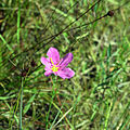
Kissimmee Prairie Preserve State Park

Last updated

Kissimmee Prairie Preserve State Park
IUCN category V (protected landscape/seascape)
USA Florida location map.svg
Red pog.svg
Usa edcp location map.svg
Red pog.svg
Location Okeechobee County, Florida, USA
Nearest city Okeechobee, Florida
Coordinates 27°35′35″N81°04′10″W / 27.59306°N 81.06944°W / 27.59306; -81.06944
Governing body Florida Department of Environmental Protection
Website Official website

Kissimmee Prairie Preserve State Park is a Florida state park, located approximately 25 miles north of Okeechobee, off US 441. [1] [2]

Contents

Related Research Articles

<span class="mw-page-title-main">Everglades National Park</span> National park in Florida (US)

Everglades National Park is an American national park that protects the southern twenty percent of the original Everglades in Florida. The park is the largest tropical wilderness in the United States and the largest wilderness of any kind east of the Mississippi River. An average of one million people visit the park each year. Everglades is the third-largest national park in the contiguous United States after Death Valley and Yellowstone. UNESCO declared the Everglades & Dry Tortugas Biosphere Reserve in 1976 and listed the park as a World Heritage Site in 1979, and the Ramsar Convention included the park on its list of Wetlands of International Importance in 1987. Everglades is one of only three locations in the world to appear on all three lists.

<span class="mw-page-title-main">Myakka River State Park</span> State park in Florida, United States

Myakka River State Park is a Florida State Park, that is located nine miles (14 km) east of Interstate 75 in Sarasota County and a portion of southeastern Manatee County on the Atlantic coastal plain. This state park consists of 37,000 acres (150 km2), making it one of the state's largest parks. It is also one of the oldest parks in the state. It was delineated in the 1930s by the Civilian Conservation Corps. A small portion of the park was the gift of the family of Bertha Palmer to the state. The park is named after the Myakka River.

<span class="mw-page-title-main">Paynes Prairie Preserve State Park</span> Protected ecological system in Florida

Paynes Prairie Preserve State Park is a Florida State Park, encompassing a 21,000-acre (85 km2) savanna in Alachua County, Florida lying between Micanopy and Gainesville. It is also a U.S. National Natural Landmark. It is crossed by both I-75 and U.S. 441. It is in the center of the Paynes Prairie Basin. The basin's primary source of drainage is Alachua Sink. During occasional wet periods, the basin will become full. A notable period occurred from 1871 to 1891 when the Alachua Sink was temporarily blocked. During this period, shallow draft steamboats were a frequent sight on Alachua Lake in the center of the prairie. The region was also historically known as the Alachua Savannah. Its drainage has been modified by several canals. Since 1927, Camps Canal has linked the basin to the River Styx which leads to Orange Lake and eventually the Atlantic Ocean through the St. Johns River. That reduced the basins water intake by half. Additional changes to the prairie's environment have been detrimental to its hydrology. In 1970, the state of Florida acquired the land and has been in the process of restoring the environment to a more natural condition ever since.

<span class="mw-page-title-main">Timucuan Ecological and Historic Preserve</span> Wetlands in Florida (US) managed by the National Park Service

The Timucuan Ecological and Historic Preserve is a U.S. National Preserve in Jacksonville, Florida. It comprises 46,000 acres (19,000 ha) of wetlands, waterways, and other habitats in northeastern Duval County. Managed by the National Park Service in cooperation with the City of Jacksonville and Florida State Parks, it includes natural and historic areas such as the Fort Caroline National Memorial and the Kingsley Plantation.

<span class="mw-page-title-main">Fort Pierce Inlet State Park</span> State park in Florida, United States

Fort Pierce Inlet State Park, a 340-acre (1.4 km2) part of the Florida State Park system, is located just north of the Fort Pierce Inlet, on North Hutchinson Island, near Fort Pierce. It consists of beaches, dunes and a coastal hammock between the Atlantic Ocean and the waters of Tucker Cove, an indentation of the Indian River Lagoon.

<span class="mw-page-title-main">Gainesville-Hawthorne State Trail</span> Rail trail in Florida

Gainesville-Hawthorne State Trail is a paved rail trail in Florida.

<span class="mw-page-title-main">Lake Kissimmee State Park</span> State park in Florida, United States

Lake Kissimmee State Park is a 5,930-acre (24 km2) Florida State Park located north of State Road 60, 15 miles (24 km) east of Lake Wales. It contains floodplain, forest, prairie, hammock, flatwoods and Lakes Kissimmee, Tiger, and Rosalie. The park is home to 50 species of plants and animals that are either threatened, of special concern or endangered.

<span class="mw-page-title-main">Rainbow Springs State Park</span> State park in Florida, United States

Rainbow Springs State Park is a Florida state park located on U.S. 41, 3 miles (5 km) north of Dunnellon, Florida. It comprises 1,459.07 acres (5.9046 km2) upland and 12.83 acres (51,900 m2) submerged. The most significant natural feature is the first-magnitude headspring basin, which produces up to 600,000,000 US gallons (2,300,000 m3) of fresh water per day, forming the Rainbow River. The looking-glass waters of Rainbow Springs come from several vents, not one large bubbling spring. The river itself supports a wide variety of fish, wildlife, and plants, many within easy viewing by visitors. In total, the park contains 11 distinct natural communities, including sandhills, flatwoods, upland mixed forests, and hydric hammocks.

<span class="mw-page-title-main">San Felasco Hammock Preserve State Park</span> State park in Florida, United States

San Felasco Hammock Preserve State Park is a Florida State Park in Alachua County, Florida. It is located northwest of Gainesville, Florida on CR 232, just south of the town of Alachua.

<span class="mw-page-title-main">Florida Trail</span> A US National Scenic trail

The Florida Trail is one of eleven National Scenic Trails in the United States. It currently runs 1,500 miles (2,400 km), from Big Cypress National Preserve to Fort Pickens at Gulf Islands National Seashore, Pensacola Beach. Also known as the Florida National Scenic Trail, the Florida Trail provides permanent non-motorized recreation opportunity for hiking and other compatible activities and is within an hour of most Floridians. The Florida National Scenic Trail is designated as a National Scenic Trail by the National Trails System Act of 1968.

The South Florida Water Management District (SFWMD) is a regional governmental district that oversees water resources from Orlando to the Florida Keys. The mission of the SFWMD is to manage and protect water resources by balancing and improving water quality, flood control, natural systems and water supply, covering 16 counties in Central and Southern Florida. It is the largest water management district in the state, managing water needs for 7.7 million residents. A key initiative is the restoration of America's Everglades – the largest environmental restoration project in the nation's history. The District is also working to improve the Kissimmee River and its floodplain, Lake Okeechobee and South Florida's coastal estuaries.

Hal Scott Regional Preserve and Park is a 9,515-acre (38.51 km2) nature preserve located along the banks of the Econlockhatchee River in east Orange County, Florida, United States. The Preserve is bordered by the Econlockhatchee on the West and Wedgefield, Florida on the East. It is managed by the St. Johns River Water Management District and Orange County Parks and Recreation. Recreational amenities include camping, hiking, horseback riding, mountain biking, fishing, and wildlife viewing.

<span class="mw-page-title-main">Fort Kissimmee Cemetery</span> Cemetery in Florida

Fort Kissimmee Cemetery is one of the oldest Florida Heartland pioneer cemeteries located on the eastern boundary of the Avon Park Bombing Range in Highlands County, Florida along the Kissimmee River. The cemetery is approximately 20 miles (32 km) east of Avon Park, Florida.

Deer Prairie Creek Preserve is a 6,439-acre (26.06 km2) natural area with 70 miles (110 km) of trail in unincorporated Sarasota County, Florida, USA, around six miles (9.7 km) along the Myakka River.

T. Mabry Carlton, Jr. Memorial Reserve, also known as the Carlton Reserve, is a 24,565-acre (9,941 ha) preserve in Sarasota County, Florida. The reserve has 100 miles (160 km) of hiking, equestrian and biking trails.

<span class="mw-page-title-main">Nature Coast State Trail</span>

The Nature Coast State Trail (NCST) is a 31.7-mile long segment of Florida's Statewide System of Greenways and Trails System built along abandoned railroad tracks, and designated by the U.S. Department of the Interior as a National Recreation Trail. It has two primary sections following unused rail lines that were originally built by the Atlantic Coast Line Railroad. It includes historic sites such as a 1902 train trestle bridge over the Suwannee River near Old Town and train stations in Trenton, Cross City, and Chiefland. At Wilcox Junction abandoned rail tracks cross and connect with several communities. The trail is available to hikers, cyclists, and horse riders.

DeLuca Preserve is a 27,000 acres (11,000 ha) protected area in Florida. It was donated by the DeLuca family in 2020. Ducks Unlimited holds the property's conservation easement.

References

  1. "Kissimmee Prairie Preserve: A stargazer's paradise in Central Florida". Orlando Sentinel. Retrieved April 20, 2023.
  2. Shi, Pulin (April 25, 2014). Valuing the Economic Benefits of Florida's Conservation Lands (Thesis). Duke University.

Commons-logo.svg Media related to Kissimmee Prairie Preserve State Park at Wikimedia Commons