Flamingo is the southernmost headquarters of Everglades National Park, in Monroe County, Florida, United States. Flamingo is one of the two end points of the 99-mile (159-km) Wilderness Waterway, and the southern end of the only road through the park from Florida City. It began as a small coastal settlement on the eastern end of Cape Sable on the southern tip of the Florida peninsula, facing Florida Bay. The actual town of Flamingo was located approximately 4+1⁄2 miles west of the current Flamingo campground area. All that remains of the former town are a few remnants of building foundations, and it is considered a ghost town.

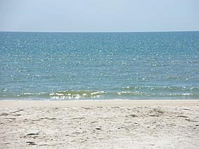
Sea Rim State Park is a 4,141-acre (1,676 ha) state park in southeast Texas. The park is located on the Gulf of Mexico in southern Jefferson County, south of Port Arthur and just west of Sabine Pass. The park was closed for several years due to extensive damage from Hurricanes Rita (2005) and Ike (2008). The park has recently re-opened but currently has limited resources.

St. Andrews State Park is a 1,200-acre (4.9 km2) Florida State Park located three miles (5 km) east of Panama City Beach Florida, off U.S. 98. It is the headquarters of one of the state's five AmeriCorps Florida State Parks chapters.

St. George Island is an island and Census-designated place (CDP) off the Florida Panhandle in the northern Gulf of Mexico. It is in Franklin County, Florida, United States.

Assateague Island National Seashore is a unit of the National Park Service system of the U.S. Department of the Interior. Located on the East Coast along the Atlantic Ocean in Maryland and Virginia, Assateague Island is the largest natural barrier island ecosystem in the Middle Atlantic states region that remains predominantly unaffected by human development. Located within a three-hour drive to the east and south of Richmond, Washington, Baltimore, Wilmington, Philadelphia major metropolitan areas plus north of the several clustered smaller cities around Hampton Roads harbor of Virginia with Newport News, Hampton, Norfolk, Portsmouth, Chesapeake and Virginia Beach. The National Seashore offers a setting in which to experience a dynamic barrier island and to pursue a multitude of recreational opportunities. The stated mission of the park is to preserve and protect “unique coastal resources and the natural ecosystem conditions and processes upon which they depend, provide high-quality resource-based recreational opportunities compatible with resource protection and educate the public as to the values and significance of the area”.

Disney's Fort Wilderness Resort & Campground is a themed camping resort located in the Magic Kingdom Resort Area at the Walt Disney World Resort. It officially opened on November 19, 1971. The resort is adjacent to Bay Lake and the upcoming Reflections Vacation Club Resort. The resort is also located near Disney's Wilderness Lodge. It also formerly contained Disney's River Country, a water park which closed on November 2, 2001.

Osceola National Forest is a National Forest located in northeast Florida.

Bill Baggs Cape Florida State Recreation Area occupies approximately the southern third of the island of Key Biscayne, at coordinates 25°40′25″N80°09′34″W. This park includes the Cape Florida Light, the oldest standing structure in Greater Miami. In 2005, it was ranked as having the 8th best beach in the country, and in 2013 Forbes ranked it at 7th.

Anastasia State Park is a 1,600-acre (6.5 km2) state park in Florida, United States. Its location is on a peninsula on Anastasia Island across Matanzas Bay from downtown St. Augustine along the Atlantic coastal plain. This park has a variety of wildlife, birds and plants in a setting of beaches, tidal salt marsh, and marine and upland hammock.

Cayo Costa State Park is a state park in the U.S. state of Florida, on Cayo Costa, an island directly south of Boca Grande and just north of North Captiva Island, approximately 12 miles (19 km) west of Cape Coral. The park is accessible only by charter boat, private boat, ferry or helicopter.

Collier–Seminole State Park is a Florida State Park located on US 41, 17 miles (27 km) south of Naples, Florida. The park is the home of a National Historic Mechanical Engineering Landmark, the Bay City Walking Dredge used to build the Tamiami Trail through the Everglades. The park includes of 6,430 acres (26 km2) of mangrove swamp, cypress swamps, salt marshes, mangrove river estuaries, and pine flatwoods. Among the wildlife of the park are American alligators, raccoons, ospreys, and American white ibis. brown pelicans, wood storks, bald eagles, red-cockaded woodpeckers, American crocodiles, Florida black bears and Big Cypress fox squirrels also inhabit the park.
Lake Kissimmee State Park is a 5,930-acre (24 km2) Florida State Park located north of State Road 60, 15 miles (24 km) east of Lake Wales. It contains floodplain, forest, prairie, hammock, flatwoods and Lakes Kissimmee, Tiger, and Rosalie. The park is home to 50 species of plants and animals that are either threatened, of special concern or endangered.

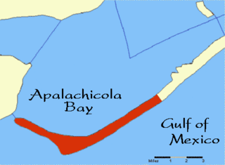
Cape St. George Island is an uninhabited barrier island situated on Florida's North Gulf Coast, south-southeast of St. Vincent Island, west of St. George Island and 8–10 miles south-southwest of the town of Apalachicola in Franklin County, Florida. It was formerly part of St. George Island, but was separated from the main island in 1954, when the U.S. Army Corps of Engineers constructed the ship channel known as Bob Sikes Cut.

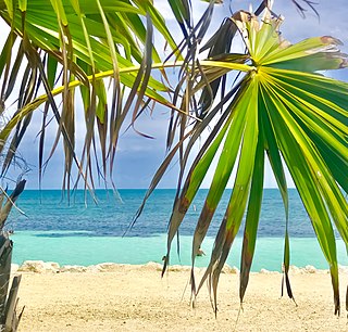
Bahia Honda is an island in the lower Florida Keys.

Peninsula State Park is a 3,776-acre (1,528 ha) Wisconsin state park with eight miles (13 km) of Green Bay shoreline in Door County. Peninsula is the third largest state park in Wisconsin and is visited by an estimated one million visitors annually.

The Tiger Bay State Forest is in the U.S. state of Florida. The 27,330-acre (11,060 ha) forest is located in Volusia County, Florida, between Daytona Beach and DeLand.

Colt Creek State Park is a Florida State Park in Central Florida, 16 miles (26 km) north of Lakeland off of State Road 471. This 5,067 acre park nestled within the Green Swamp Wilderness Area and named after one of the tributaries that flows through the property was opened to the public on January 20, 2007. Composed mainly of pine flatwoods, cypress domes and open pasture land, this piece of pristine wilderness is home to many animal species including the American bald eagle, Southern fox squirrel, gopher tortoise, white-tailed deer, wild turkey and bobcat.

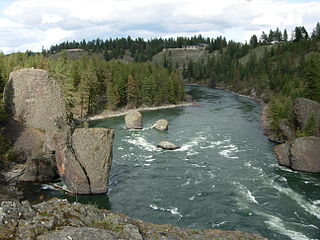
Riverside State Park is a Washington state park located 9 miles (14 km) northwest of Spokane in the community of Nine Mile Falls. The park protects 11,162 acres (4,517 ha) of Okanagan dry forest along the Spokane and Little Spokane rivers. It is the second largest state park in Washington after Mount Spokane State Park and is a popular recreation area for locals.

Lac La Ronge Provincial Park is located in the boreal forest of the north central part of the Canadian province of Saskatchewan within the Canadian Shield. Situated in the Churchill River system, this provincial park has close to 100 lakes and more than 30 canoe routes, many of which follow old fur trade routes. Summer activities include camping, hiking, boating, fishing, and swimming. In the winter, there's cross-country skiing, snowmobiling, and ice fishing. Saskatchewan's highest waterfall is in the park. Nistowiak Falls are located north of Lac La Ronge along the Rapid River.
Greenwater Lake Provincial Park is a provincial park in the Canadian province of Saskatchewan. It is located on the eastern side of the province in the Porcupine Hills on Highway 38. The closest town, Porcupine Plain, is about 28 kilometres to the north-east of the park visitor centre. Founded on 19 February 1932, Greenwater is one of the oldest provincial parks in Saskatchewan. The original six parks were established in 1931 and Greenwater Provincial Park was added one year later. In 1964, the park was expanded to its current size.


