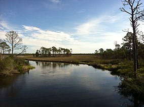
Franklin County is a county along the Gulf of Mexico in the panhandle of the U.S. state of Florida. As of the 2020 census, the population was 12,451, making it the third-least populous county in Florida. The county seat is Apalachicola. The county includes several large preserved areas and rivers and has been home to commercial timber and fishing industry. More recently it has become popular for tourism and retirement. It includes several rivers, state parks, and islands.

Pinellas County is located on the west central coast of the U.S. state of Florida. As of the 2020 census, the population was 959,107, making it the seventh-most populous county in the state. It is also the most densely populated county in Florida, with 3,491 residents per square mile. The county is part of the Tampa–St. Petersburg–Clearwater Metropolitan Statistical Area. Clearwater is the county seat. St. Petersburg is the largest city in the county, as well as the largest city in Florida that is not a county seat.

Indian Harbour Beach is a coastal city in Brevard County, Florida, United States. It is part of the Palm Bay–Melbourne–Titusville, Florida Metropolitan Statistical Area. The population was 9,019 at the 2020 census, up from 8,225 at the 2010 census.

Carrabelle is a city in Franklin County along Florida's Panhandle, United States. It is located east of Apalachicola at the mouth of the Carrabelle River on the Gulf of Mexico. The population was 2,606 as of the 2020 census.

Bonita Springs is a city in Lee County, Florida, United States. The population was 53,644 at the 2020 census, up from 43,914 at the 2010 census. It is part of the Cape Coral-Fort Myers, Florida Metropolitan Statistical Area, on the state's southwest coast.
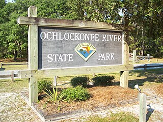
Ochlockonee River State Park is a Florida State Park located in Wakulla County, Florida, south of the town of Sopchoppy in the Florida Panhandle. Located off of U.S. 319 on the Ochlockonee River, just north of the Gulf of Mexico coast, it is surrounded by the Apalachicola National Forest and the St. Marks National Wildlife Refuge and provides important habitat for the endangered red-cockaded woodpecker.

St. George Island is an island and Census-designated place (CDP) off the Florida Panhandle in the northern Gulf of Mexico. It is in Franklin County, Florida, United States. As of the 2020 census, the population was 990.

Tate's Hell State Forest is 202,000 acres (819 km2) of land in Franklin and Liberty counties in Florida. The forest is located near Carrabelle off US 98 along the Gulf coast and on St. James Island. At one time, Tate's Hell supported at least 12 major habitats including: wet flatwoods, wet prairie, seepage slope, baygall, floodplain forest, floodplain swamp, basin swamp, upland hardwood forest, sandhill, pine ridges, dense titi swamp thickets and scrub. Tate's Hell State Forest is an important hydrologic area and includes a section of the New River. The park's watershed provides fresh water into the Apalachicola Bay, the Carrabelle River and the Ochlockonee River.
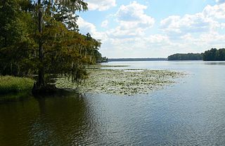
Lake Talquin is a reservoir located on the Ochlockonee River between Leon County and Gadsden County in north Florida. The lake, located about 10 miles (15 km) west of Tallahassee, is south of Interstate 10 and bordered by State Road 20 on the east and State Road 267 on the west.
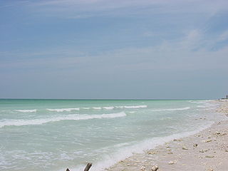
Honeymoon Island State Park is a Florida State Park located on Honeymoon Island, a barrier island across St. Joseph Sound from Dunedin, Palm Harbor, Ozona, and Crystal Beach. The park is 385 acres (1.6 km2) in land area with 2,400 acres (10 km2) submerged and 4 miles (6 km) of beach. It lies at the western end of Causeway Boulevard, which becomes Curlew Road east of Alternate US 19. Its address is 1 Causeway Blvd. Consistently receiving more than one million visitors each year, it is the most-visited state park in Florida.
Apalachee Bay is a bay in the northeastern Gulf of Mexico occupying an indentation of the Florida coast to the west of where the Florida peninsula joins the United States mainland. It is bordered by Taylor, Jefferson, Wakulla, and Franklin counties.
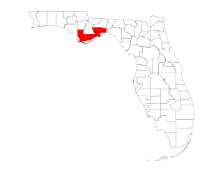
The Forgotten Coast refers to a largely undeveloped and sparsely populated coastline in the panhandle of the US state of Florida. The trademarked term was first used in 1992, but the Forgotten Coast's exact extent is not agreed upon.
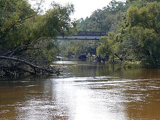
The Ochlockonee River is a fast running river, except where it has been dammed to form Lake Talquin in Florida, originating in Georgia and flowing for 206 miles (332 km) before terminating in Florida.

Alligator Point is an unincorporated community on St. James Island in Franklin County, Florida, United States. It is located along U.S. 98, south of Bald Point State Park, along the Gulf of Mexico. Alligator Point is a small beach community made up of mostly beach homes and the Alligator Point Yacht Basin. Located on Florida's "Forgotten Coast", nearby attractions include Bald Point State Park and the St. Marks Wildlife Refuge. Alligator Harbor is known for its clam harvesting and was featured on Discovery Channel's "Dirty Jobs."

The Tiger Bay State Forest is in the U.S. state of Florida. The 27,330-acre (11,060 ha) forest is located in Volusia County, Florida, between Daytona Beach and DeLand.
The St. Joe Company is a land development company headquartered in Panama City Beach, Florida. Founded in 1936 and until 1966 known as St. Joe Paper Company, the company still operates a forestry division but is primarily engaged in real estate development and asset management. The company's land holdings are concentrated in Northwest Florida with the vast majority located in Bay and Walton counties. Of the 110,500 acres The St. Joe Company owns that fall within the Bay-Walton Sector Plan, 53,000 acres were placed into conservation by the company. The company develops its land for a variety of uses including residential neighborhoods, hotels, apartment communities, leasable commercial space, office buildings and medical facilities among others.
The following is an alphabetical list of articles related to the U.S. state of Florida.

Crooked River is a waterway in Franklin County, Florida, that connects the tidal estuary of the Ochlockonee River to a junction with the tidal Carrabelle River and the New River above the town of Carrabelle, Florida. The Crooked River channel is 41 kilometres (25 mi) long, while its ends are 24 kilometres (15 mi) apart.

St. James Island is an inhabited area along the Florida Panhandle surrounded by the Carrabelle River, Crooked River, Ochlockonee River, and St. George Sound in Franklin County, Florida. It is more than 20 miles (32 km) long and averages 4 miles (6.4 km) wide. It is separated from the mainland by the tidal Crooked River. The highest elevation on St. James Island is 70 feet (21 m) above sea level, the highest on the Gulf coast of Florida between Pensacola and Tampa.
Galop Island is an uninhabited island in the Saint Lawrence River located in St. Lawrence County, northeast of Ogdensburg, New York. The 675-acre (2.73 km2) island is owned by the New York Power Authority and managed by the New York State Office of Parks, Recreation and Historic Preservation as the undeveloped Galop Island State Park.
