
St. Andrews State Park is a 1,200-acre (4.9 km2) Florida State Park located three miles (5 km) east of Panama City Beach Florida, off U.S. 98. It is the headquarters of one of the state's five AmeriCorps Florida State Parks chapters.

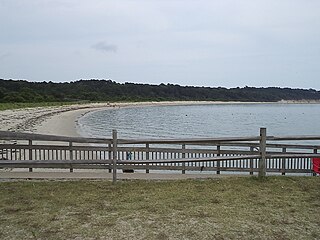
St. George Island State Park is a Florida State Park located on the east end of St. George Island, approximately 10 miles southeast of Eastpoint, in northwestern Florida.

Gandy Bridge is the southernmost bridge spanning Old Tampa Bay from St. Petersburg, Florida to Tampa, Florida. The original 1924 span was dismantled in 1975. The second bridge, constructed in 1956 was used for vehicular traffic until 1997, when it was converted to recreational use by non-motorized traffic. It became known as the Friendship Trail Bridge and was demolished in 2016, after closing in 2008 due to hazardous conditions and several failed efforts to preserve the span. The third (1975) and fourth (1997) spans of the Gandy Bridge are currently being used for vehicle traffic.

Skyway Fishing Pier State Park is a Florida State Park located on the north and south sides of the mouth of Tampa Bay. When the original cantilevered Sunshine Skyway Bridge, carrying I-275, partially collapsed in 1980, due to the collision of a freighter on one of its pilings, it was replaced by the current bridges. The approaches to the old bridge, however, were left in place and converted into the longest fishing pier in the world.
Lake Louisa State Park is a 4,372-acre (17.69 km2) Florida State Park located south of Clermont, in the northeast corner of the Green Swamp and the southwestern shore of Lake Louisa. It is made up of bald cypress, live oak, and saw palmettos. In addition to Lake Louisa, the park contains Hammond Lake, Dixie Lake, Dude Lake, and Bear Lake, along with several smaller lakes.

The Rickenbacker Causeway is a causeway that connects Miami, Florida to the barrier islands of Virginia Key and Key Biscayne across Biscayne Bay.

Miller/Knox Regional Shoreline is a 295-acre (1.19 km2) bayside park near the Brickyard Cove neighborhood of the Point Richmond District in Richmond, California.

The Pensacola Bay Bridge, also known locally as the Three-Mile Bridge, runs between downtown Pensacola, Florida, and Gulf Breeze, Florida. It carries six lanes of U.S. Highway 98 across Pensacola Bay.

The Merrill P. Barber Bridge is a concrete arch bridge that spans the Indian River Intracoastal Waterway in Indian River County, Florida. The bridge was completed in 1995. A fishing pier is constructed below the bridge on the east side.

The Sebastian Inlet Bridge is a high concrete bridge. It spans the Indian River outlet which is also referred to as the Sebastian Inlet. It carries State Road A1A between Indian River County and Brevard County.
The following is an alphabetical list of articles related to the U.S. state of Florida.
Kiptopeke State Park is a state park located in the southern end of the Eastern Shore of Virginia and the Delmarva Peninsula in Northampton County, near Cape Charles. The park offers recreational access to the brackish waters of the Chesapeake Bay with its shoreline, beach, boat ramps and piers, as well as unique migratory bird habitat along the East Coast flyway. It is also known for the concrete ships sunk to protect the former ferry port from erosion during severe storms.

Bill Burton Fishing Pier State Park is a public recreation area on the Choptank River in Trappe, Maryland. The state park preserves portions of the former Choptank River Bridge as a pier, and includes 25 acres (10 ha) of land upriver from the pier in Talbot County.
North Florida is a region of the U.S. state of Florida comprising the northernmost part of the state. Along with South Florida and Central Florida, it is one of Florida's three most common "directional" regions. It includes Jacksonville and nearby localities in Northeast Florida, an interior region known as North Central Florida, and the Florida Panhandle. North Florida is considered to be part of the Southern United States, namely the Deep South, and contains the state capital of Tallahassee.
The Florida Keys Overseas Heritage Trail is a 106-mile (171 km) paved rail trail—a multi-use bicycle and pedestrian facility—being constructed between Key Largo and Key West in the Florida Keys. As of January 2022, 90 mi (140 km) of the trail has been constructed.
The Imperial River is a river in southwest Florida in the United States. It is fed by the Kehl Canal and marshland at 26°22′16″N81°41′23″W, just east of the city limits of Bonita Springs in unincorporated southwest Lee County. It is approximately 9.3 miles (15.0 km) long, from its headwaters just east of I-75 in the Flint Pen Strand, through downtown Bonita Springs and to its mouth at the north end of Fishtrap Bay, near the southern end of Estero Bay. It was originally named Surveyors Creek before the city was developed. The river is part of The Great Calusa Blueway.
S.S. Jolley Bridge is a bridge located in Collier County, Florida connecting Marco Island with the mainland in Naples. The bridge is a good location for fishing.

The Long Key Bridge, officially known as the Dante B. Fascell Bridge, is a bridge in the Florida Keys connecting Long Key and Conch Key, roughly halfway between Miami and Key West. At a length of nearly two and a half miles, it is the second longest bridge on the Overseas Highway after the Seven Mile Bridge. The current bridge opened in 1982, replacing the parallel Long Key Viaduct, which carried the Overseas Railroad from 1907 to 1935 and was repurposed for highway use shortly after.


