
State Road 15 is part of the Florida State Road System. This route is part of a multi two-state route 15 that begins at Florida and ends at Georgia at the North Carolina state line.
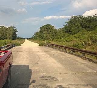
Picayune Strand State Forest is one of 37 state forests in Florida managed by the Florida Forest Service. The 78,000-acre forest consists primarily of cypress swamps, wet pine flatwoods and wet prairies. It also features a grid of closed roads over part of it, left over from its previous land development schemes.
Holopaw is an unincorporated community in Osceola County, Florida, United States. It is located at the eastern end of the multiplex of highways US 192 and US 441. It has a population of fewer than 5,000 people and is part of the Orlando-Kissimmee Metropolitan Statistical Area.
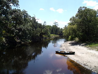
The Econlockhatchee River is an 87.7-kilometer-long (54.5 mi) north-flowing blackwater tributary of the St. Johns River. The Econ River flows through Osceola, Orange, and Seminole counties in Central Florida, just east of the Orlando Metropolitan Area. It is a designated Outstanding Florida Waters.

The Cary State Forest is in the U.S. state of Florida. The 13,385-acre (5,417 ha) forest is located in the northeast in Bryceville, Florida, a community between Baldwin and Callahan northwest of Jacksonville. It was established as the second State Forest of Florida, in 1937.

Etoniah Creek State Forest is in the U.S. state of Florida. The 8,679-acre (35 km2) forest is located in North Central Florida, west of Palatka near Florahome. This area is the only known site for Conradina etonia, an endangered plant.

The Jennings State Forest is in the U.S. state of Florida. The 25,301-acre (102 km2) forest is located in northeastern Florida, near Jacksonville. The forest is the home of rare plants such as the Bartram's Ixia and St. John's Susan.

The Matanzas State Forest is in the U.S. state of Florida. The 4,699-acre (19 km2) forest is located in northeastern Florida, near St. Augustine, though it is closer to Crescent Beach. Matanzas State Forest is bordered approximately by U.S. 1 to the west, State Road 206 to the north, the Matanzas River to the east, and the Faver-Dykes State Park to the south.

The Myakka State Forest is in the U.S. state of Florida. The 8,593-acre (35 km2) forest is located on the southwest coast, in North Port.

The Point Washington State Forest is in the U.S. state of Florida. The 15,131-acre (61 km2) forest is located in the panhandle, in southern Walton County. It was purchased under Florida's Conservation and Recreation Lands (CARL) program in 1992. The main road through the forest is U.S. Route 98, and it is also near the Topsail Hill Preserve, Grayton Beach and Deer Lake State Parks.

The Ralph E. Simmons Memorial State Forest is in the U.S. state of Florida. The 3,638-acre (15 km2) forest is located in northeastern Florida, near Hilliard. The forest was renamed in 1996 for Ralph E. Simmons, a former member of the St. Johns River Water Management District Governing Board.

The Seminole State Forest is in the U.S. state of Florida. The 25,812-acre (10,446 ha) forest is located in Central Florida, near Eustis. Access to the forest is available from Florida State Road 44, Lake County Road 46A and Florida State Road 46. Surrounding parks and preserved areas include Lower Wekiva River Preserve State Park, Rock Springs Run State Reserve, Lake Norris Conservation Area, and the Ocala National Forest. The Florida National Scenic Trail runs through the from southeast to northwest.

The Lake Wales Ridge State Forest is in the U.S. state of Florida. The 26,563-acre (107 km2) forest is located on the Lake Wales Ridge in Central Florida, within Polk County near Frostproof.

The Tiger Bay State Forest is in the U.S. state of Florida. The 27,330-acre (11,060 ha) forest is located in Volusia County, Florida, between Daytona Beach and DeLand.

The Withlacoochee State Forest is 157,479-acre (637 km2) in the western central part in the U.S. state of Florida, near Lecanto, Inverness, Floral City, Brooksville, Ridge Manor, and Dade City. The forest was named for the Withlacoochee River, which passes through some of the major tracts within.

The Twin Rivers State Forest is in the US state of Florida. The 14,882-acre (60 km2) forest is located in North Central Florida, along the banks of the Withlacoochee and Suwannee rivers.

The Wakulla State Forest is in the U.S. state of Florida. The 4,897-acre (20 km2) forest is located in the panhandle, near Tallahassee; it includes a major tract in Wakulla County and a small tract, the former Woodville State Forest, in Leon County. The forest is also a Wildlife Management Area managed by the Florida Fish and Wildlife Conservation Commission.
U.S. Route 441 (US 441) in Florida is a north–south United States Highway. It runs 433 miles (697 km) from Miami in South Florida northwest to the Georgia border north of the Lake City area.
Watson Island State Forest is located in St. Johns County, Florida. The state forest includes 199 acres of Bottomland Forest, 129 acres of Wet Flatwoods, 124 acres of Mesic Flatwoods, 26 acres of floodplain, 23 acres of Baygall forest, 2 acres of Floodplain Marsh, 2 acres of ruderal and 1 acre of dome swamp.

