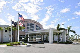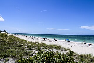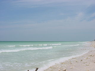
Charlotte County is a U.S. county located in the U.S. state of Florida. As of the 2020 census, the population was 186,847. Its county seat is Punta Gorda.

Lee County is located in Southwest Florida on the Gulf Coast. As of the 2020 census, the population was 760,822. The county seat is Fort Myers, and the largest city is Cape Coral with an estimated 2020 population of 194,000. Lee County comprises the Cape Coral–Fort Myers, FL Metropolitan Statistical Area.

Sarasota County is located in West-Central Florida on the Gulf Coast. At the 2020 US census, the population was 434,006. Its county seat is Sarasota and its largest city is North Port. Sarasota County is part of the North Port–Sarasota–Bradenton, FL metropolitan statistical area.

Englewood is a census-designated place (CDP) in Charlotte and Sarasota counties in the U.S. state of Florida. As of the 2010 census, it had a population of 14,863.

Manasota Key is a census-designated place (CDP) consisting mainly of the community of Englewood Beach in Charlotte County, Florida, United States. The population of the CDP was 1,229 at the 2010 census. It is part of the Punta Gorda Metropolitan Statistical Area.
Lake Norman State Park, formerly Duke Power State Park, is a 1,942-acre (7.86 km2) North Carolina state park near Troutman, Iredell County, North Carolina in the United States. The park is on the northern shore of Lake Norman at the mouth of Hicks Creek. The park is open for year-round recreation including, boating, fishing, water skiing, swimming and camping. Lake Norman State Park is on Inland Sea Road in Troutman just off U.S. Route 70 between Interstates 40 and 77.

Donner Lake is a freshwater lake in Northeast California on the eastern slope of the Sierra Nevada and about 20 miles (32 km) northwest of the much larger Lake Tahoe. A moraine serves as a natural dam for the lake. The lake is located in the town of Truckee, between Interstate 80 to the north and Schallenberger Ridge to the south. The tracks of the Union Pacific Railroad run along Schallenberger Ridge and closely follow the route of the original transcontinental railroad. The historic route of the Lincoln Highway, the first automobile road across America and US 40 follows the northern shoreline, then climbs to Donner Pass from where the entire lake may be viewed.
Deep Creek National Park, formerly the Deep Creek Conservation Park, is a protected area in the Australian state of South Australia located on the southern coast of Fleurieu Peninsula in the gazetted localities of Deep Creek and Delamere about 11 kilometres east of Cape Jervis.

The Conecuh National Forest in southern Alabama covers 83,000 acres (340 km2), along the Alabama - Florida line in Covington and Escambia counties. Topography is level to moderately sloping, broad ridges with stream terraces and broad floodplains.

Gulf Islands National Seashore offers recreation opportunities and preserves natural and historic resources along the Gulf of Mexico barrier islands of Florida and Mississippi. The protected regions include mainland areas and parts of seven islands. Some islands along the Alabama coast were originally considered for inclusion, but none are part of the National Seashore.

Honeymoon Island State Park is a Florida State Park located on Honeymoon Island, a barrier island across St. Joseph's Sound from Palm Harbor, Ozona, and Crystal Beach. The park is 385 acres (1.6 km2) in land area with 2,400 acres (10 km2) submerged and 4 miles (6 km) of beach. It lies at the western end of Causeway Boulevard, which becomes Curlew Road east of Alternate US 19. Its address is 1 Causeway Blvd. Consistently receiving more than one million visitors each year, it is the most-visited state park in Florida.

Cayo Costa State Park is a state park in the U.S. state of Florida, on Cayo Costa, an island directly south of Boca Grande and just north of North Captiva Island, approximately 12 miles (19 km) west of Cape Coral. The park is accessible only by charter boat, private boat, ferry or helicopter.

Delnor-Wiggins Pass State Park is a Florida state park located on a barrier island on Florida's southwest coast near Naples, Florida, 6 miles west of I-75 in North Naples. The Cocohatchee River and the Gulf of Mexico are accessible from the park, which contains a hard-bottom reef.

Don Pedro Island State Recreation Area is a state park in the U.S. state of Florida. It is located on a stretch of Don Pedro Island, a 129-acre (0.52 km2) barrier island lying across the Intracoastal Waterway from Placida in Charlotte County, between Palm Island and Little Gasparilla Island. The park has mangrove forests, dunes and white beaches. Activities include swimming, sunbathing, shelling and viewing nature. Among the wildlife of the park are loggerhead turtles. Amenities include beaches, docks, and picnic areas as well as guided nature talks and walks. The park is only accessible by boat and is open from 8:00 am till sundown year round. The easiest way to get there is Palm Island Transit. The location of the Palm Island Transit is 2000 Panama Boulevard, Englewood, Florida.

Egmont Key State Park and National Wildlife Refuge is a Florida State Park located on the island of Egmont Key, at the mouth of Tampa Bay. Egmont Key lies southwest of Fort De Soto Park and can only be reached by boat or ferry. Located within Egmont Key State Park are the 1858 Egmont Key Lighthouse, maintained by the U.S. Coast Guard, and the ruins of Fort Dade, a Spanish–American War era fort that housed 300 residents. Egmont Key is located in Hillsborough County Florida on a narrow strip of the county that extends along the Tampa Port Shipping Channel.

Gainesville-Hawthorne State Trail is a paved rail trail in Florida.

Lovers Key State Park is a 712-acre (2.88 km2) Florida State Park located on Lover's Key and three other barrier islands—Black Island, Inner and Long Key. It is at 8700 Estero Blvd., Fort Myers Beach, between Big Carlos Pass and New Pass and 10.5 miles (16.9 km) west of Interstate 75 on exit 116. The park lies within the city limits of Bonita Springs and is just north of Bonita Beach. The park uses a Fort Myers Beach zip code for address purposes.

Great Salt Plains State Park is a 840-acre (3.4 km2) Oklahoma state park located in Alfalfa County, Oklahoma. It is located 8 miles (13 km) north of Jet, Oklahoma on SH-38 and 12 miles (19 km) east of Cherokee. Recreational opportunities at Great Salt Plains State Park include boating, camping, picnicking, swimming, hiking, mountain biking and exploring. The Great Salt Plains Lake is located at the park and covers 9,300 acres (38 km2) with 41 miles (66 km) of shoreline and is a shallow, salty lake with fishing opportunities for catfish, saugeye, sandbass and hybrid striper. The average depth is reportedly 4 feet (1.2 m) and the impoundment capacity is 31,420 acre-feet. Salinity of the water in the reservoir is one-fourth that of sea water. Personal watercraft are not recommended. The park has RV and tent sites, comfort stations with showers, cabins, picnic sites, group shelters, swimming beach, playgrounds, boat ramps, fishing dock and equestrian trails. Horse rental is not available.


