
State Road 9336, also known in parts as the Ingraham Highway, Tower Road and West Palm Drive, is an 8.75-mile-long (14.08 km) two- to four-lane road in Miami-Dade County, in the U.S. state of Florida. The route is the only signed four-digit state road in Florida. The route connects US 1, and the Homestead Extension of Florida's Turnpike by proxy, in Florida City with the Everglades National Park, acting as the park's primary mode of entry. The road continues on from its western terminus at the national park's entrance as Main Park Road for another 39.3 miles (63.2 km), providing access to many of the park's facilities and the ghost town of Flamingo, in Monroe County, at its western end.

State Road 994, locally known as Quail Roost Drive, is an 8.06-mile-long (12.97 km) east–west four-lane road in southern Miami-Dade County, Florida area. It connects Krome Avenue with U.S. Route 1.

State Road 579 is a 0.5-mile (0.80 km) stretch of Fletcher Avenue between Florida Avenue and Nebraska Avenue in Tampa, Florida. Similar to SR 678 to the north, it exists to connect U.S. Route 41, Interstate 275, and US 41 Business. Despite its odd-numbered Florida Department of Transportation designation, SR 579 is signed east–west.

State Road 907 (SR 907), also known as Alton Road and 63rd Street, is a major north–south artery in Miami Beach, Florida, USA, extending 5.659-mile (9.107 km). It is one of a few of the state roads that have both termini on the same state route. In this case, the southern terminus is the intersection of Alton Road and Fifth Street, and the northern terminus is the intersection of 63rd Street and Collins Avenue. Alton Road snakes up the western side of the barrier islands comprising Miami Beach, while Collins Avenue parallels the Atlantic shore to the east. In addition, SR 907 is often used as a bypass for the oft-congested SR A1A.
State Road 997, also known as Krome Avenue and West 177th Avenue is a 36.7-mile-long (59.1 km) north–south state highway in western Miami-Dade County, Florida. It runs from State Road 998 in Homestead north across U.S. Route 41 to U.S. Route 27 near Countyline Dragway, just south of the Broward County line. Its main use is as a bypass around the western side of Miami, linking the routes that run southwest, west and northwest from that city. The road passes through newer suburbs in the southern third of its length, while the northern two thirds of the highway traverse the eastern edge of the Everglades.
State Road 944, locally known as Hialeah Drive and North 54th Street, is a 5.822-mile-long (9.370 km) east–west street spanning Hialeah and Miami, Florida. The western terminus is an intersection with Okeechobee Road in Hialeah; its eastern terminus is an intersection with Biscayne Boulevard. Along with the north–south Palm Avenue, Hialeah Drive is a baseline for addresses in the City of Hialeah.

State Road 989, locally known as Allapattah Road and Southwest 112th Avenue, is a 3.0-mile-long (4.8 km) north–south four lane undivided highway in southern Miami-Dade County, Florida, United States, that connects Homestead Air Reserve Base and Cutler Bay. SR 989 begins at an interchange with the Homestead Extension of Florida's Turnpike and ends at an intersection with the Dixie Highway.

From the late 1950s to the 1970s, State Road 908 was a 13-mile-long (21 km), east–west street in southern Dade County, Florida. Locally, it was known as Southwest 232nd Street, Silver Palm Drive, and Bailes Road. Its western terminus was an intersection with Country Club Road in Redland; its eastern terminus was an intersection with Galloway Road midway between Cutler Bay and Black Point. All but 1.3 miles (2.1 km) of SR 908 was on Silver Palm Drive—the section just east of South Dixie Highway was bypassed by using US 1 and Bailes Drive in Goulds.

State Road 934 runs for 13.1 miles (21.1 km) from State Road 826 in Medley to SR A1A in Miami Beach. It is a major east–west highway in the Miami metropolitan area.

County Road 854, locally known as Ives Dairy Road, Dan Marino Boulevard, and Honey Hill Drive, is the unsigned designation for an east–west commuter road spanning 8.7 miles (14.0 km) across northern Miami-Dade County, which encompasses sections of North 199th Street, North 202nd Street, North 203rd Street, and North 205th Terrace. Its western terminus is an intersection with Red Road/Northwest 57th Avenue near Miami Lakes and Carol City, the eastern terminus is an intersection with Biscayne Boulevard in Aventura, a half block east of an overpass over West Dixie Highway that once served as part of the Dixie Highway and US 1.

Glades Road is an 11.115-mile (17.888 km) long east–west arterial boulevard in southern Palm Beach County, Florida. The majority of the road is signed as State Road 808, but the westernmost 3.5 miles (5.63 km) is designated as County Road 808. SR 808 begins at an intersection with US 441–SR 7 in what was formerly Mission Bay (but is now unincorporated Boca Raton; its eastern terminus is an intersection with Federal Highway in Boca Raton. The county-maintained segment proceeds west from US 441 / SR 7 and bends south to end at the western terminus of Palmetto Park Road.

State Road 858, known locally as Hallandale Beach Boulevard, is a 5.429-mile-long (8.737 km) divided highway in southern Broward County, Florida. Its western terminus is an intersection with U.S. Route 441 at the border between Miramar and West Park; its eastern terminus is an intersection with South Ocean Drive on the boundary between Hallandale Beach and Hollywood, just east of the Intracoastal Waterway. SR 858 is the latitudinal baseline for Hallandale Beach's street grid.

Coral Way, co-signed State Road 972 between Douglas Road and US 1 in Miami, is a 16.4-mile-long (26.4 km) primary east-west street that extends from Southwest 157th Avenue in western Miami-Dade County to Brickell Avenue in the Brickell neighborhood of Downtown Miami, Florida.

Flagler Street is a 12.4-mile (20.0 km) main east–west road in Miami. Flagler Street is the latitudinal baseline that divides all the streets on the Miami-Dade County grid plan as north or south streets. Flagler Street is named after industrialist Henry Flagler and serves as a major commercial east–west highway through central Miami-Dade County, with a mixture of residential neighborhoods and strip malls, the commercial presence increasing as SR 968 approaches downtown Miami.
State Road 802 (SR 802) is a major east–west highway serving central Palm Beach County, Florida spanning 10.313 miles (16.597 km). The western terminus of SR 802 is an intersection with U.S. Route 441 (US 441) and SR 7 near Wellington; the eastern terminus is an intersection with Ocean Boulevard (SR A1A) in Lake Worth Beach. State Road 802 is a major commuter highway that is also a primary access road for the beaches of Palm Beach County. The majority of SR 802 is known locally as Lake Worth Road.
State Road 804 (SR 804) is a 9.843-mile-long (15.841 km) east–west highway serving as a major commercial and commuter road through Boynton Beach in southern Palm Beach County, Florida. It is known locally and signed as Boynton Beach Boulevard for nearly all of its route, with the exception of when the road becomes concurrent with U.S. Route 1 (US 1 southward for two blocks, then continues along Ocean Avenue in downtown Boynton Beach to its eastern terminus at SR A1A. The western terminus of SR 804 is at the junction of US 441 / SR 7, close to the eastern boundary of the Loxahatchee National Wildlife Refuge and the historic northern boundary of The Everglades. Boynton Beach Boulevard adheres to Northwest 2nd Avenue in the Boynton Beach street numbering grid.

U.S. Highway 1 (US 1) in Florida runs 545 miles (877 km) along the state's east coast from Key West to its crossing of the St. Marys River into Georgia north of Boulogne and south of Folkston. US 1 was designated through Florida when the U.S. Numbered Highway System was established in 1926. With the exception of Monroe County, the highway runs through the easternmost tier of counties in the state, connecting numerous towns and cities along its route, including nine county seats. The road is maintained by the Florida Department of Transportation (FDOT).
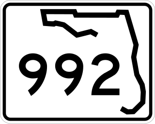
Coral Reef Drive, also known as Southwest 152nd Street, is a 9.6-mile-long (15.4 km) main east–west road south of Miami in Miami-Dade County, Florida, United States. It serves to connect the communities of Country Walk and Richmond Heights with Palmetto Bay. State Road 992 is designated along the 2.462-mile-long (3.962 km) section of Coral Reef Drive between the Homestead Extension of Florida's Turnpike and US 1.
