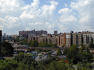
Fordham University is a private Jesuit research university in New York City. Established in 1841 and named after the Fordham neighborhood of the Bronx in which its original campus is located, Fordham is the oldest Catholic and Jesuit university in the northeastern United States and the third-oldest university in New York State.

New York Medical College is a private medical school in Valhalla, New York. Founded in 1860, it is a member of the Touro University System.
Baychester is a neighborhood geographically located in the northeast part of the Bronx, New York City. Its boundaries are East 222nd Street to the northeast, the New England Thruway (I-95) to the east, Gun Hill Road to the southwest, and Boston Road to the northwest. Eastchester Road is the primary thoroughfare through Baychester.
Pelham Gardens is a neighborhood located in the Northeast section of the Bronx, New York City. Its boundaries, starting from the north and moving clockwise are East Gun Hill Road to the north and east, Pelham Parkway to the south, and the IRT Dyre Avenue Line to the west ending at the esplanade. Eastchester Road is the primary thoroughfare through Pelham Gardens.
Allerton is a working-class neighborhood geographically located in the East Bronx section of the Bronx, New York City. It is named in honor of Daniel Allerton, an early Bronx settler who purchased and farmed this area with his wife Hustace. It consists of two subsections called Bronxwood and Laconia. Its boundaries, starting from the north and moving clockwise, are Adee Avenue, Boston Road, and Gun Hill Road to the northeast; the IRT Dyre Avenue Line to the east; Waring Avenue to the south; and Bronx River Parkway to the west. White Plains Road and Boston Road are the primary thoroughfares through Allerton.

Fordham Manor is a neighborhood located in the western Bronx, New York City. Fordham is roughly bordered by East 196th Street to the north, the Harlem River to the west, Fordham Road to the south, and Southern Boulevard to the east. The neighborhood's primary thoroughfares are Fordham Road and Grand Concourse.

Melrose is a mostly residential neighborhood in the southwestern section of the New York City borough of the Bronx. It adjoins the business and one-time theater area known as The Hub. Melrose is rectangular-shaped, being bordered by Saint Anns Avenue on the east, 149th Street on the south, Park Avenue on the west, and 163rd Street to the north. Melrose Avenue and Third Avenue are the primary thoroughfares through Melrose.

Norwood, also known as Bainbridge, is a residential neighborhood in the northwest Bronx, New York City, U.S. It is bound by Van Cortlandt Park and Woodlawn Cemetery to the north, the Bronx River to the east, and Mosholu Parkway to the southwest. The area is dominated topographically by what was once Valentine's Hill, the highest point being near the intersection of 210th Street and Bainbridge Avenue, where Gun Hill Road intersects, and around the Montefiore Medical Center, the largest landowner and employer of the neighborhood. Norwood's main commercial arteries are Gun Hill Road, Jerome Avenue, Webster Avenue, and Bainbridge Avenue.

Bedford Park is a residential neighborhood in the northwest Bronx, New York City, adjacent to the New York Botanical Garden. Its boundaries, starting from the north and moving clockwise, are: Mosholu Parkway to the north, Webster Avenue to the east, East 196th Street to the south, and Jerome Avenue to the west.

University Heights is a neighborhood of the West Bronx in New York City. Its boundaries, starting from the north and moving clockwise, are: West Fordham Road to the north, Jerome Avenue to the east, West Burnside Avenue to the south and the Harlem River to the west. University Avenue is the primary thoroughfare in University Heights.

Montefiore Medical Center is a premier academic medical center and the primary teaching hospital of the Albert Einstein College of Medicine in the Bronx, New York City. Its main campus, the Henry and Lucy Moses Division, is located in the Norwood section of the northern Bronx. It is named for Moses Montefiore and is one of the 50 largest employers in New York. In 2020, Montefiore was ranked No. 6 New York City metropolitan area hospitals by U.S. News & World Report. Adjacent to the main hospital is the Children's Hospital at Montefiore, which serves infants, children, teens, and young adults aged 0–21.

Morris Heights is a residential neighborhood located in the West Bronx. Its boundaries, starting from the north and moving clockwise are: West Burnside Avenue to the north, Jerome Avenue to the east, the Cross-Bronx Expressway to the south, and the Harlem River to the west. University Avenue is the primary thoroughfare through Morris Heights.

Castle Hill is a neighborhood located in the southeast section of the borough of the Bronx in New York City. Its boundaries are Waterbury Avenue and Westchester Avenue to the north, Westchester Creek to the east, the East River to the south, and White Plains Road to the west. Unionport is a subsection of Castle Hill, typically considered north of Lafayette Avenue.

Fordham Plaza, originally known as Fordham Square, is a major commercial and transportation hub in the Fordham and Belmont sections of the Bronx in New York City, New York, United States. It is located on the south side of Fordham Road at Third and Webster Avenues, at the eastern end of the commercial strip along Fordham Road that runs past Grand Concourse and Jerome Avenue to about Grand Avenue, and to the west of the Bronx's Little Italy district on Arthur Avenue in Belmont.

Belmont is a primarily residential neighborhood in the Bronx in New York City. Its boundaries are Fordham Road to the north, Bronx Park to the east, East 181st Street to the south, and Third Avenue to the west. These boundaries give the neighborhood a crescent-like shape. The neighborhood is noted for its "close-knit community" and "small-town feel", and as a result of its cultural history and wide array of Italian businesses, is widely known as the "Little Italy of the Bronx". Arthur Avenue, noted for its local restaurants and markets, is its primary thoroughfare.

St Barnabas Hospital is a non-profit teaching hospital founded in 1866. The hospital is located in the Belmont neighborhood of The Bronx in New York City. It is a level II adult trauma center and is a major clinical affiliate for clinical clerkship of the New York Institute of Technology College of Osteopathic Medicine.
Misericordia Hospital is a 3-block medical center in the Bronx, New York City. that opened in 1887 in Staten Island, moved to Manhattan in 1889, and moved to The Bronx in 1958. The hospital was renamed Our Lady of Mercy Hospital in 1985, acquired by Montefiore Medical Center in 2008 and renamed as their North Division, then renamed the Wakefield Division of Montefiore. Misericordia is a not-for-profit voluntary teaching hospital.


