The Silver Line is a system of bus routes in Boston and Chelsea, Massachusetts, operated by the Massachusetts Bay Transportation Authority (MBTA). It is operated as part of the MBTA bus system, but branded as bus rapid transit (BRT) as part of the MBTA subway system. Six routes are operated as part of two disconnected corridors. As of 2023, weekday ridership on the Silver Line was 27,000.

JFK/UMass station is a Massachusetts Bay Transportation Authority (MBTA) intermodal transfer station, located adjacent to the Columbia Point area of Dorchester, Boston, Massachusetts. It is served by the rapid transit Red Line; the Greenbush Line, Kingston/Plymouth Line, and Middleborough/Lakeville Line of the MBTA Commuter Rail system, and three MBTA bus routes. The station is named for the John F. Kennedy Presidential Library and Museum and the University of Massachusetts Boston, both located nearby on Columbia Point.

Longwood Medical Area station is a light rail stop on the MBTA Green Line E branch, located in the Mission Hill neighborhood of Boston, Massachusetts. It is named for the adjacent Longwood Medical Area.

Brigham Circle station is a station on the light rail MBTA Green Line "E" branch, located just east of Brigham Circle in the Mission Hill neighborhood of Boston, Massachusetts. With raised platforms installed in a 2001-03 renovation, the station is accessible when served by low-floor streetcars.

Reservoir station is a light rail station on the MBTA Green Line D branch, located in Brookline, Massachusetts, adjacent to the Cleveland Circle area of Brighton. The station is adjacent to Reservoir Yard and Carhouse, with the Cleveland Circle terminus of the C branch just a block away. With a daily ridership of 3,395, Reservoir is the second-busiest surface stop on the D branch.

The C branch, also called the Beacon Street Line or Cleveland Circle Line, is one of four branches of the Massachusetts Bay Transportation Authority's Green Line light rail system in the Boston, Massachusetts metropolitan area. The line begins at Cleveland Circle in the Brighton neighborhood of Boston and runs on the surface through Brookline along the median of Beacon Street. Reentering Boston, the line goes underground through the Saint Mary's Street incline and joins the B and D branches at Kenmore. Trains run through the Boylston Street subway to Copley where the E branch joins, then continue through the Tremont Street subway to downtown Boston. The C branch has terminated at Government Center station since October 2021.

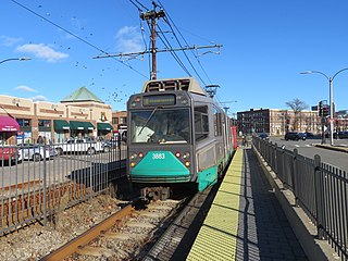
The B branch, also called the Commonwealth Avenue branch or Boston College branch, is a branch of the MBTA Green Line light rail system which operates on Commonwealth Avenue west of downtown Boston, Massachusetts. One of four branches of the Green Line, the B branch runs from Boston College station down the median of Commonwealth Avenue to Blandford Street. There, it enters Blandford Street portal into Kenmore station, where it merges with the C and D branches. The combined services run into the Boylston Street subway and Tremont Street subway to downtown Boston. B branch service has terminated at Government Center since October 2021. Unlike the other branches, B branch service runs solely through the city limits of Boston. The Green Line Rivalry between Boston College and Boston University is named in reference to the B branch, which runs to both universities.

The Fairmount Line or Dorchester Branch is a line of the MBTA Commuter Rail system in Boston, Massachusetts, USA. Except for a short portion in Milton, it lies entirely within Boston, running southwest from South Station through the neighborhoods of Dorchester, Mattapan and Hyde Park. Weekend service began on November 29, 2014. Most trains reverse direction at the south end at Readville, but some Franklin/Foxboro Line trains use the Fairmount Line rather than the Northeast Corridor.

Back of the Hill station is a surface stop on the light rail MBTA Green Line E branch, located in the Mission Hill neighborhood of Boston, Massachusetts. It is named after, and primarily serves, the adjacent Back of the Hill apartment complex, a Section 8 development for elderly and disabled residents. Back of the Hill is located on the street running section of the E branch on South Huntington Avenue. The station has no platforms; passengers wait in bus shelters on the sidewalks and cross a traffic lane to reach Green Line trains.

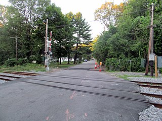
Silver Hill station is an MBTA Commuter Rail Fitchburg Line station in Weston, Massachusetts, United States. The station has a small shelter, parking area, and a gravel boarding area; it is not accessible. It was the least-used station in the entire MBTA system in 2018, with an average of just eleven daily boardings. Silver Hill station opened in 1844 as one of the original stops on the Fitchburg Railroad. The Boston and Maine Railroad unsuccessfully attempted to close the station in 1959. It remained in use until its temporary closure by the Massachusetts Bay Transportation Authority (MBTA) in December 2020 due to low ridership and a lack of accessibility, with indefinite closure effective April 2021. It reopened on November 18, 2024.

Hastings station was an MBTA Commuter Rail Fitchburg Line station in Weston, Massachusetts. The station had a small parking area but no platforms; passengers boarded trains from the Viles Street grade crossing. It was originally opened in the 1890s to serve the adjacent Hook & Hastings organ factory. The factory closed in 1935, but the station remained open with limited service. It was temporarily closed by the Massachusetts Bay Transportation Authority (MBTA) in December 2020 due to its low ridership and lack of accessibility; indefinite closure became effective in April 2021.

South Street station is a light rail surface stop on the MBTA Green Line B branch, located in the median of Commonwealth Avenue east of South Street in the Brighton neighborhood of Boston, Massachusetts. South Street is the lowest-ridership stop on the B branch, with just 214 daily boardings by a 2011 survey.

Valley Road station is a light rail station in Milton, Massachusetts. It serves the MBTA's Mattapan Line, a branch of the Red Line. The station is located off Eliot Street near Valley Road and consists of two side platforms that serve the lines's two tracks. Valley Road is the only station on the Line that is not accessible.

Summit Avenue station is a light rail stop on the MBTA Green Line C branch, located in the median of Beacon Street between Winchester Street and Summit Avenue in the Coolidge Corner neighborhood of Brookline, Massachusetts. The stop has two low side platforms that serve the line's two tracks; it is not accessible.

Blandford Street station is a surface-level light rail station on the MBTA's Green Line B branch located in Boston, Massachusetts. The station is located in the center median of Commonwealth Avenue at Silber Way and Blandford Mall, about 2 blocks west of Kenmore Square, near the east end of Boston University. The station consists of two low side platforms, which serve the B branch's two tracks. The station is the first station outbound on the B branch after it splits off from the C and D branches at Kenmore.

Packards Corner station is a light rail stop on the MBTA's Green Line B branch located at Packard's Corner—the intersection of Commonwealth Avenue and Brighton Avenue—in Allston, Boston, Massachusetts. The station is located in a median between the westbound travel lanes and frontage road of Commonwealth Avenue.

Harvard Avenue station is a light rail station on the MBTA Green Line B branch, located in the Allston neighborhood of Boston, Massachusetts. The station is located on the west side of Commonwealth Avenue at Harvard Avenue, in a residential and commercial district. The station consists of two side platforms, located on opposite sides of Harvard Avenue, which serve the B branch's two tracks. The station is fully accessible. Harvard Avenue is the second-busiest surface stop on the Green Line surface branches, with an average of 4,077 boardings on weekdays.

Boston University Central station is a surface-level light rail station on the MBTA Green Line B branch, located the center median of Commonwealth Avenue west of St. Marys Street in Boston, Massachusetts, surrounded by the Boston University campus. It consists of two side platforms, which serve the B branch's two tracks. The station is accessible, with raised platforms to allow level boarding onto low-floor trams and a high platform on the inbound side to serve high-floor light rail vehicles.

Chiswick Road station is a light rail station on the MBTA's Green Line B branch, located in the median of Commonwealth Avenue north of Chiswick Road in the Brighton neighborhood of Boston, Massachusetts. Chiswick Road consists of two side platforms, which serve the B branch's two tracks.


