Related Research Articles

Adams County is a county in the U.S. state of Pennsylvania. As of the 2020 census, the population was 103,852. Its county seat is Gettysburg. The county was created on January 22, 1800, from part of York County, and was named for the second President of the United States, John Adams. On July 1–3, 1863, a crucial battle of the American Civil War was fought near Gettysburg; Adams County as a result is a center of Civil War tourism.

Essex County is a county located in the Middle Peninsula in the U.S. state of Virginia; the peninsula is bordered by the Rappahannock River on the north and King and Queen County on the south. As of the 2020 census, the population was 10,599. Its county seat is Tappahannock.

Botetourt County is a US county that lies in the Roanoke Region of the Commonwealth of Virginia. Located in the mountainous portion of the state, the county is bordered by two major ranges, the Blue Ridge Mountains and the Appalachian Mountains.

Jasper County is a county located in the U.S. state of Texas. As of the 2020 census, its population was 32,980. Its county seat is Jasper. The county was created as a municipality in Mexico in 1834, and in 1837 was organized as a county in the Republic of Texas. It is named for William Jasper, an American Revolutionary War hero.

Collin County is located in the U.S. state of Texas. It is part of the Dallas-Fort Worth-Arlington metropolitan statistical area, and a small portion of the city of Dallas is in the county. At the 2020 United States census, the county's population is 1,064,465, making it the sixth-most populous county in Texas and the 43rd-largest county by population in the United States. Its county seat is McKinney.

Warren County is a county located in the U.S. state of Pennsylvania. As of the 2010 census, the population was 41,815. Its county seat is Warren. The county was formed in 1800 from parts of Allegheny and Lycoming counties; attached to Crawford County until 1805 and then to Venango County until Warren was formally organized in 1819.

Mercer County is a county located in the U.S. state of Pennsylvania. As of the 2020 census, the population was 110,652. Its county seat is Mercer, and its largest city is Hermitage. The county was created in 1800 and later organized in 1803.

Franklin County is a county located in South Central Pennsylvania. As of the 2020 census, the population was 155,932 Its county seat is Chambersburg.

Columbia County is a county located in the north-central part of the U.S. state of Pennsylvania. As of the 2020 census, the population was 64,727. Its county seat is Bloomsburg. The county was created on March 22, 1813, from part of Northumberland County. It was named Columbia, alluding to the United States and Christopher Columbus.

McCurtain County is in the southeastern corner of the U.S. state of Oklahoma. As of the 2010 census, the population was 33,151. Its county seat is Idabel. It was formed at statehood from part of the earlier Choctaw Nation in Indian Territory. The name honors an influential Choctaw family that lived in the area. Green McCurtain was the last chief when Oklahoma became a state in 1907.

Wright County is a county located in the southern portion of the U.S. state of Missouri. As of the 2010 census, the population was 18,815. Its county seat is Hartville. The county was officially organized on January 29, 1841, and is named after Silas Wright, a former Congressman, U.S. Senator and Governor of New York.

Greene County is located in the U.S. state of Missouri. As of the 2020 census, its population was 298,915 making it the fourth most-populous county in Missouri. Its county seat and most-populous city is Springfield. The county was organized in 1833 and is named after American Revolutionary War General Nathanael Greene.

Lawrence County is a county located in the U.S. state of Mississippi. As of the 2010 census, the population was 12,929. Its county seat is Monticello. The county is named for the naval hero James Lawrence.

Washington County is a county located in the U.S. state of Illinois. As of the 2010 census, it had a population of 14,716. Its county seat is Nashville. It is located in the southern portion of Illinois known locally as "Little Egypt".

Washington County is a regional economic, educational, and cultural hub in the Northwest Arkansas region. Created as Arkansas's 17th county on November 30, 1848, Washington County has 13 incorporated municipalities, including Fayetteville, the county seat, and Springdale. The county is also the site of small towns, bedroom communities, and unincorporated places. The county is named for George Washington, the first President of the United States.

Armstrong is a city in Emmet County, Iowa, United States. The population was 875 at the 2020 census. It was originally known as Armstrong Grove.
Garvin is a town in McCurtain County, Oklahoma, United States. The population was 256 at the 2010 census, compared to 143 in 2000.

Lyons Township is one of 29 townships in Cook County, Illinois. As of the 2010 census, its population was 111,688, with its most populous municipalities including La Grange, Justice and Summit. Lyons Township was established in 1850. The village of Lyons, almost all of which lies within the township, is often confused with it.

Idabel High School is high school located in Idabel, Oklahoma, which is in McCurtain County in the southeastern corner of the state. It is a part of Idabel Public Schools.

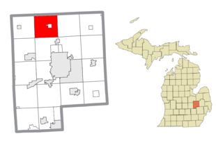
Vienna Charter Township is a charter township of Genesee County in the U.S. state of Michigan. The population was 13,255 at the 2010 census, slightly up from 13,108 at the 2000 census.
References
- 1 2 3 4 5 6 "Search for Public School Districts – District Detail for FOREST GROVE". National Center for Education Statistics . Institute of Education Sciences . Retrieved 2022-03-05.
- ↑ "SCHOOL DISTRICT REFERENCE MAP (2010 CENSUS): McCurtain County, OK" (Archive). U.S. Census Bureau. Retrieved on January 22, 2016.
- ↑ Minor, Jeff. "School resumes after bus accident" (). Texarkana Gazette . Retrieved on January 22, 2016.