Related Research Articles

The Derwent is a river in Derbyshire, England. It is 50 miles (80 km) long and is a tributary of the River Trent, which it joins south of Derby. Throughout its course, the river mostly flows through the Peak District and its foothills.

High Peak is a local government district with borough status in Derbyshire, England. The borough compromises high moorland plateau in the Dark Peak area of the Peak District National Park. The district stretches from Holme Moss in the north to Sterndale Moor in the south and from Hague Bar in the west to Bamford in the east. The population of the borough taken at the 2011 Census was 90,892. The borough is unusual in having two administrative centres for its council, High Peak Borough Council. The offices are based in both Buxton and Glossop. The borough also contains other towns including Chapel-en-le-Frith, Hadfield, New Mills and Whaley Bridge.
Belper is a town and civil parish in the local government district of Amber Valley in Derbyshire, England, located about 7 miles (11 km) north of Derby on the River Derwent. As well as Belper itself, the parish also includes the village of Milford and the hamlets of Bargate, Blackbrook and Makeney. As of the 2011 Census, the parish had a population of 21,823. Originally a centre for the nail-making industry since Medieval times, Belper expanded during the early Industrial Revolution to become one of the first mill towns with the establishment of several textile mills; as such, it forms part of the Derwent Valley Mills World Heritage Site.
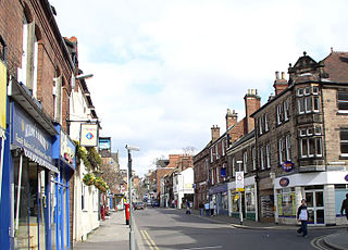
Duffield is a village in the Amber Valley district of Derbyshire, 5 miles (8.0 km) north of Derby. It is centred on the western bank of the River Derwent at the mouth of the River Ecclesbourne. It is within the Derwent Valley Mills World Heritage Area and the southern foothills of the Pennines.
Sir John Lexington was a baron and royal official in 13th century England. He has been described as having been Lord Chancellor, but other scholars believe he merely held the royal seals while the office was vacant or the chancellor was abroad. He served two terms, once from 1247 to 1248, and again from 1249 to 1250.

William III de Ferrers, 5th Earl of Derby of Chartley Castle in Staffordshire, was an English nobleman and major landowner, unable through illness to take much part in national affairs. From his two marriages, he left numerous children who married into noble and royal families of England, France, Scotland and Wales.

Matlock Bath railway station is a Grade II listed railway station owned by Network Rail and managed by East Midlands Railway. It is located in the village of Matlock Bath in Derbyshire, England. The station is unmanned by rail staff and is located on the Derwent Valley Line, 16.25 miles (26.15 km) north of Derby towards Matlock.
Robert II de Ferrers, 2nd Earl of Derby was a younger, but eldest surviving son of Robert de Ferrers, 1st Earl of Derby and his wife Hawise. He succeeded his father as Earl of Derby in 1139. He was head of a family which controlled a large part of Derbyshire including an area later known as Duffield Frith.

Milford is a village in Derbyshire, England, on the River Derwent, between Duffield and Belper on the A6 trunk road.

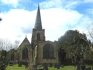
Duffield Castle was a Norman Castle in Duffield, Derbyshire. The site is a Scheduled Ancient Monument.
Duffield Frith was, in medieval times, an area of Derbyshire in England, part of that bestowed upon Henry de Ferrers by King William, controlled from his seat at Duffield Castle. From 1266 it became part of the Duchy of Lancaster and from 1285 it was a Royal Forest with its own Forest Courts.

Alderwasley is a village and civil parish in the Amber Valley district of Derbyshire, England. The population of the civil parish as of the 2011 census was 469. Alderwasley Hall is the home to one of the sites of Alderwasley Hall School which is a special school for children and young people with Aspergers and/or Speech and Language Difficulties. It is about six miles north of Belper.

Shining Cliff Woods are on the west bank of the River Derwent near to Ambergate Derbyshire.

Henry de Ferrers, magnate and administrator, was a Norman who after the 1066 Norman conquest was awarded extensive lands in England.
William I de Ferrers, 3rd Earl of Derby was a 12th-century English Earl who resided in Tutbury Castle in Staffordshire and was head of a family which controlled a large part of Derbyshire known as Duffield Frith. He was also a Knight Templar.
William II de Ferrers, 4th Earl of Derby, was a favourite of King John of England. He succeeded to the estate upon the death of his father, William de Ferrers, 3rd Earl of Derby, at the Siege of Acre in 1190. He was head of a family which controlled a large part of Derbyshire which included an area known as Duffield Frith.

Holbrook is a village in Derbyshire at the southern end of the Pennines around five miles north of Derby, England. The population of the civil parish as of the 2011 census was 1,538.
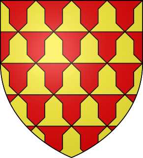
Robert de Ferrers, 6th Earl of Derby (1239–1279) was an English nobleman.

The Forest of High Peak was, in medieval times, a moorland forest covering most of the north west of Derbyshire, England, extending as far south as Tideswell and Buxton. From the time of the Norman Conquest it was established as a royal hunting reserve, administered by William Peverel, a follower of William I, who was based at Peveril Castle. The Royal Forest of Peak was bounded by the River Goyt to the west, the River Wye to the south, the River Derwent to the east and the River Etherow to the north. In 1305 it covered about 100 square miles.

Morley Park is an area within the parish of Ripley in the English county of Derbyshire, north of Derby. It is about five miles north of the village of Morley itself.
References
Turbutt, G., (1999) A History of Derbyshire. Volume 2: Medieval Derbyshire, Cardiff: Merton Priory Press
Coordinates: 53°01′27″N1°28′53″W / 53.0241°N 1.4814°W
| | This Derbyshire location article is a stub. You can help Wikipedia by expanding it. |