Fort Okfuskee

Last updated
Fort Okfuskee
Near Our Town, Alabama in United States
Fort Okfuskee.jpg
John Lodge 1754 map showing the location of Okfuskee (spelled Ockfuskee in center of image)
USA Alabama location map.svg
Red pog.svg
Fort Okfuskee
Usa edcp location map.svg
Red pog.svg
Fort Okfuskee
Coordinates 32°48′32″N85°53′54″W / 32.80889°N 85.89833°W / 32.80889; -85.89833
TypeStockade fort
Site information
OwnerPrivate
Controlled byPrivate
Open to
the public
No
ConditionSubmerged
Site history
Built1735, 1744
Built by Province of Georgia traders (first fort), Province of South Carolina traders (second fort)
In use1735-1743, 1744-1745

Fort Okfuskee (also spelled Ofuski or Oakfuskee) was the name of two separate forts built by Great Britain in what is now Tallapoosa County, Alabama. The first fort was built to ensure British trade with the Creek Indians after the French constructed Fort Toulouse. The fort was abandoned a little over a decade after construction after facing difficulties in being supplied. A second Fort Okfuskee was built a year later, but was abandoned in less than a year due to lack of colonial support. [1]

Contents

History

Background

Soon after Europeans arrived in the present-day southeastern United States, Native Americans began trading deerskins and slaves for European goods and weapons. The Creek Indians initially traded with Spanish and French colonists, but eventually established trade with the British from the Province of South Carolina and Province of Georgia. [2]

To protect their trade interests and prevent other European encroachment, the French built Fort Toulouse in 1717 at the confluence of the Coosa and Tallapoosa Rivers. The British realized the need for continued trade with the Creeks and other Native Americans to ensure a supply of deerskins and warriors to fight other European powers. [3] By 1722, the British had established a factory at the Creek town of Okfuskee on the Tallapoosa River. [4] In the 1700s, Okfuskee was one of the largest Creek towns and the destination of many British traders. [5] The town occupied both sides of the Tallapoosa River and owed its size to the fact that it lay at the intersection of two major routes, the Upper Trading Path that connected it to Charleston and the Okfuskee Trail that connected it to Savannah. The Upper Trading Path continued westward, connecting Okfuskee with the Chickasaw tribe. [6] As early as 1727, South Carolina considered constructing a fort to protect their trade interests in Okfuskee. [7]

After the formation of the Province of Georgia in 1732, Georgia claimed exclusive rights to trade with the Creeks. [8] In doing so, Georgia sought to exclude traders from the Province of South Carolina from contact with the Creeks in the surrounding area. [9] In addition to their trade relationship with the Creeks, the British also traded with one of the Creek's rivals, the Chickasaws. To strengthen their relationship with the Chickasaws, the British planned to attack Fort Toulouse. After meeting with the Creeks, the British demanded the Creeks either destroy Fort Toulouse or allow the British to construct their own fort on Creek land. [10] The Creeks relented to the British demand for a fort, and Georgia's James Oglethorpe dispatched Patrick McKay and other men to expel "unlicensed" traders from Creek lands. [8]

Georgia fort

After meeting with Okfuskee villagers in 1735, Georgia rangers were left to construct and garrison the new fort. [11] The fort, referred to as Fort Okfuskee, was likely a palisade constructed around a trade house. Fort Okfuskee was built on the west side of the Tallapoosa opposite the village of Okfuskee. [12] McKay's second-in-command, Lieutenant Anthony Willey (also spelled Willy), was placed in charge of the construction of Fort Okfuskee. Willey had previously served at Fort Moore prior to traveling with McKay. [9] Willey and two to three other soldiers arranged trades with the Creeks and monitored other traders in the surrounding area until 1742. [8] Even though they were monitored, the Creeks still conducted trade with agents from South Carolina, including a trader named Alexander Wood. [13]

In 1742, Oglethorpe sent Captain Richard Kent to relieve Willey of command of Fort Okfuskee. [14] Kent, the senior ranger officer in Georgia and commander of the Augusta Regiment, arrived at Fort Okfuskee with three other men. [8] Kent and his soldiers remained at Fort Okfuskee until June 1743, after which Fort Okfuskee was abandoned by the Georgians. [15]

South Carolina fort

Modern reconstruction of Fort Toulouse as it possibly appeared when in use by the French Fort Toulouse.jpg
Modern reconstruction of Fort Toulouse as it possibly appeared when in use by the French

After Georgia abandoned Fort Okfuskee, South Carolina continued to trade with the Creeks in Okfuskee. In 1743, representatives from Okfuskee visited Charleston to request assistance from the British in ending a war with the Cherokee. During this trip, the Creeks consented to South Carolina building a second fort in Okfuskee. [13] Lieutenant Governor William Bull instructed Wood (now with the title of Captain), to construct the fort. [13]

The Governor of French Louisiana, Pierre de Rigaud, marquis de Vaudreuil-Cavagnial, learned of South Carolina's desire to construct a new fort at Okfuskee. Vaudreuil demanded that the commandant of Fort Toulouse notify the Abihka and Tallapoosas that the French would withdraw trade from Fort Toulouse if they did not refuse to help build the new fort and destroy any constructed portions. [16] Despite these demands, the French continued to trade with the citizens of Okfuskee to ensure their cooperation. [17] The French ordered coats and limburg cloth (a trade fabric from the province of Limburg in the Netherlands that was usually dyed blue or scarlet), to use as trade items with the Creeks. [18]

Most sources list Captain Wood as leading construction of the second Fort Okfuskee, but some sources list a trader named Dubois as being responsible for its construction. [17] The fort was constructed from March to May 1744. [8] [19] The fort was described as a "house surrounded by a stockade" and was enclosed by a 150-square-foot palisade. [6] [20] This second fort was likely similar in appearance to the stockaded trading house found at Ocmulgee Old Fields. [19] Lieutenant Governor Bull sought funding for the fort, but the South Carolina Commons House of Assembly thought it would be too costly to supply the fort and provide it with any cannons. [19] The House also debated if Fort Okfuskee should even have a permanent garrison or just serve as a temporary refuge for traders. [17] As a consequence, the second Fort Okfuskee was barely supplied and soldiers there were responsible for their own food and clothing. [21]

By 1745, Fort Okfuskee was described by traders and other Europeans as being totally abandoned and in disrepair. [6] Prior to its abandonment, a portion of the fort was burned. [17]

Present day

The site of Fort Okfuskee was inundated when the Tallapoosa River was dammed in the creation of Lake Martin in 1926. [22] A historical marker describing Fort Okfuskee is located near Alexander City on U.S. Route 280. [23]

Related Research Articles

<span class="mw-page-title-main">Muscogee</span> Indigenous people from Southeastern Woodlands

The Muscogee, also known as the Mvskoke, Muscogee Creek, and the Muscogee Creek Confederacy, are a group of related Indigenous peoples of the Southeastern Woodlands in the United States. Their historical homelands are in what now comprises southern Tennessee, much of Alabama, western Georgia and parts of northern Florida.

<span class="mw-page-title-main">Creek War</span> 1813–14 US Indian War

The Creek War, was a regional conflict between opposing Native American factions, European powers, and the United States during the early 19th century. The Creek War began as a conflict within the tribes of the Muscogee, but the United States quickly became involved. British traders and Spanish colonial officials in Florida supplied the Red Sticks with weapons and equipment due to their shared interest in preventing the expansion of the United States into regions under their control.

<span class="mw-page-title-main">Coosa River</span> River in Alabama and Georgia, U.S.

The Coosa River is a tributary of the Alabama River in the U.S. states of Alabama and Georgia. The river is about 280 miles (450 km) long.

Red Sticks —the name deriving from the red-painted war clubs of some Native American Creek—refers to an early 19th century traditionalist faction of Muscogee Creek people in the Southeastern United States. Made up mostly of Creek of the Upper Towns that supported traditional leadership and culture, as well as the preservation of communal land for cultivation and hunting, the Red Sticks arose at a time of increasing pressure on Creek territory by European American settlers. Creek of the Lower Towns were closer to the settlers, had more mixed-race families, and had already been forced to make land cessions to the Americans. In this context, the Red Sticks led a resistance movement against European American encroachment and assimilation, tensions that culminated in the outbreak of the Creek War in 1813. Initially a civil war among the Creek, the conflict drew in United States state forces while the nation was already engaged in the War of 1812 against the British.

<span class="mw-page-title-main">Tallapoosa River</span> River in Alabama and Georgia, United States

The Tallapoosa River runs 265 miles (426 km) from the southern end of the Appalachian Mountains in Georgia, United States, southward and westward into the Appalachian foothills in Alabama. It is formed by the confluence of McClendon Creek and Mud Creek in Paulding County, Georgia. Lake Martin at Dadeville, Alabama is a large and popular water recreation area formed by a dam on the river. The Tallapoosa joins the Coosa River about 10 miles (16 km) northeast of Montgomery near Wetumpka to form the Alabama River.

<span class="mw-page-title-main">Savannah Town, South Carolina</span>

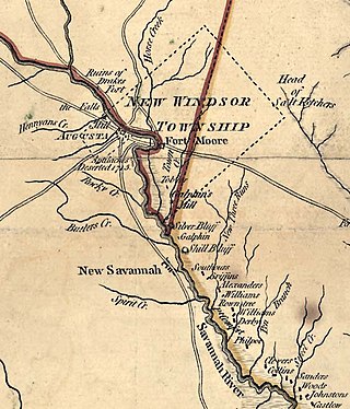
Savannah Town, South Carolina is a defunct settlement that was located in the colonial years on the Savannah River below the Fall Line in present-day Aiken County. In the 1670s the Westo had a village here, but they were displaced by the Savannah in a trade war, and it became known by 1685 as Savannah Town. The English colony had traders who did a lucrative business in dressed skins with the Savannah Shawnee. Fortified as a frontier post, the settlement developed and ferry service was established across the river. The town was gradually overtaken by its competitor of Augusta, Georgia, established in 1735 five miles upriver and closer to Indian settlements. Traders here intercepted commerce, sending it to their port of Savannah on the coast. By 1740 Savannah Town was declining, and by 1765 the village was abandoned and the fort closed.

<span class="mw-page-title-main">Okfuskee</span>

Okfuskee are a Muscogee tribe. Alternative spellings include the traditional Mvskoke spelling "Akfvske", referring to the tribal town in Alabama, and the comparable spelling Oakfuskee. They formed part of the former Creek (Muscogee) Confederacy in Alabama, prior to their removal during the 1830s to the Indian Territory. Okfuskee County, Oklahoma is named for a settlement where members of the tribe formerly lived.

<span class="mw-page-title-main">Fort King George</span> United States historic place

Fort King George State Historic Site is a fort located in the U.S. state of Georgia in McIntosh County, adjacent to Darien. The fort was built in 1721 along what is now known as the Darien River and served as the southernmost outpost of the British Empire in the Americas until 1727. The fort was constructed in what was then considered part of the colony of South Carolina, but was territory later settled as Georgia. It was part of a defensive line intended to encourage settlement along the colony's southern frontier, from the Savannah River to the Altamaha River. Great Britain, France, and Spain were competing to control the American Southeast, especially the Savannah-Altamaha River region.

<span class="mw-page-title-main">Fort Toulouse and Fort Jackson</span> United States historic place

Fort Toulouse and Fort Jackson are two forts that shared the same site at the fork of the Coosa River and the Tallapoosa River, near Wetumpka, Alabama.

<span class="mw-page-title-main">Fort Claiborne</span> United States historic site in Alabama

Fort Claiborne was a stockade fort built in 1813 in present-day Monroe County, Alabama during the Creek War.

<span class="mw-page-title-main">Fort Bainbridge</span> United States historic site in Alabama

Fort Bainbridge was an earthen fort located along the Federal Road on what is today the county line between Macon and Russell counties in Alabama. Fort Bainbridge was located twenty-five miles west of Fort Mitchell.

<span class="mw-page-title-main">Fort Decatur (Alabama)</span> United States historic site

Fort Decatur was an earthen fort established in March 1814 on the banks of the Tallapoosa River as part of the Creek War and the larger War of 1812. The fort was located on the east bank of the Tallapoosa River, near the modern community of Milstead. Fort Decatur was also located near the Creek town of Tukabatchee. It was most likely named for Stephen Decatur.

<span class="mw-page-title-main">Fort Dale</span> Stockade fort built in present-day Butler County, Alabama, United States

Fort Dale was a stockade fort built in present-day Butler County, Alabama by Alabama Territory settlers. The fort was constructed in response to Creek Indian attacks on settlers in the surrounding area.

<span class="mw-page-title-main">Fort Hull</span> American historical site in Alabama

Fort Hull was an earthen fort built in present-day Macon County, Alabama in 1814 during the Creek War. After the start of hostilities, the United States decided to mount an attack on Creek territory from three directions. The column advancing west from Georgia built Fort Mitchell and then clashed with the Creeks. After a pause in operations, the column from Georgia continued its march and built Fort Hull. The fort was used as a supply point and was soon abandoned after the end of the Creek War.

<span class="mw-page-title-main">Fort Leslie</span> American historical site in Alabama

Fort Leslie was a stockade fort built in present-day Talladega County, Alabama, in 1813 during the Creek War. After the Creek War began, protective stockades were built by settlers and Creeks who were allied with the United States to protect themselves from hostile Creek attacks. Fort Leslie was the focal point of the Battle of Talladega but was soon abandoned after the end of the Creek War.

Sophia Durant was a Koasati Native American plantation owner, who served as the speaker, interpreter, and translator for her brother, Alexander McGillivray, a leader in the Muscogee Confederacy.

Sehoy, or Sehoy I, was an 18th-century matriarch of the Muscogee Confederacy and a member of the Wind clan.

<span class="mw-page-title-main">Fort Madison (Alabama)</span> United States historic site in Alabama

Fort Madison was a stockade fort built in August 1813 in present-day Clarke County, Alabama, during the Creek War, which was part of the larger War of 1812. The fort was built by the United States military in response to attacks by Creek warriors on encroaching American settlers. The fort shared many similarities to surrounding stockade forts in its construction but possessed a number of differences in its defenses. The fort housed members of the United States Army and settlers from the surrounding area, and it was used as a staging area for raids on Creek forces and supply point on further military expeditions. Fort Madison was subsequently abandoned at the conclusion of the Creek War and only a historical marker exists at the site today.

Fort Montgomery was a stockade fort built in August 1814 in present-day Baldwin County, Alabama, during the Creek War, which was part of the larger War of 1812. The fort was built by the United States military in response to attacks by Creek warriors on encroaching American settlers and in preparation for further military action in the War of 1812. Fort Montgomery continued to be used for military purposes but in less than a decade was abandoned. Nothing exists at the site today.

Fort Pierce, was two separate stockade forts built in 1813 in present-day Baldwin County, Alabama, during the Creek War, which was part of the larger War of 1812. The fort was originally built by settlers in the Mississippi Territory to protect themselves from attacks by Creek warriors. A new fort of the same name was then built by the United States military in preparation for further action in the War of 1812, but the fort was essentially abandoned within a few years. Nothing exists at the site today.

References

  1. Harris 1977, pp. 47.
  2. Hahn, Steven C. "Creeks in Alabama". Encyclopedia of Alabama. Retrieved March 14, 2023.
  3. Wood 1984, pp. 41.
  4. Wood 1984, pp. 44.
  5. Wright 2003, pp. 120.
  6. 1 2 3 Piker 2004, pp. 36.
  7. Piker 2004, pp. 28.
  8. 1 2 3 4 5 Thomas 1989, pp. xii.
  9. 1 2 Wood 1984, pp. 45.
  10. Waselkov, Wood & Herbert 1982, pp. 52.
  11. Piker 2004, pp. 34.
  12. Brannon 1924, pp. 52.
  13. 1 2 3 Piker 2004, pp. 35.
  14. Cashin 2006, pp. 109.
  15. Wood 1984, pp. 46.
  16. Wood 1984, pp. 47.
  17. 1 2 3 4 Waselkov, Wood & Herbert 1982, pp. 53.
  18. Rowland & Sanders 1927, pp. 26.
  19. 1 2 3 Wood 1984, pp. 48.
  20. Waselkov, Wood & Herbert 1982, pp. 54.
  21. Piker 2004, pp. 142.
  22. Roberts 1988, pp. 12.
  23. "Fort Okfuskee". HMdb.org. Retrieved March 12, 2023.

Sources