Interstate 59 (I-59) is an Interstate Highway located in the southeastern United States. It is a north–south route that spans 445.23 miles (716.53 km) from a junction with I-10 and I-12 at Slidell, Louisiana, to a junction with I-24 near Wildwood, Georgia.

York County is a county in the U.S. state of Nebraska. As of the 2010 United States Census, the population was 13,665. Its county seat is York.

Seward County is a county in the U.S. state of Nebraska. As of the 2010 United States Census, the population was 16,750. Its county seat is Seward. The county was formed in 1855, and was organized in 1867. It was originally called Greene County, and in 1862 it was renamed for William H. Seward, United States Secretary of State under Abraham Lincoln and Andrew Johnson. Seward County is part of the Lincoln, NE Metropolitan Statistical Area.

Hamilton County is a county in the U.S. state Nebraska. As of the 2010 United States Census, the population was 9,124. Its county seat is Aurora. The county was named for Alexander Hamilton, the first Secretary of the Treasury in the new United States government.

Polk County is a county in the northwestern part of the U.S. state of Minnesota. The population was 31,600 at the 2010 United States Census. Its county seat is Crookston, and the largest community is East Grand Forks.

Mahnomen County is a county in the U.S. state of Minnesota. As of the 2010 United States Census, the population was 5,413. Its county seat is Mahnomen.

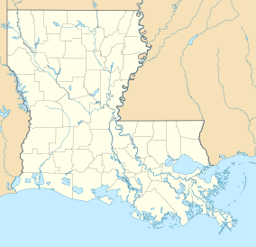
Vernon Parish is a parish located in the U.S. state of Louisiana. As of the 2010 census, the population was 52,334. The parish seat is Leesville. Bordered on the west by the Sabine River, the parish was founded in 1871 during the Reconstruction era.

Fort Polk South is a census-designated place (CDP) in Vernon Parish, Louisiana, United States. The population was 11,000 at the 2000 census.

DeRidder is a small city in, and the parish seat of, Beauregard Parish, Louisiana, United States. A small portion of the city extends into Vernon Parish. As of the 2010 census DeRidder had a population of 10,578. It is the smaller principal city of the Fort Polk South-DeRidder CSA, a Combined Statistical Area that includes the Fort Polk South and DeRidder micropolitan areas, which had a combined population of 87,988 at the 2010 census.
U.S. Highway 171 (US 171) is a part of the United States Numbered Highway System and the only route within that system currently located entirely within the state of Louisiana. It spans 177.44 miles (285.56 km) in a north–south direction from the junction of US 90 and Louisiana Highway 14 (LA 14) in Lake Charles to the junction of US 79/US 80 and LA 3094 in Shreveport.

Kisatchie National Forest, the only National forest in Louisiana, United States, is located in the forested piney hills and hardwood bottoms of seven central and northern parishes. It is part of the Cenozoic uplands and has large areas of longleaf pine forests. It is one of the largest pieces of natural landscape in Louisiana, with some 604,000 acres (2,440 km2) of public land, more than half of which is vital longleaf pine and flatwoods vegetation. These support many rare plant and animal species. There are also rare habitats, such as hillside seepage bogs and calcareous prairies. The forest also contains and provides a buffer for the Kisatchie Hills Wilderness, a nationally designated wilderness area that contributes to protecting biodiversity of the coastal plain region of the United States.
Fort Polk is a United States Army installation located in Vernon Parish, approximately ten miles (15 km) east of Leesville, Louisiana, and thirty miles (50 km) north of DeRidder in Beauregard Parish, Louisiana.

Louisiana Highway 27 (LA 27) is a state highway located in southwestern Louisiana. It runs 132.42 miles (213.11 km) in a general north–south direction from LA 14 in Holmwood to the junction of U.S. Highways 171 and 190 in DeRidder.

The Circle B Bar Reserve is an area of protected lands in Polk County, Florida. Comprising 1,267 acres (5.13 km2) at 4399 Winter Lake Road near Lakeland, Florida, the area is managed by the Polk County Board of County Commissioners (BOCC). It is jointly owned by the BOCC and the Southwest Florida Water Management District. The park was purchased in 2000 for $7.4 million using funds provided by an environmental lands acquisition referendum approved by voters in 1994.

The Sherburne Complex is a joint land management venture of the U.S. Fish and Wildlife Service, the Louisiana Department of Wildlife and Fisheries (LDWF), and the U.S. Army Corps of Engineers that began in 1983. The area consists of 44,000 acres (180 km2), and is managed by the Louisiana Department of Wildlife and Fisheries. The complex is located in the Morganza Flood way system of the Atchafalaya Basin about 30 miles (48 km) west of Baton Rouge, Louisiana and actually extends a little south of the I-10 Atchafalaya Basin Bridge at Whiskey Bay, Louisiana. The bridge crosses the Whiskey Bay Pilot Channel. Located on the graveled LA 975, the west boundary is on the east side of the Atchafalaya River with the east boundary being the East Protection Levee. The complex stretches just north of old highway 190, and a short distance to the south of I-10. The nearest town is Krotz Springs to the north off US 190.

Louisiana Highway 975 (LA 975) is a gravel state highway in central Louisiana. It runs north–south for 18.4 miles (29.6 km). The southern terminus is at Whiskey Bay in Iberville Parish, and the northern terminus is east of Krotz Springs at a junction with U.S. Route 190 (US 190) and the north, south LA 973, in Pointe Coupee Parish. The entire route traverses the Sherburne Complex WMA, which is a combined Sherburne WMA, Atchafalaya National Wildlife Refuge, and Bayou Des Ourse, managed by the Louisiana Department of Wildlife and Fisheries. The road runs between the Atchafalaya River and Whiskey Bay Pilot Channel on the west and the East Protection Levee on the east.

Peason Ridge Wildlife Management Area, also referred to as Peason Ridge WMA, is a 74,309-acre tract of protected area located in the Parishes of Natchitoches, Sabine, and Vernon, in the state of Louisiana. The WMA is managed by the Louisiana Department of Wildlife and Fisheries (LDWF).
J. C. "Sonny" Gilbert Wildlife Management Area is a 7,524-acre (3,045 ha) wildlife management area in Catahoula, Parish, Louisiana, owned by the Louisiana Department of Wildlife and Fisheries. It is located 6 miles (9.7 km) miles west of Sicily Island. The area contains the 17 ft (5.2 m) high Rock Falls, one of the tallest waterfalls in the state.