
Morrill County is a county in the U.S. state of Nebraska. As of the 2010 United States Census, the population was 5,042. Its county seat is Bridgeport.
Scouting in Nebraska has a long history, from the 1910s to the present day, serving thousands of youth in programs that suit the environment in which they live.

Gering is a city in, and the county seat of, Scotts Bluff County, in the Panhandle region of Nebraska, United States. The population was 8,500 at the 2010 census.

Scotts Bluff National Monument is located west of the City of Gering in western Nebraska, United States. This National Park Service site protects over 3,000 acres of historic overland trail remnants, mixed-grass prairie, rugged badlands, towering bluffs and riparian area along the North Platte River. The park boasts over 100,000 annual visitors.

Fort Leavenworth is a United States Army installation located in Leavenworth County, Kansas, in the city of Leavenworth, roughly 20 miles northwest of Kansas City. Built in 1827, it is the second oldest active United States Army post west of Washington, D.C., and the oldest permanent settlement in Kansas. Fort Leavenworth has been historically known as the "Intellectual Center of the Army."

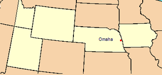
The Nebraska Panhandle is an area in the western part of the state of Nebraska and one of several U.S. state panhandles, or elongated geographical regions that extend from their main political entity.

Fort Caspar was a military post of the United States Army in present-day Wyoming, named after 2nd Lieutenant Caspar Collins, a U.S. Army officer who was killed in the 1865 Battle of the Platte Bridge Station against the Lakota and Cheyenne. Founded in 1859 along the banks of the North Platte River as a trading post and toll bridge on the Oregon Trail, the post was later taken over by the Army and named Platte Bridge Station to protect emigrants and the telegraph line against raids from Lakota and Cheyenne in the ongoing wars between those nations and the United States. The site of the fort, near the intersection of 13th Street and Wyoming Boulevard in Casper, Wyoming, is listed in the National Register of Historic Places and is now owned and operated by the City of Casper as the Fort Caspar Museum and Historic Site.

Fort Kearny was a historic outpost of the United States Army founded in 1848 in the western U.S. during the middle and late 19th century. The fort was named after Col. and later General Stephen Watts Kearny. The outpost was located along the Oregon Trail near Kearney, Nebraska. The town of Kearney took its name from the fort. The "e" was added to Kearny by postmen who consistently misspelled the town name. A portion of the original site is preserved as Fort Kearny State Historical Park by the Nebraska Game and Parks Commission.
Camp Collins was a 19th-century outpost of the United States Army in the Colorado Territory. The fort was commissioned in the summer of 1862 to protect the Overland Trail from attacks by Native Americans in a conflict that later became known as the Colorado War. Located along the Cache la Poudre River in Larimer County, it was relocated from its initial location near Laporte after a devastating flood. Its second location downstream on the Poudre was used until 1866 and became the nucleus around which the City of Fort Collins was founded.

Fort Fetterman was constructed in 1867 by the United States Army on the Great Plains frontier in Dakota Territory, approximately 11 miles northwest of present-day Douglas, Wyoming. Located high on the bluffs south of the North Platte River, it served as a major base for the start of several United States military expeditions against warring Native American tribes. The fort is listed on the National Register of Historic Places.
Florence is a neighborhood in Omaha, Nebraska, United States on the city's north end and originally one of the oldest cities in Nebraska. It was incorporated by the Nebraska Territorial Legislature on March 10, 1857. The site of Winter Quarters for Mormon migrants traveling west, it has the oldest cemetery for people of European descent and oldest standing gristmill in Nebraska. Florence was the site of an illegal territorial legislature in 1858. Given the high concentration of National Register of Historic Places in the neighborhood, it is regarded as "the historic front door to Omaha as well as the state."
A private in the Fourth Infantry, Charles Howard served as photographer for the Stanton Expedition in 1877, traveling throughout eastern Wyoming, western Nebraska and into the Black Hills of Dakota Territory.
The Department of the Platte was a military administrative district established by the U.S. Army on March 5, 1866, with boundaries encompassing Iowa, Nebraska, Dakota Territory, Utah Territory and a small portion of Idaho. With headquarters in Omaha, the district commander oversaw the army's role initially along the Overland route to Salt Lake City, then later the construction route of the Union Pacific Railroad. The district also included the Montana road through eastern Wyoming. The district was discontinued when the Army's command was reorganized in 1898.

The Great Platte River Road was a major overland travel corridor approximately following the course of the Platte River in present-day Nebraska and Wyoming that was shared by several popular emigrant trails during the 19th century, including the Trapper's Trail, the Oregon Trail, the Mormon Trail, the California Trail, the Pony Express route, and the military road connecting Fort Leavenworth and Fort Laramie. The road, which extended nearly 800 miles (1,300 km) from the Second Fort Kearny to Fort Laramie, was utilized primarily from 1841 to 1866. In modern times it is often regarded as a sort of superhighway of its era, and has been referred to as "the grand corridor of America's westward expansion".

Fort Mitchell, Nebraska was an Army fort in service from 1864–1867, located in present-day Scotts Bluff County, Nebraska.

Mitchell Pass is a gap through the bluffs near Scottsbluff and Gering, Nebraska. Beginning in 1851, two of the Westward Expansion Trails passed through the gap, as did the Pony Express in the early 1860s. Today the area is protected as part of Scotts Bluff National Monument.

The Battle of Mud Springs took place February 4–6, 1865, in Nebraska between the U.S. army and warriors of the Lakota Sioux, Cheyenne, and Arapaho tribes. The battle was inconclusive, although the Indians succeeded in capturing some Army horses and a herd of several hundred cattle. Mud Springs is located 8 mi northwest of Dalton, Nebraska, and is today a National Historic Site.
The Battle of Platte Bridge, also called the Battle of Platte Bridge Station, on July 26, 1865 was the culmination of a summer offensive by the Lakota Sioux and Cheyenne Indians against the United States army. In May and June the Indians raided army outposts and stagecoach stations over a wide swath of Wyoming and Montana. In July, they assembled a large army, estimated by Cheyenne warrior George Bent to number 3,000 warriors, and descended upon Platte Bridge. The bridge, across the North Platte River near present-day Casper, Wyoming, was guarded by 120 soldiers. In an engagement near the bridge, and another against a wagon train guarded by 28 soldiers a few miles away, the Indians killed 29 soldiers while suffering at least eight dead.

South Platte Trail was a historic trail that followed the southern side of South Platte River from Fort Kearny in Nebraska to Denver, Colorado. Plains Indians, such as the Cheyenne and the Arapaho, hunted in the lands around the South Platte River. They also traded at trading posts along the route, as did white travelers. Travelers included trappers, traders, explorers, the military, and those following the gold rush. The trail was also used by the Pony Express.

O'Fallons Bluff is a section of bluffs about 20 miles (32 km) long that run along the south side of the Platte river near Sutherland in Lincoln County, Nebraska. The Oregon and California trails ran up and over these bluffs. They were characterized by American pioneers heading west to Oregon and California as sparse in vegetation with a number of violent incidents involving Native Americans. In the early 1860s, a Pony Express station was located about 5 miles (8 km) west of where the wagon trails went up the bluff. During construction of Interstate 80, the steep part of the bluffs were cut away but wagon ruts remained, which are marked by iron hoops signifying wagon wheels. It was listed in the National Register of Historic Places in 1974.


