Fortress of Mainz

Last updated
Fortress of Mainz
Festung Mainz
Mainz
Zitadelle mainz.jpg
Mainz um 1844 lehnhardt.jpg
Coordinates 50°0′0″N8°16′16″E / 50.00000°N 8.27111°E / 50.00000; 8.27111
Type Fortress
Site history
Built1619 onwards
The Reduit of the Fortress of Mainz Bundesfestung Mainz Kastel.jpg
The Reduit of the Fortress of Mainz
Provisions Magazine of Mainz; on the ground floor with restaurant Proviantamt Mainz.jpg
Provisions Magazine of Mainz; on the ground floor with restaurant

The Fortress of Mainz was a fortressed garrison town between 1620 and 1918. At the end of the Napoleonic Wars, under the term of the 1815 Peace of Paris, the control of Mainz passed to the German Confederation and became part of a chain of strategic fortresses which protected the Confederation. [1] With the dissolution of the Confederation and the Austro-Prussian War, control of the fortress first passed to Prussia, and, after the 1871 Unification of Germany, to the German Empire.

Contents

1839

In 1839 an article on Mainz in The Penny Cyclopædia stated that Mainz was one of the strongest fortresses in Europe, and a chief bulwark of Germany against France. At the Congress of Vienna, Mainz was assigned to the Louis, Grand-Duke of Hesse-Darmstadt, but it was decided that, as a fortress, it should belong to the German Confederation, with a garrison of Austrian, Prussian, and Hessian troops. This garrison in time of peace consisted of 6,000 men. The military governor, who retained his post five years, was alternately an Austrian and a Prussian general. A criticism of the fortress was that it was too large, as it required for its defence a garrison of 30,000 men. [2]

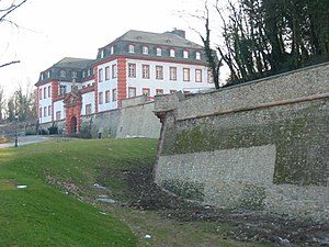
The fortress of Mainz was connected, by a bridge over the Rhine, with the strongly fortified village of Kastel. The extent of the works, which were much enlarged by the French while the city was in their possession, including the work called the Weisenauer Schanze or Fort Weisenau , but exclusive of Kastel and of the small redoubt, was two and a half leagues. Among the principal works were the citadel, with the Eichelstein, and that called the Hauptstein , an extremely strong work projecting beyond all the rest, on an eminence called the Linsenberg. Kastel, which at that time was united with Mainz as an outwork, had very extensive fortifications, which consisted of four strong forts besides the strongly fortified island of Petersau, including which latter the works were of greater extent than even those of Mainz itself. The inner works consisted of 14 principal and 13 smaller bastions. On the land side there were four great gates with double drawbridges, and toward the river several more gates. The Rhine runs from south to north, and the Main from east to west. About a mile above the junction of the two rivers was the village of Kostheim on the Main, and a little farther up a bridge of boats, defended by a strong tête-de-pont . [2]

1864

Karl Baedeker writing in 1864 stated that Mainz was amongst the strongest fortresses of the German Confederation. It was surrounded by a threefold line of fortifications: first ring, the chief rampart consisting of 14 bastions comprising the citadel; second ring, a line of advanced forts, connected by glacis; third ring, by still more advanced entrenchments, erected partly by the Prussian, partly by the Austrian engineers, of which the principal were the Weisenauer Lager, the Hartenberg, and the Binger Thurm. On the north side of the town stood a vast Military Hospital, facing the Schlossplatz. In time of peace the garrison consisted of 3,000 Prussian, and a similar number of Austrian troops; in time of war the number of soldiers could be trebled. [3]

Structures and buildings

According to Lehnhardts map of Mainz ~ 1844 [4] many bastions are to be found:

Related Research Articles

Mainz Capital of Rhineland-Palatinate, Germany

Mainz is the capital and largest city of Rhineland-Palatinate, Germany.

German Confederation Association of German states from 1815 to 1866

The German Confederation was an association of 39 predominantly German-speaking sovereign states in Central Europe, created by the Congress of Vienna in 1815 as a replacement of the former Holy Roman Empire, which had been dissolved in 1806.

Hartenberg-Münchfeld Borough of Mainz in Rhineland-Palatinate, Germany

Hartenberg-Münchfeld is a borough of the Rhineland-Palatinate state capital Mainz, Germany.

The Limes Germanicus is the name given in modern times to a line of frontier fortifications that bounded the ancient Roman provinces of Germania Inferior, Germania Superior and Raetia, dividing the Roman Empire and the unsubdued Germanic tribes from the years 83 to about 260 AD. The Limes used either a natural boundary such as a river or typically an earth bank and ditch with a wooden palisade and watchtowers at intervals. A system of linked forts was built behind the Limes.

Dagobert Sigmund von Wurmser

Dagobert Sigismund, Count von Wurmser was an Austrian field marshal during the French Revolutionary Wars. Although he fought in the Seven Years' War, the War of the Bavarian Succession, and mounted several successful campaigns in the Rhineland in the initial years of the French Revolutionary Wars, he is probably most remembered for his unsuccessful operations against Napoleon Bonaparte during the 1796 campaign in Italy.

Western Russian fortresses

The Western Russian fortresses are a system of fortifications built by the Russian Empire in Eastern Europe in the early 19th century. The fortifications were constructed in three chains at strategic locations along Russia's western border, primarily to combat the threat of Prussia and Austria-Hungary, and to establish Russian rule in new western territories. By the late 19th century the fortifications were obsolete and the system became defunct by the collapse of the Russian Empire in 1917.

Fortress of Luxembourg Fortifications in and around Luxembourg City, Luxembourg, largely dismantled in 1867

The Fortress of Luxembourg is the former fortifications of Luxembourg City, the capital of the Grand Duchy of Luxembourg, which were mostly dismantled beginning in 1867. The fortress was of great strategic importance for the control of the Left Bank of the Rhine, the Low Countries, and the border area between France and Germany.

Rhine crisis

The Rhine crisis of 1840 was a diplomatic crisis between the Kingdom of France and the German Confederation, caused by the demand by French minister Adolphe Thiers that the river Rhine be reinstated as France's border in the east, at a loss of some 32,000 km2 (12,000 sq mi) of German territory.

Mainz Citadel

The Mainzer Zitadelle is situated at the fringe of Mainz Old Town, near Mainz Römisches Theater station. The fortress was constructed in 1660 and was an important part of the Fortress Mainz.

Principality of Erfurt Former principality

The Principality of Erfurt was a small state in modern Thuringia, Germany, that existed from 1807 to 1814, comprising the modern city of Erfurt and the surrounding land. It was subordinate directly to Napoleon, the Emperor of the French, rather than being a part of the Confederation of the Rhine. After nearly 3 months of siege, the city fell to Prussian, Austrian and Russian forces. Having mainly been Prussian territory before the Napoleonic Wars, most of the lands were restored to Prussia by the Congress of Vienna.

Under the terms of the 1815 Peace of Paris, France was obliged to pay for the construction of a line of fortresses to protect the German Confederation against any future aggression by France. All fortresses were located outside Austria and Prussia — the two biggest, bickering powers of the Confederation.

Fort Winiary

Fort Winiary was part of Festung Posen, a system of defensive fortifications around the Polish city of Poznań.

Königsberg fortifications

The fortifications of the former East Prussian capital Königsberg consist of numerous defensive walls, forts, bastions and other structures. They make up the First and the Second Defensive Belt, built in 1626—1634 and 1843—1859, respectively. The 15 metre-thick First Belt was erected due to Königsberg's vulnerability during the Polish–Swedish wars. The Second Belt was largely constructed on the place of the first one, which was in a bad condition. The new belt included twelve bastions, three ravelins, seven spoil banks and two fortresses, surrounded by a water moat. Ten brick gates served as entrances and passages through defensive lines and were equipped with moveable bridges.

Siege of Mainz (1792)

The siege of Mainz was a short engagement at the beginning of the War of the First Coalition. The victorious French army of Custine seized the town on October 21, 1792, after three days of siege. The French occupied Mainz, and tried to install the Republic of Mainz there.

Rudolf Eickemeyer

Jean Marie Rodolphe Eickemeyer, also called Heinrich Maria Johann Rudolf Eickemeyer, was an engineer, mathematician, and general of the French Revolutionary Wars. Eickemeyer was born on 11 March 1753 in Mainz, and died 9 September 1825 in Gau-Algesheim, a town in the Mainz-Bingen district of present-day Rhineland-Palatinate.

Nossa Senhora da Graça Fort Ancient fort in Alcáçova, Portugal

The Nossa Senhora da Graça Fort, officially Conde de Lippe Fort and known historically as La Lippe, is a fort in the village of Alcáçova, about 1 kilometre (0.62 mi) north of the town of Elvas in the Portalegre District of Portugal.

Polygonal fort Type of fortification

A polygonal fort is a type of fortification originating in France in the late 18th century and fully developed in Germany in the first half of the 19th century. Unlike earlier forts, polygonal forts had no bastions, which had proved to be vulnerable. As part of ring fortresses, polygonal forts were generally arranged in a ring around the place they were intended to protect, so that each fort could support its neighbours. The concept of the polygonal fort proved to be adaptable to improvements in the artillery which might be used against them, and they continued to be built and rebuilt well into the 20th century.

The Siege of Marsal was a battle of the Franco-Prussian War on August 13 to 14 between the French Empire and the combined German forces of Prussia and Bavaria in Marsal Under the command of Lieutenant General Jakob von Hartmann, after replacing the Prussian 4th Cavalry Division, II Corps of the Kingdom of Bavaria forced the surrender of the French Empire's defenses, after a brief resistance by the French troops stationed at the fortress. Marsal fell to the German army in the same period as the French fortresses of Lichtenberg, La Petite-Pierre and Vitry. With the quick victory of the Bavarian army at Marsal, the road from Dieuze to Nancy was open to the Germans. In addition, the siege also brought the Germans a lot of raw materials for the war, as well as hundreds of prisoners.

The Siege of Neu-Breisach was a battle of encirclement in the Franco-Prussian War, which took place from 13 October until 10 November 1870 in France. A few days after the surrender at Fort Mortier of Neu-Breisach, with a divisional reserve, German General Hermann von Schmeling forced the fortress of Neu-Breisach which surrendered, and won many spoils from the French army here. The siege demonstrated the high efficiency of the Baden batteries. With the surrender of Neu-Breisach, the Imperial German Army captured the last of the fortifications at Alsace, except for the Belfort and of Bitche. After this victory, Von Schmeling moved his cannons southwest to carry out the Siege of Belfort.

Siege of Thionville (1870) 1870 battle of the Franco-Prussian War

The Siege of Thionville was a battle of the Franco-Prussian War which occurred in Thionville of the Moselle from November 13 to November 24, 1870. The small French garrison repulsed an attempted attack on August 14. It was subjected to a blockade and then besieged from November 13. After the capitulation of Metz, on October 28, 1870, the Prussians move part of their powerful artillery to Thionville. Bombed from November 22, the square surrendered on November 24. The capture of Thionville and that of Montmédy a month later gave the Germans control of the railroad to the Picardy front.

References

  1. Jean Dennis G.G. Lepage, French fortifications 1715-1815, Mayence p. 243-245
  2. 1 2 "Mainz". Penny Cyclopaedia of the Society for the Diffusion of Useful Knowledge. The Penny Cyclopædia of the Society for the Diffusion of Useful Knowledge (Limona–Massachutise). 14. London: Charles Knight & co. New York: William Jackson. 1839. p. 309.
  3. Karl Baedeker, A Handbook for travellers on the Rhine, from Holland to Switzerland, Koblenz, 1864 - p. 279
  4. Franz Dumont; Ferdinand Scherf; Friedrich Schütz, eds. (1998), Mainz - Die Geschichte der Stadt (in German) (first ed.), Mainz: Philipp von Zabern
Attribution