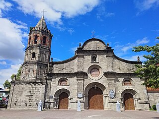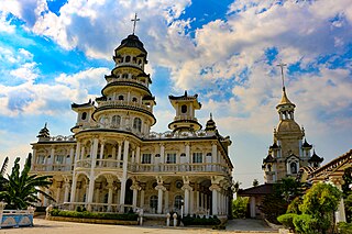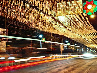
Bulacan, officially the Province of Bulacan, is a province in the Philippines located in the Central Luzon region. Its capital is the city of Malolos. Bulacan was established on August 15, 1578, and part of the Metro Luzon Urban Beltway Super Region.

San Jose del Monte, officially the City of San Jose del Monte, is a 1st class component city in the province of Bulacan, Philippines. According to the 2020 census, it has a population of 651,813 people, making it the largest local government unit within the province of Bulacan and Central Luzon, and the 18th most populated city in the Philippines.

Bocaue, officially the Municipality of Bocaue, is a 1st class municipality in the province of Bulacan, Philippines. According to the 2020 census, it has a population of 141,412 people.

Santa Maria, officially the Municipality of Santa Maria, is a 1st class urban municipality in the province of Bulacan, Philippines. According to the 2020 census, it has a population of 289,820 people. representing 7.8% of the population of the province.

Pandi, officially the Municipality of Pandi, is a 2nd class municipality in the province of Bulacan, Philippines. According to the 2020 census, it has a population of 155,115 people.

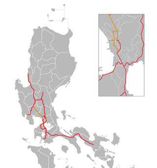
The North Luzon Expressway (NLEX), signed as E1 of the Philippine expressway network, partially as N160 of the Philippine highway network, and partially as R-8 of the Metro Manila arterial road network, is a controlled-access highway that connects Metro Manila to the provinces of the Central Luzon region in the Philippines. The expressway, which includes the main segment and its various spurs, has a total length of 101.8 kilometers (63.3 mi) and travels from its northern terminus at Santa Ines Interchange in Mabalacat, Pampanga, to its southern terminus at Balintawak Interchange in Quezon City, which is adjacent to its connection to Skyway, an elevated toll road that connects the expressway to its counterpart in the south, the South Luzon Expressway. The segment of the expressway between Santa Rita Exit in Guiguinto and the Balintawak Interchangeis part of Asian Highway 26 of the Asian highway network. Although its name implies a connection to northern Luzon, the expressway's northern end is actually in Central Luzon.

The Pan-Philippine Highway, also known as the Maharlika Highway, is a network of roads, expressways, bridges, and ferry services that connect the islands of Luzon, Samar, Leyte, and Mindanao in the Philippines, serving as the country's principal transport backbone. Measuring 3,379.73 kilometers (2,100.07 mi) long excluding sea routes not counted by highway milestones, it is the longest road in the Philippines that forms the country's north–south backbone component of National Route 1 (N1) of the Philippine highway network. The entire highway is designated as Asian Highway 26 (AH26) of the Asian Highway Network.

The Metro Manila Skyway, officially the Metro Manila Skyway System (MMSS) or simply the Skyway, is an elevated highway serving as the main expressway of Metro Manila, Philippines. It connects the North and South Luzon Expressways with access to Ninoy Aquino International Airport via the NAIA Expressway (NAIAX). It is the first fully grade-separated highway in the Philippines and one of the longest elevated highways in the world, with a total length of approximately 39.2 kilometers (24.4 mi).

The North Luzon East Expressway (NLEE) is a proposed four-lane, 92.1-kilometre (57.2 mi) long limited-access toll expressway in the Central Luzon region of the Philippines.

The Diocese of Malolos is a Latin Church ecclesiastical jurisdiction or diocese of the Catholic Church in the Philippines, encompassing the whole Province of Bulacan and Valenzuela City in metropolitan Manila and is a suffragan to the metropolitan Archdiocese of Manila. The mother church of the Diocese is the Cathedral-Basilica of the Immaculate Conception located in Malolos City, Bulacan. The Blessed Virgin Mary, under the title of Immaculate Conception is the principal patroness of the diocese.
San Jose Del Monte station is a future Metro Rail Transit (MRT) station located on the MRT Line 7 (MRT-7) system in San Jose del Monte, Bulacan.It is the northern terminus of the line.

The Quirino Highway, formerly called the El Quirino Express Road or Ipo Road, is a four-to-eight lane, secondary highway that connects Quezon City to the municipality of Norzagaray in Bulacan, Philippines. The road is designated as National Route 127 (N127) of the Philippine highway network within the city bounds of Quezon City, Radial Road 7 (R-7), and a spur of Radial Road 8 (R-8) of Metro Manila's arterial road network.

Radial Road 8, more commonly referred to as R-8, is a network of roads and bridges that altogether form the eighth radial road of Manila in the Philippines. It runs north-south through northern Metro Manila linking the City of Manila with Quezon City, Caloocan, and Valenzuela into the northern provinces of Bulacan, Pampanga, Tarlac, Pangasinan, and La Union. The portion of R-8 between Guiguinto and Balintawak is also designated a component of the Pan-Philippine Highway network (AH26). It also has a spur segment in Quirino Highway from NLEX to its junction with R-7 at Commonwealth Avenue, both in Quezon City.

The Bulacan Provincial Board is the Sangguniang Panlalawigan of the Philippine province of Bulacan.

Kellen Transport Incorporated or simply KTI is a city bus company formed as a subsidiary of former Jell Transport, Inc. or JTI. It plies the previous routes from Baclaran, Parañaque to Grotto, San Jose del Monte, Bulacan. Now they operating in EDSA Carousel route under the ES Consortium. It's a subsidiary of ES Transport Inc., which a parent company operates both city and provincial operations.
Local elections were held in Bulacan on May 9, 2016, as part of the 2016 Philippine general election. Voters selected their candidates of choice for all local positions: a town mayor, vice mayor and town councilors, as well as members of the Sangguniang Panlalawigan, the vice-governor, governor and representatives for the four districts of Bulacan and the lone district of San Jose del Monte.

Jose Abad Santos Avenue (JASA), also known as the Olongapo–Gapan Road and the Gapan–San Fernando–Olongapo Road, is a two-to-thirteen-lane 118-kilometer (73 mi) major highway spanning the provinces of Bataan, Nueva Ecija, Pampanga, and Zambales in Central Luzon, Philippines. The highway is designated as National Route 3 (N3) of the Philippine highway network.

The Metro Rail Transit Line 7, also known as MRT Line 7 or MRT-7, is a rapid transit line under construction in the Philippines. When completed, the line will be 22.8 kilometers (14.2 mi) long, with 14 stations, and the first line to have a third rail electrification. The line runs in a northeast–southwest direction, beginning at San Jose del Monte, Bulacan up to the North Triangle Common Station in North Avenue, Quezon City.

National Route 1 (N1) is a primary national route that forms part of the Philippine highway network, running from Luzon to Mindanao. Except for a 19-kilometer (12 mi) gap in Metro Manila and ferry connections, the highway is generally continuous. Most sections of N1 forms the Pan-Philippine Highway except for sections bypassed by expressways.

NLEX Harbor Link, signed as E5 of the Philippine expressway network, is a four- to six-lane expressway that serves as a spur of North Luzon Expressway (NLEX) linking it to the Port of Manila to the west and Quezon City to the east. It runs from Katipunan and C.P. Garcia Avenues in Quezon City to Radial Road 10 in Navotas, which in turn leads to the Port of Manila. Currently, its segment from Mindanao Avenue in Valenzuela to Navotas is operational.


