
St. Francis County is a county in the U.S. state of Arkansas. As of the 2020 census, the population was 23,090. The county seat is Forrest City.
Madison County is a county located in the U.S. state of Arkansas. As of the 2020 census, the population was 16,521. The county seat is Huntsville. The county was formed on September 30, 1836, and named for Madison County, Alabama, the home of some early settlers. They also named the county seat after Madison County in Alabama's county seat, Huntsville.
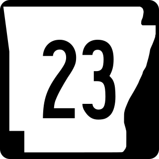
Arkansas Highway 23 is a north–south state highway in north Arkansas. The route runs 129.88 miles (209.02 km) from US 71 near Elm Park north to the Missouri state line through Ozark and Eureka Springs. Between AR 16 at Brashears and Interstate 40 north of Ozark, Highway 23 winds through the Ozark National Forest and is designated as the Pig Trail Scenic Byway due to its steep hills and hairpin turns. The route has a strong connection with the University of Arkansas Razorbacks, connecting fans in Central Arkansas with the Northwest Arkansas area.

Highway 16 is an east–west state highway in Arkansas. The route begins in Siloam Springs at US Highway 412 (US 412) and Highway 59 and runs east through Fayetteville and the Ozark National Forest to US Highway 67 Business (US 67B) in Searcy. Highway 16 was created during the 1926 Arkansas state highway numbering, and today serves as a narrow, winding, 2-lane road except for overlaps of 10 miles (16 km) through Fayetteville. Much of the highway winds through the Ozarks, including the Ozark National Forest, where a portion of the highway is designated as an Arkansas Scenic Byway. The route has two spur routes in Northwest Arkansas; in Fayetteville and Siloam Springs.
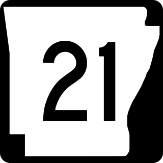
Highway 21 is a north–south state highway in north central Arkansas. The route of 99.14 miles (159.55 km) runs from US Route 64 (US 64) in Clarksville north across US 62 to Missouri Route 13 at the Missouri state line The route is a two-lane highway with the exception of a brief concurrency with US 62, a four-lane highway, in Berryville.

Highway 295 is a designation for four north–south state highways in Madison County. One segment of 5.50 miles (8.85 km) runs from the Ozark National Forest north to Highway 16 at Crosses. A second segment of 3.07 miles (4.94 km) runs northeast from Combs to Madison County Road 4554 (CR 4554). The third segment runs 4.71 miles (7.58 km) north from CR 5395 at Japton through Georgetown to Highway 74 at Drake's Creek. A fourth segment of 10.88 miles (17.51 km) begins at Highway 74 at Wesley and runs north to US Route 412 (US 412).

Highway 127 is a designation for four state highways in Northwest Arkansas. One route of 4.13 miles (6.65 km) begins at Madison County Road 3345 (CR 3345) and runs northwest to Highway 23 at Aurora. A second route of 4.86 miles (7.82 km) begins at US Highway 412 (US 412) at Old Alabam and runs north to Highway 23 at Forum. A third route of 8.58 miles (13.81 km) begins at Highway 12 and runs north to Highway 12 near Clifty. A fourth route of 5.82 miles (9.37 km) begins at Lost Bridge Village and runs north to US Highway 62 in Garfield. Highway 127 Spur is a spur route of 0.25 miles (0.40 km) near the southern terminus of the Lost Bridge Village route that provides access to Lost Bridge Marina. All routes are maintained by the Arkansas State Highway and Transportation Department (AHTD).

Highway 221 is a north–south state highway in Carroll County, Arkansas. The route begins at the McIlroy Wildlife Management Area and runs north through Berryville to Missouri Route 39 at the Missouri state line. Created in 1957, the route has remained unchanged since 1967. The route is maintained by the Arkansas State Highway and Transportation Department (AHTD).

Highway 303 is a designation for three north–south state highways in Northwest Arkansas. Each connects sparsely populated rural areas to east-west corridors.
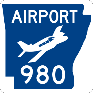
Highway 980 is a state highway designation for all state maintained airport roads in Arkansas.

Highway 45 is a designation for three state highways in northwest Arkansas. The southern segment of 26.97 miles (43.40 km) runs from Highway 96 north across US Route 71 (US 71) to Interstate 540/US 71 (I-540/US 71) in Fort Smith. Another segment of 10.64 miles (17.12 km) runs Highway 59 at Dutch Mills to US 62 in rural Washington County. A third route of 25.42 miles (40.91 km) runs from U.S. Route 71B (US 71B) in Fayetteville to Highway 12 near Clifty. These routes were formerly connected until a portion of approximately 50 miles (80 km) was redesignated Arkansas Highway 59 and many United States highways were rerouted through Fayetteville.

Eight special routes of U.S. Route 412 exist.
Old Alabam is an unincorporated community in Madison County, Arkansas, United States. It is located on AR 127 near U.S. Route 412. The community is about 4.5 miles northeast of Huntsville and one mile south of the community of Alabam.
Aurora is an unincorporated community in Madison County, Arkansas, United States. It is located south of Huntsville at the junction of AR 127 and AR 23. The community lies on the banks of War Eagle Creek.
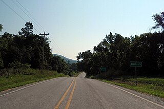
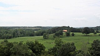
Brashears is an unincorporated community in Madison County, Arkansas, United States. It is located at the junction of AR 16 and AR 23. The community is within the Ozark-St. Francis National Forest and just south of the upper White River. The community of Combs is about two miles west on route 16 and St. Paul is about two miles east.
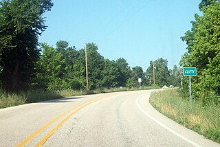
Clifty is an unincorporated community in Madison County, Arkansas, United States. It is located on Arkansas Highway 12.

Combs is an unincorporated community in southern Madison County, Arkansas, United States. It is located on Arkansas Highway 16 at the southern terminus of AR 295. The community is within the Ozark-St. Francis National Forest and just south of the upper White River. The community of Brashears is about two miles east on route 16. The population was 431 as of the 2021 census, the overwhelming majority of which was white.

Kingston is an unincorporated community and census-designated place (CDP) in northeast Madison County, Arkansas, United States. It was first listed as a CDP in the 2020 census with a population of 97.

Lee's Creek Township is one of thirty-seven townships in Washington County, Arkansas, USA. As of the 2000 census, its total population was 640.


