
The Lappa Valley Railway is a 15 in minimum gauge railway located near Newquay in Cornwall. The railway functions as a tourist attraction, running from Benny Halt to East Wheal Rose, where there is a leisure area with two miniature railways.

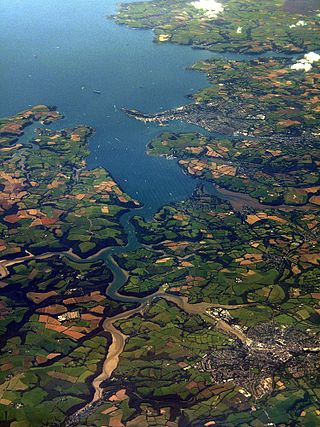
Par is a village and fishing port with a harbour on the south coast of Cornwall, England, United Kingdom. The village is situated in the civil parish of Tywardreath and Par, although West Par and the docks lie in the parish of St Blaise.
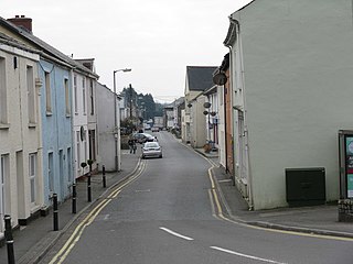
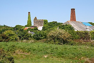
St Blazey is a small town in Cornwall, England, United Kingdom.

Towan is found in many placenames in Cornwall. However, The Towans usually refers to the three-mile (5 km) stretch of coastal dunes which extends north-east from the estuary of the River Hayle to Gwithian beach with a midpoint near Upton. The South West Coast Path crosses the towans.

The Great Flat Lode is a mineral-bearing body of rock under the southern granite slopes of Carn Brea south of Camborne in west Cornwall, England, UK.
The Redruth and Chasewater Railway,, was an early mineral railway line in Cornwall, England, UK. It opened in 1825 and was built to convey the output from copper mines in the Gwennap area to wharves on Restronguet Creek around Devoran, and to bring in coal to fuel mine engines; later it carried timber for pit props and also house coal.
Lanescot is a village in Cornwall, England, United Kingdom. It is in a former mining area, about four miles (6 km) east-northeast of St Austell and four miles (6 km) west-northwest of Fowey. The Saints' Way long-distance footpath passes through Lanescot.
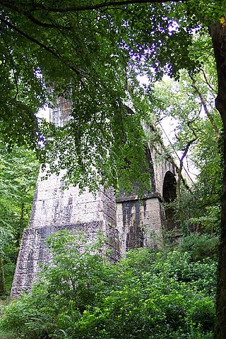
The Treffry Viaduct is a historic dual-purpose railway viaduct and aqueduct located close to the village of Luxulyan, Cornwall in the United Kingdom. The viaduct crosses the Luxulyan Valley, and with it forms an integral part of the Cornwall and West Devon Mining Landscape, a World Heritage Site. It is scheduled under the Ancient Monuments and Archaeological Areas Act 1979 and due to its poor condition is on Historic England's, Heritage at Risk Register.

Caradon Hill is on Bodmin Moor in the former Caradon district of Cornwall, England, United Kingdom. The summit is 371 metres (1,217 ft) above mean sea level. Caradon Hill is on the southeastern edge of the moor; it is between the villages of Minions (northwest), Upton Cross (northeast), Pensilva (southeast) and Darite (southwest).

The Cornwall Minerals Railway owned and operated a network of 45 miles (72 km) of standard gauge railway lines in central Cornwall, England, United Kingdom. It started by taking over an obsolescent horse-operated tramway in 1862, and it improved and extended it, connecting Newquay and Par Harbours, and Fowey. Having expended considerable capital, it was hurt by a collapse in mineral extraction due to a slump in prices. Despite its title, it operated a passenger service between Newquay and Fowey.
The Luxulyan Valley is the steep sided and thickly wooded valley of the River Par, situated in mid Cornwall, England, UK. It contains a major concentration of early 19th century industrial remains, and was designated as part of a World Heritage Site in 2006.
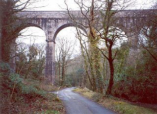
The Treffry Tramways were a group of mineral tramways in Cornwall in the United Kingdom, constructed by Joseph Treffry (1782-1850), a local land owner and entrepreneur. They were constructed to give transport facilities to several mines and pits producing non-ferrous metal, granite and china clay in the area between the Luxulyan Valley and Newquay, and were horse-operated, with the use of water and steam power on inclines, and at first operated in conjunction with the Par Canal and Par Docks, also constructed by Treffry. One of the routes crossed the Luxulyan Valley on a large viaduct, the largest in Cornwall when it was built.
Joseph Austen Treffry was an engineer, mining adventurer, and industrialist who became a significant landowner in Cornwall, England.
The Great County Adit, sometimes called the County Adit, or the Great Adit was a system of interconnected adits that helped drain water from the tin and copper mines in the Gwennap area of Cornwall, in the United Kingdom. Construction started in 1748 and it eventually reached a length of over 40 miles (64 km) of a tunnel, providing drainage to over 100 mines at an average depth of 80–100 metres (260–330 ft).
Wheal Vor was a metalliferous mine about 2 miles (3.2 km) north west of Helston and 1 mile (1.6 km) north of the village of Breage in the west of Cornwall, England, UK. It is considered to be part of the Mount's Bay mining district. Until the mid-19th century the mine was notable for its willingness to try out new innovations. Although very rich in copper and tin ores, the mine never lived up to its expectations: during the later part of the 19th century it had several periods of closure, and an attempt to reopen it in the 1960s was not successful mainly because of bureaucracy. Today the site is part of the Cornwall and West Devon Mining Landscape.
Wheal Busy, sometimes called Great Wheal Busy and in its early years known as Chacewater Mine, was a metalliferous mine halfway between Redruth and Truro in the Gwennap mining area of Cornwall, England. During the 18th century the mine produced enormous amounts of copper ore and was very wealthy, but from the later 19th century onwards was not profitable. Today the site of the mine is part of the Cornwall and West Devon Mining Landscape World Heritage Site.

Consolidated Mines, also known as Great Consolidated mine, but most commonly called Consols or Great Consols was a metalliferous mine about a mile ESE of the village of St Day, Cornwall, England. Mainly active during the first half of the 19th century, its mining sett was about 600 yards north–south; and 2,700 yards east–west, to the east of Carharrack. Although always much troubled by underground water, the mine was at times highly profitable, and it was the largest single producer of copper ore in Cornwall. Today the mine is part of the Cornwall and West Devon Mining Landscape World Heritage Site.
Wheal Fortune or Great Wheal Fortune is the site of a mine in the civil parishes of Breage and Sithney in west Cornwall. Part of the disused mine was designated as a Site of Special Scientific Interest (SSSI) for its geological interest in 1991 and is also a Geological Conservation Review site of national importance for the minerals on the site.

Devon Great Consols was a copper mine near Tavistock in Devon. The lease on the site was taken from the Duke of Bedford in 1844 by a group of investors. The 1,024 shares, sold at one pound each, were divided among the six men. Earlier attempts to mine this property had all ended in failure.

Par Docks is an Imerys-owned harbour in the village of Par, Cornwall, United Kingdom, which was used for the export of china clay from the numerous Imerys sites in the clay-rich region of Mid-Cornwall.

