
The Allegheny River is a 325-mile-long (523 km) tributary of the Ohio River that is located in western Pennsylvania and New York in the United States. It runs from its headwaters just below the middle of Pennsylvania's northern border, northwesterly into New York, then in a zigzag southwesterly across the border and through Western Pennsylvania to join the Monongahela River at the Forks of the Ohio at Point State Park in Downtown Pittsburgh, Pennsylvania.

The Pennsylvania Turnpike, sometimes shortened to Penna Turnpike or PA Turnpike, is a controlled-access toll road which is operated by the Pennsylvania Turnpike Commission (PTC) in Pennsylvania. It runs for 360 miles (580 km) across the southern part of the state, connecting Pittsburgh and Philadelphia, and passes through four tunnels as it crosses the Appalachian Mountains. A component of the Interstate Highway System, it is part of Interstate 76 (I-76) between the Ohio state line and Valley Forge. I-70 runs concurrently with I-76 between New Stanton and Breezewood, Interstate 276 (I-276) between Valley Forge and Bristol Township, and I-95 from Bristol Township to the New Jersey state line.

Freeport is a borough in Armstrong County, Pennsylvania, United States. It is situated along the Allegheny River in the southwestern corner of the county. The population was 1,736 at the 2020 census.
Hovey Township is a township which is located in far northern Armstrong County, Pennsylvania, United States. The population was seventy-four at the time of the 2020 census, a decrease from the figure of 97 tabulated in 2010.

Parker is a city located in Armstrong County, Pennsylvania, United States. It is in the extreme northwestern portion of the county. The population was 695 at the 2020 census. The city was named for Judge John Parker, a lead surveyor of Lawrenceburg and founder/owner of Parker's Landing, the two villages combined to create Parker.

Foxburg is a borough in Clarion County, Pennsylvania, United States. It is located along the east bank of the Allegheny River, about 2 miles (3 km) north of the mouth of the Clarion River. As of the 2020 census it had a population of 181.
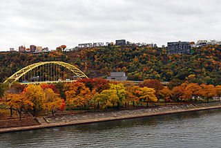
Point State Park is a Pennsylvania state park which is located on 36 acres (150,000 m2) in Downtown Pittsburgh, Allegheny County, Pennsylvania, US, at the confluence of the Allegheny and Monongahela rivers, forming the Ohio River.

Greater Pittsburgh is the metropolitan area surrounding the city of Pittsburgh in Western Pennsylvania, United States. The region includes Allegheny County, Pittsburgh's urban core county and economic hub, and seven adjacent Pennsylvania counties: Armstrong, Beaver, Butler, Fayette, Lawrence, Washington, and Westmoreland in Western Pennsylvania, which constitutes the Pittsburgh, PA Metropolitan Statistical Area MSA as defined by the U.S. Office of Management and Budget.
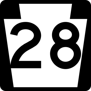
Pennsylvania Route 28 is a major state highway, which runs for 98 miles (158 km) from Anderson Street in Pittsburgh to U.S. Route 219 (US 219) in Brockway in Pennsylvania in the United States.

The South Tenth Street Bridge, most often called the Tenth Street Bridge, but officially dubbed the Philip Murray Bridge, is a suspension bridge that spans the Monongahela River in Downtown Pittsburgh, Pennsylvania.

The Hot Metal Bridge is a truss bridge in Pittsburgh, Pennsylvania, that crosses the Monongahela River. The bridge consists of two parallel spans on a single set of piers: the former Monongahela Connecting Railroad Bridge, built in 1887, on the upstream side and the former Hot Metal Bridge, built in 1900, on the downstream side. The Monongahela Connecting Railroad Bridge carried conventional railroad traffic, while the Hot Metal Bridge connected parts of the J&L Steel mill, carrying crucibles of molten iron from the blast furnaces in ladle transfer cars to the open hearth furnaces on the opposite bank to be converted to steel. During World War II 15% of America's steel making capacity crossed over the Hot Metal Bridge, up to 180 tons per hour. The upstream span was converted to road use after a $14.6 million restoration, and opened by Mayor Tom Murphy with a ceremony honoring former steel workers on June 23, 2000. The bridge connects 2nd Avenue at the Pittsburgh Technology Center in South Oakland with Hot Metal Street in the South Side. The downstream span reopened for pedestrian and bicycle use in late 2007 after two years of work. The Great Allegheny Passage hiker/biker trail passes over this bridge as it approaches Pittsburgh's Golden Triangle area.

Allegheny Islands State Park is a 43-acre (17 ha) Pennsylvania state park in Harmar Township, Allegheny County, Pennsylvania in the United States. The undeveloped park is composed of three alluvial islands located in the middle of the Allegheny River northeast of Pittsburgh. The islands are just north of the boroughs of Oakmont and Plum, and southwest of Cheswick. Bridges for the Pennsylvania Turnpike and the Bessemer and Lake Erie Railroad Branch of the Canadian National Railway cross the Allegheny River at the middle island.

Foxburg Country Club, established in 1887, is the oldest golf course in continuous use in the United States. It is located in Foxburg, Clarion County, Pennsylvania, United States of America, approximately 55 miles (89 km) north of Pittsburgh on a hill rising about 300 feet above the Allegheny River. The course was listed in 2007 as Foxburg Country Club and Golf Course on the National Register of Historic Places. The clubhouse contains the American Golf Hall of Fame.

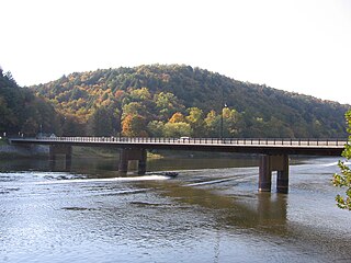
Foxburg Bridge was a steel-built truss bridge in Foxburg, Pennsylvania. The crossing, which spanned the Allegheny River, was built by the Baltimore and Ohio Railroad in the 1920s. It originally had a two-tier design in which the top level carried a branch of Northern Subdivision railroad while the lower level was used by road traffic and pedestrians.

Allegheny-Clarion Valley School District (ACVSD) is a small, rural, public school district in western Pennsylvania. It spans portions of four counties and is the only Pennsylvania public school district to do so. The district is one of the 500 public school districts of Pennsylvania. The Allegheny-Clarion Valley School District encompasses approximately 121 square miles (310 km2). In Armstrong County it covers the City of Parker and Hovey Township. In Butler County it serves Allegheny Township. In Clarion County it serves the Boroughs of Emlenton, Foxburg and St. Petersburg and Perry Township and Richland Township. In Venango County it serves the Borough of Emlenton and Richland Township and Scrubgrass Township. According to 2000 federal census data, Allegheny-Clarion Valley School District serves a resident population of 5,944. By 2010, the district's population declined to 5,749 people. In 2009, the district residents' per capita income was $15,525, while the median family income was $36,867. In the Commonwealth of Pennsylvania, the median family income was $49,501 and the United States median family income was $49,445, in 2010. By 2013, the median household income in the United States rose to $52,100.
The Northern Subdivision is a railroad line owned and operated by the Buffalo and Pittsburgh Railroad (BPRR), which is owned by Genesee and Wyoming Industries, in the U.S. state of Pennsylvania. The line is one of the oldest in Pennsylvania, and at one time, stretched all the way from Callery, to Mount Jewett, Pennsylvania. Today, more than half the line is gone.

The Allegheny River Turnpike Bridge carries Interstate 76 over the Allegheny River. The structure features a pair of twin 2,350’ cast-in-place concrete segmental bridges. This is the first of its type in Pennsylvania. It was constructed between 2007 and 2010 and is the second bridge to stand on this site. The original truss bridge was built between 1949 and 1951 by the engineering firm Modjeski & Masters; the crossing predates the Interstate System by several years.
The Donald R. Lobaugh Bridge is a cantilever bridge that carries vehicular traffic across the Allegheny River between Buffalo and Allegheny townships in Pennsylvania.

The Manchester Bridge, also known as the North Side Point Bridge, was a steel Pratt truss bridge that spanned the Allegheny River in Pittsburgh, Pennsylvania.
The following is a timeline of the history of the city of Pittsburgh, Pennsylvania, US.

