Related Research Articles
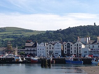
Ramsey is a coastal town in the north of the Isle of Man. It is the second largest town on the island after Douglas. Its population is 7,845 according to the 2016 Census. It has one of the biggest harbours on the island, and has a prominent derelict pier, called the Queen's Pier. It was formerly one of the main points of communication with Scotland. Ramsey has also been a route for several invasions by the Vikings and Scots.
Foxdale A.F.C. is a football club based in Foxdale on the Isle of Man. They compete in the second tier of the Isle of Man Football League.
University College Isle of Man is the primary centre for tertiary, vocational education, higher education and adult education on the British Crown dependency of the Isle of Man, located in the Manx capital Douglas.
The Centre for Manx Studies is a department of the School of Archaeology, Classics and Egyptology in the University of Liverpool whose focus is the study of the Isle of Man, the Manx language, and Manx culture and history.

Glenfaba is one of the six sheadings of the Isle of Man.

Patrick is one of the seventeen historic parishes of the Isle of Man.

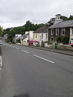
Foxdale consisting of the districts of Upper and Lower Foxdale on the A3 Castletown to Ramsey Road with the junction of the A24 Foxdale to Braaid road and the A40 The Hope road in the parish of Kirk Patrick in the Isle of Man.

The Manx Northern Railway (MNR) was the second common carrier railway built in the Isle of Man. It operated as an independent concern only from 1879 to 1905.
Artle Beck is a minor river of Lancashire.
The Foxdale Railway was a 3 ft narrow gauge branch line which ran from St. John's to Foxdale on the Isle of Man.

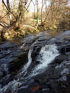
Waterfall was the only intermediate station on the Foxdale Railway on the Isle of Man.

Ramsey Station was a station on the Manx Northern Railway, later owned and operated by the Isle of Man Railway; it served the town of Ramsey in the Isle of Man, and was the terminus of a line that ran between St. John's and this station, which was the railway's headquarters.
One of the characteristics of the Isle of Man Railway are the numerous level crossings and farm crossings along the various routes; many smaller crossing places are marked only by gates the criss-cross farm land and provide access to individual private roads which connect the farms to the main roads. Being largely rural in nature the railway has many of these scattered along the existing South Line, and there were, as one might expect, many more on the closed sections of the railway. These can be summarised as follows, along with other points of interest along the line not covered in the Isle of Man Railway stations section:-
Foxdale Station was the southern terminus of the Foxdale Railway in the Isle of Man.
The King William Banks are a series of sand banks 14 mi Northeast of Ramsey, Isle of Man.
The Isle of Man Mining Company, also referred to as the Foxdale Mining Company, was a mining company formed to operate the Foxdale Mines on the Isle of Man.
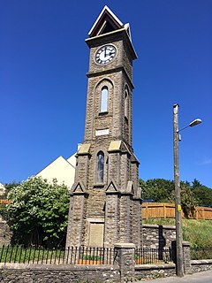
The Victoria Clock Tower, also referred to as the Queen Victoria Memorial, is a heritage-registered clock tower located in the former mining village of Foxdale, Isle of Man, and is said to have been the first memorial in the British Empire dedicated to the 64-year reign of Queen Victoria.

The Foxdale Mines is a collective term for a series of mines and shafts which were situated in a highly mineralised zone on the Isle of Man, running east to west, from Elerslie mine in Crosby to Niarbyl on the coast near Dalby. In the 19th century the mines were widely regarded as amongst the richest ore mines in the British Isles.
The geology of the Isle of Man consists primarily of a thick pile of sedimentary rocks dating from the Ordovician period, together with smaller areas of later sedimentary and extrusive igneous strata. The older strata was folded and faulted during the Caledonian and Acadian orogenies The bedrock is overlain by a range of glacial and post-glacial deposits. Igneous intrusions in the form of dykes and plutons are common, some associated with mineralisation which spawned a minor metal mining industry.
References
- ↑ The Isle of Man : celebrating a sense of place. Liverpool: Liverpool University Press. 1990. p. 14. ISBN 9780853230366.
Coordinates: 54°11′12″N4°38′30″W / 54.1867°N 4.6417°W